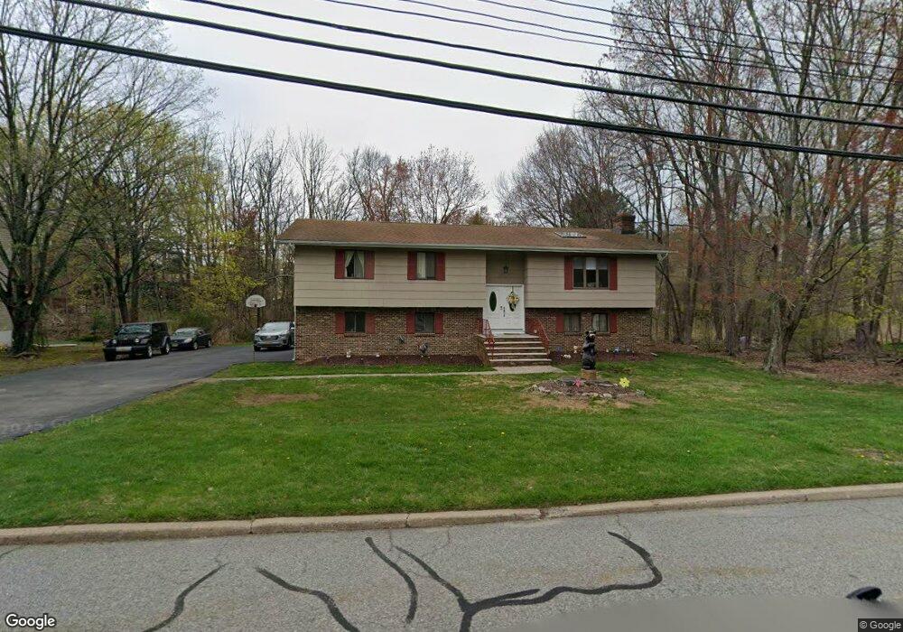
13 Bradrick Ln West Milford, NJ 07480
Estimated Value: $539,000 - $660,000
--
Bed
--
Bath
2,202
Sq Ft
$272/Sq Ft
Est. Value
About This Home
This home is located at 13 Bradrick Ln, West Milford, NJ 07480 and is currently estimated at $599,993, approximately $272 per square foot. 13 Bradrick Ln is a home located in Passaic County with nearby schools including Macopin Middle School and West Milford High School.
Ownership History
Date
Name
Owned For
Owner Type
Purchase Details
Closed on
Oct 17, 2022
Sold by
Murphy Robert
Bought by
Murphy Robert and Murphy Debora
Current Estimated Value
Purchase Details
Closed on
Aug 10, 1998
Sold by
Betty Simon Trustee Llc
Bought by
Murphy Robert and Murphy Debora
Home Financials for this Owner
Home Financials are based on the most recent Mortgage that was taken out on this home.
Original Mortgage
$151,000
Interest Rate
6.94%
Create a Home Valuation Report for This Property
The Home Valuation Report is an in-depth analysis detailing your home's value as well as a comparison with similar homes in the area
Home Values in the Area
Average Home Value in this Area
Purchase History
| Date | Buyer | Sale Price | Title Company |
|---|---|---|---|
| Murphy Robert | -- | -- | |
| Redacted Upon Request | -- | None Listed On Document | |
| Murphy Robert | $196,000 | -- |
Source: Public Records
Mortgage History
| Date | Status | Borrower | Loan Amount |
|---|---|---|---|
| Previous Owner | Murphy Robert | $151,000 |
Source: Public Records
Tax History Compared to Growth
Tax History
| Year | Tax Paid | Tax Assessment Tax Assessment Total Assessment is a certain percentage of the fair market value that is determined by local assessors to be the total taxable value of land and additions on the property. | Land | Improvement |
|---|---|---|---|---|
| 2025 | $11,477 | $283,100 | $103,800 | $179,300 |
| 2024 | $11,536 | $283,100 | $103,800 | $179,300 |
| 2022 | $11,015 | $283,100 | $103,800 | $179,300 |
| 2021 | $10,715 | $283,100 | $103,800 | $179,300 |
| 2020 | $10,602 | $283,100 | $103,800 | $179,300 |
| 2019 | $10,461 | $283,100 | $103,800 | $179,300 |
| 2018 | $10,435 | $283,100 | $103,800 | $179,300 |
| 2017 | $10,483 | $283,100 | $103,800 | $179,300 |
| 2016 | $10,500 | $283,100 | $103,800 | $179,300 |
| 2015 | $10,378 | $283,100 | $103,800 | $179,300 |
| 2014 | $10,126 | $283,100 | $103,800 | $179,300 |
Source: Public Records
Map
Nearby Homes
- 0 Rock Ledge Rd Unit 25030488
- 0 Rock Ledge Rd Unit 3983243
- 11 Eagles Nest Terrace
- 2 Iron Hill
- 33 Eagles Nest Terrace
- 24 Eagles Nest Terrace
- 2 Heritage Dr
- 45 Heritage Dr
- 60 Eagles Nest Terrace
- 68 Heritage Dr
- 82 Heritage Dr
- 91 Heritage Dr
- 1731 MacOpin Rd
- 1772 MacOpin Rd
- 17 Camelot Dr
- 95 Morris Ave
- 43 Bisset Dr
- 54 Nosenzo Pond Rd
- 9 Somerset Place
- 7 New Bedford Rd Unit H