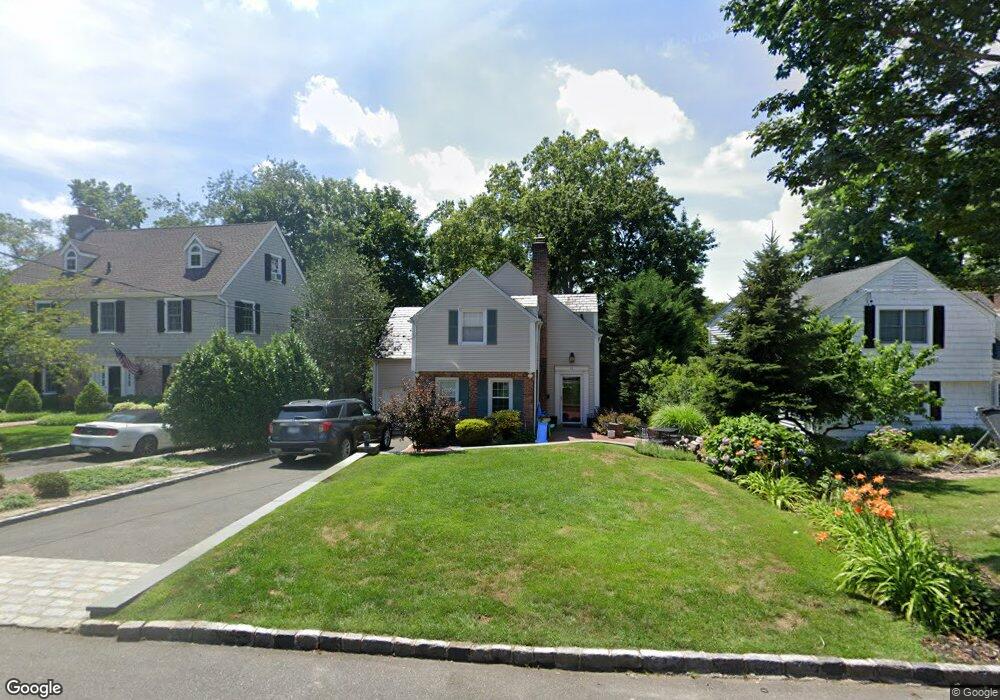
13 Briarcliff Dr Port Washington, NY 11050
Estimated Value: $1,316,222 - $1,454,000
3
Beds
3
Baths
1,849
Sq Ft
$749/Sq Ft
Est. Value
About This Home
This home is located at 13 Briarcliff Dr, Port Washington, NY 11050 and is currently estimated at $1,385,111, approximately $749 per square foot. 13 Briarcliff Dr is a home located in Nassau County with nearby schools including John Philip Sousa Elementary School, Carrie Palmer Weber Middle School, and Paul D. Schreiber Senior High School.
Ownership History
Date
Name
Owned For
Owner Type
Purchase Details
Closed on
May 16, 2017
Sold by
Mandel Nina G
Bought by
Whelan Derek and Whelan Sarah
Current Estimated Value
Home Financials for this Owner
Home Financials are based on the most recent Mortgage that was taken out on this home.
Original Mortgage
$752,000
Outstanding Balance
$623,138
Interest Rate
3.97%
Mortgage Type
New Conventional
Estimated Equity
$761,973
Purchase Details
Closed on
Jun 13, 2007
Sold by
Peony & Orchard Llc
Bought by
Mandel Nina
Purchase Details
Closed on
May 28, 2005
Sold by
Booranaphonsathit Suwit
Purchase Details
Closed on
May 27, 2005
Sold by
Ngadiman Sutini
Purchase Details
Closed on
Mar 13, 1997
Sold by
Freedline Richard
Bought by
Booranphonsathit Suwit and Ngadiman Sutini
Create a Home Valuation Report for This Property
The Home Valuation Report is an in-depth analysis detailing your home's value as well as a comparison with similar homes in the area
Home Values in the Area
Average Home Value in this Area
Purchase History
| Date | Buyer | Sale Price | Title Company |
|---|---|---|---|
| Whelan Derek | $940,000 | Land Baron Abstract Company | |
| Mandel Nina | $829,000 | -- | |
| -- | -- | -- | |
| -- | -- | -- | |
| Booranphonsathit Suwit | $360,000 | -- |
Source: Public Records
Mortgage History
| Date | Status | Borrower | Loan Amount |
|---|---|---|---|
| Open | Whelan Derek | $752,000 |
Source: Public Records
Tax History Compared to Growth
Tax History
| Year | Tax Paid | Tax Assessment Tax Assessment Total Assessment is a certain percentage of the fair market value that is determined by local assessors to be the total taxable value of land and additions on the property. | Land | Improvement |
|---|---|---|---|---|
| 2025 | $18,429 | $782 | $338 | $444 |
| 2024 | $5,887 | $850 | $367 | $483 |
| 2023 | $19,217 | $968 | $418 | $550 |
| 2022 | $19,217 | $974 | $421 | $553 |
| 2021 | $18,192 | $1,031 | $414 | $617 |
| 2020 | $18,577 | $1,330 | $1,017 | $313 |
| 2019 | $18,713 | $1,425 | $984 | $441 |
| 2018 | $18,817 | $1,529 | $0 | $0 |
| 2017 | $12,066 | $1,699 | $1,216 | $483 |
| 2016 | $19,123 | $1,699 | $1,216 | $483 |
| 2015 | $6,835 | $1,699 | $1,216 | $483 |
| 2014 | $6,835 | $1,699 | $1,216 | $483 |
| 2013 | $6,444 | $1,699 | $1,216 | $483 |
Source: Public Records
Map
Nearby Homes
- 43 Amherst Rd
- 96 Davis Rd
- 1 Luquer Rd
- 100 Gristmill Ln
- 74 Bayview Ave Unit A
- 34 Davis Rd
- 28 Charles St
- 0 Route 5 & 20
- 113 Murray Ave
- 184 Circle Dr
- 454 Main St
- 47 Carlton Ave
- 38 Madison St Unit 38L
- 59 Colonial Dr
- 22 Franklin Ave
- 21 Beechwood Ave
- 27 Hemlock Rd
- 21A Neulist Ave
- 18 Neulist Ave
- 18 S Washington St
- 11 Briarcliff Dr
- 14 Oakland Dr
- 12 Oakland Dr
- 9 Briarcliff Dr
- 15A Briarcliff Dr
- 15 Briarcliff Dr Unit A
- 15 Briarcliff Dr
- 16 Oakland Dr
- 10 Briarcliff Dr
- 10 Oakland Dr
- 12 Briarcliff Dr
- 7 Briarcliff Dr
- 18 Oakland Dr
- 17 Briarcliff Dr
- 14 Briarcliff Dr
- 6 Hazel Rd
- 5 Briarcliff Dr
- 8 Oakland Dr
- 3 Hazel Rd
- 35 Amherst Rd