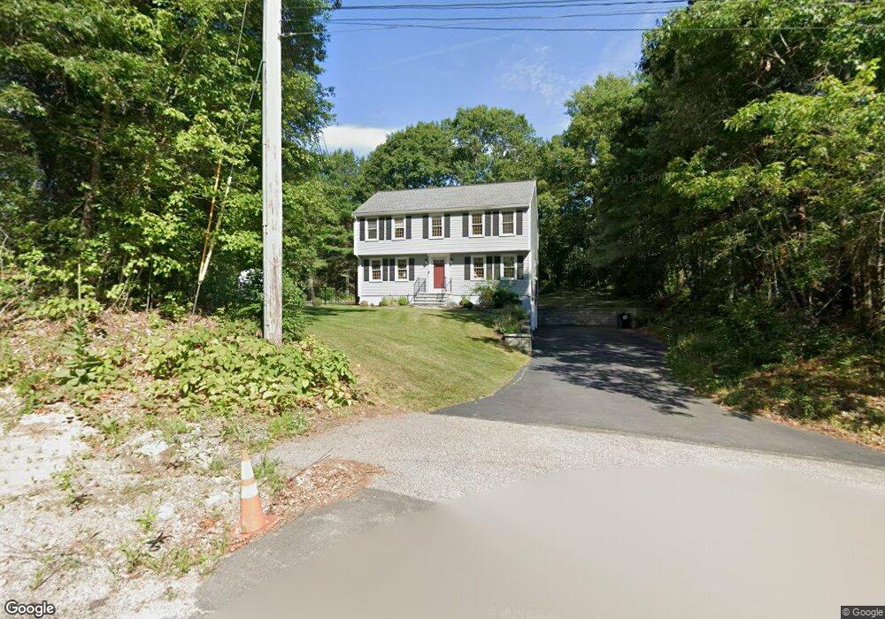
13 Briggs St Norton, MA 02766
Estimated Value: $633,408 - $762,000
4
Beds
3
Baths
1,837
Sq Ft
$391/Sq Ft
Est. Value
About This Home
This home is located at 13 Briggs St, Norton, MA 02766 and is currently estimated at $718,352, approximately $391 per square foot. 13 Briggs St is a home located in Bristol County with nearby schools including J.C. Solmonese Elementary School, Henri A. Yelle Elementary School, and Norton Middle School.
Ownership History
Date
Name
Owned For
Owner Type
Purchase Details
Closed on
Sep 8, 1997
Sold by
Carmichael John Paul and Carmichael Debra Ann
Bought by
Cerce Vincent and Cerce Carolyn N
Current Estimated Value
Purchase Details
Closed on
Nov 30, 1995
Sold by
Rooney Ralph E and Rooney Beverly M
Bought by
Carmichael John Paul and Carmichael Debra Ann
Purchase Details
Closed on
May 24, 1993
Sold by
Briggs St Norton Rt and Mahoney John T
Bought by
Rooney Ralph E and Rooney Beverly M
Purchase Details
Closed on
Nov 2, 1992
Sold by
Mansfield Coop Bk
Bought by
Briggs St Norton Rt
Purchase Details
Closed on
Nov 30, 1987
Sold by
Ventura James P
Bought by
Lund Robert W
Create a Home Valuation Report for This Property
The Home Valuation Report is an in-depth analysis detailing your home's value as well as a comparison with similar homes in the area
Home Values in the Area
Average Home Value in this Area
Purchase History
| Date | Buyer | Sale Price | Title Company |
|---|---|---|---|
| Cerce Vincent | $216,000 | -- | |
| Carmichael John Paul | $185,000 | -- | |
| Rooney Ralph E | $165,000 | -- | |
| Briggs St Norton Rt | $30,000 | -- | |
| Lund Robert W | $171,500 | -- |
Source: Public Records
Mortgage History
| Date | Status | Borrower | Loan Amount |
|---|---|---|---|
| Closed | Lund Robert W | $140,000 | |
| Closed | Lund Robert W | $163,500 |
Source: Public Records
Tax History
| Year | Tax Paid | Tax Assessment Tax Assessment Total Assessment is a certain percentage of the fair market value that is determined by local assessors to be the total taxable value of land and additions on the property. | Land | Improvement |
|---|---|---|---|---|
| 2025 | $65 | $497,800 | $169,700 | $328,100 |
| 2024 | $6,141 | $474,200 | $161,600 | $312,600 |
| 2023 | $5,816 | $447,700 | $152,500 | $295,200 |
| 2022 | $5,667 | $397,400 | $138,600 | $258,800 |
| 2021 | $5,373 | $359,900 | $132,000 | $227,900 |
| 2020 | $5,174 | $349,600 | $128,100 | $221,500 |
| 2019 | $5,054 | $339,200 | $123,300 | $215,900 |
| 2018 | $4,991 | $329,200 | $123,300 | $205,900 |
| 2017 | $4,679 | $304,400 | $123,300 | $181,100 |
| 2016 | $4,536 | $290,600 | $123,300 | $167,300 |
| 2015 | $4,374 | $284,200 | $120,800 | $163,400 |
| 2014 | $4,373 | $284,500 | $126,600 | $157,900 |
Source: Public Records
Map
Nearby Homes
- 16 Lloyd Cir Unit 30
- 13 Lloyd Cir Unit 38
- 11 Lloyd Cir Unit 39
- 17 Lloyd Cir Unit 36
- 24 Lloyd Cir Unit 34
- 4 Stanley Rd
- 126 Pine St Unit 1
- 152 Pine St Unit 23
- 29 Germain Way Unit 3
- Lot 3B Hill St
- 90 Pine St
- 0 S Washington St Unit 73437419
- 103 King Philip Rd
- 20 Lloyd Cir Unit 32
- 14 Lloyd Cir Unit 29
- 195 E Main St
- O Leonard St
- 30 Samoset St
- 9 Winnecunnet Dr Unit 9
- 81 Alcott Cir Unit T5
- 11 Briggs St
- 10 Briggs St
- 9 Briggs St
- 8 Briggs St
- 7 Briggs St
- 5 Briggs St
- 6 Briggs St
- 3 Briggs St
- 4 Briggs St
- 99 S Washington St
- 1 Briggs St
- 113 S Washington St
- 111 S Washington St
- 2 Briggs St
- 107 S Washington St
- 113 1/2 S Washington St
- 115 S Washington St
- 117 S Washington St
- 97 S Washington St
- 119 S Washington St
Your Personal Tour Guide
Ask me questions while you tour the home.