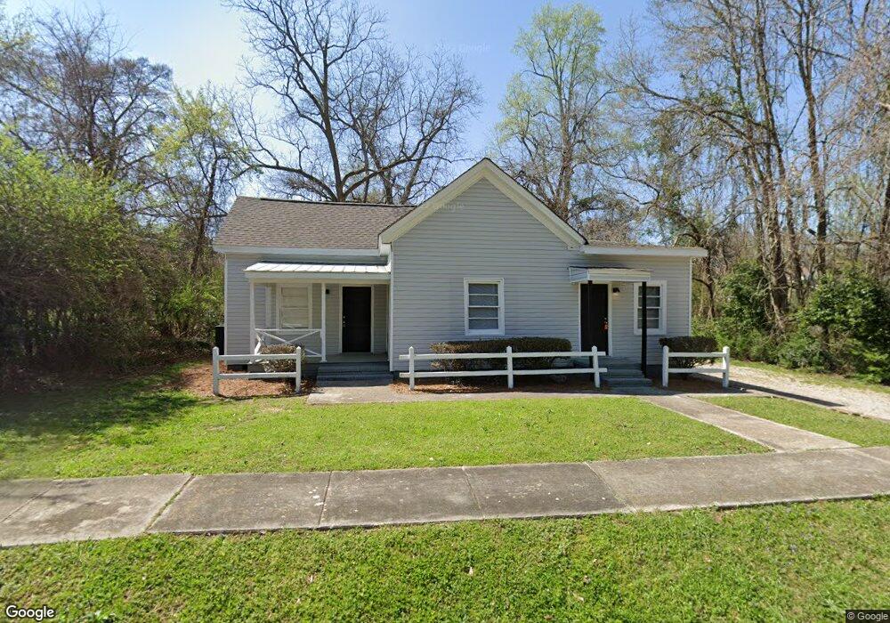
13 Cary St Lagrange, GA 30241
Estimated Value: $85,598 - $90,000
2
Beds
1
Bath
1,488
Sq Ft
$60/Sq Ft
Est. Value
About This Home
This home is located at 13 Cary St, Lagrange, GA 30241 and is currently estimated at $88,650, approximately $59 per square foot. 13 Cary St is a home located in Troup County with nearby schools including Franklin Forest Elementary School, Hollis Hand Elementary School, and Ethel W. Kight Elementary School.
Ownership History
Date
Name
Owned For
Owner Type
Purchase Details
Closed on
Aug 25, 2021
Sold by
Mccoy Squared Llc
Bought by
Sfr3 030 Llc
Current Estimated Value
Purchase Details
Closed on
Mar 18, 2019
Sold by
Cavender Steve
Bought by
Mccoy Squared Llc
Home Financials for this Owner
Home Financials are based on the most recent Mortgage that was taken out on this home.
Original Mortgage
$105,000
Interest Rate
4.3%
Mortgage Type
New Conventional
Purchase Details
Closed on
Mar 5, 1992
Sold by
Timothy M Yarbrough
Bought by
Cavender Steve
Purchase Details
Closed on
May 11, 1987
Sold by
Lucious A Thornton
Bought by
Timothy M Yarbrough
Purchase Details
Closed on
Apr 1, 1961
Sold by
Dunson Mills
Bought by
Lucious A Thornton
Create a Home Valuation Report for This Property
The Home Valuation Report is an in-depth analysis detailing your home's value as well as a comparison with similar homes in the area
Purchase History
| Date | Buyer | Sale Price | Title Company |
|---|---|---|---|
| Sfr3 030 Llc | $52,000 | -- | |
| Mccoy Squared Llc | $115,000 | -- | |
| Cavender Steve | $16,500 | -- | |
| Timothy M Yarbrough | $20,000 | -- | |
| Lucious A Thornton | -- | -- |
Source: Public Records
Mortgage History
| Date | Status | Borrower | Loan Amount |
|---|---|---|---|
| Previous Owner | Mccoy Squared Llc | $105,000 |
Source: Public Records
Tax History
| Year | Tax Paid | Tax Assessment Tax Assessment Total Assessment is a certain percentage of the fair market value that is determined by local assessors to be the total taxable value of land and additions on the property. | Land | Improvement |
|---|---|---|---|---|
| 2025 | $845 | $30,980 | $4,640 | $26,340 |
| 2024 | $760 | $27,860 | $4,640 | $23,220 |
| 2023 | $578 | $21,180 | $4,640 | $16,540 |
| 2022 | $562 | $20,140 | $4,640 | $15,500 |
| 2021 | $570 | $18,884 | $2,640 | $16,244 |
| 2020 | $347 | $18,884 | $2,640 | $16,244 |
| 2019 | $285 | $9,436 | $2,080 | $7,356 |
| 2018 | $282 | $9,345 | $1,989 | $7,356 |
| 2017 | $282 | $9,345 | $1,989 | $7,356 |
| 2016 | $269 | $8,926 | $1,989 | $6,937 |
| 2015 | $270 | $8,921 | $1,984 | $6,937 |
| 2014 | $270 | $8,921 | $1,984 | $6,937 |
| 2013 | -- | $9,674 | $2,000 | $7,674 |
Source: Public Records
Map
Nearby Homes
- 5 Curran Ave
- 4 1/2 Barnard Ave
- 15 Fulton St
- 204 Cleveland Dr
- 212 Cleveland Dr
- 3 Gulfstream Dr
- 5 Gulfstream Dr
- 147 Shenandoah Ln
- 0 N Barnard Ave
- 146 Shenandoah Ln
- 143 Shenandoah Ln
- 141 Shenandoah Ln
- 139 Shenandoah Ln
- 115 Clara Jean Ct
- 142 Shenandoah Ln
- 87 Youngs Mill Rd
- 136 Shenandoah Ln
- 2 Louise St
- 107 N Barnard Ave
- 110 Lenox Cir
Your Personal Tour Guide
Ask me questions while you tour the home.