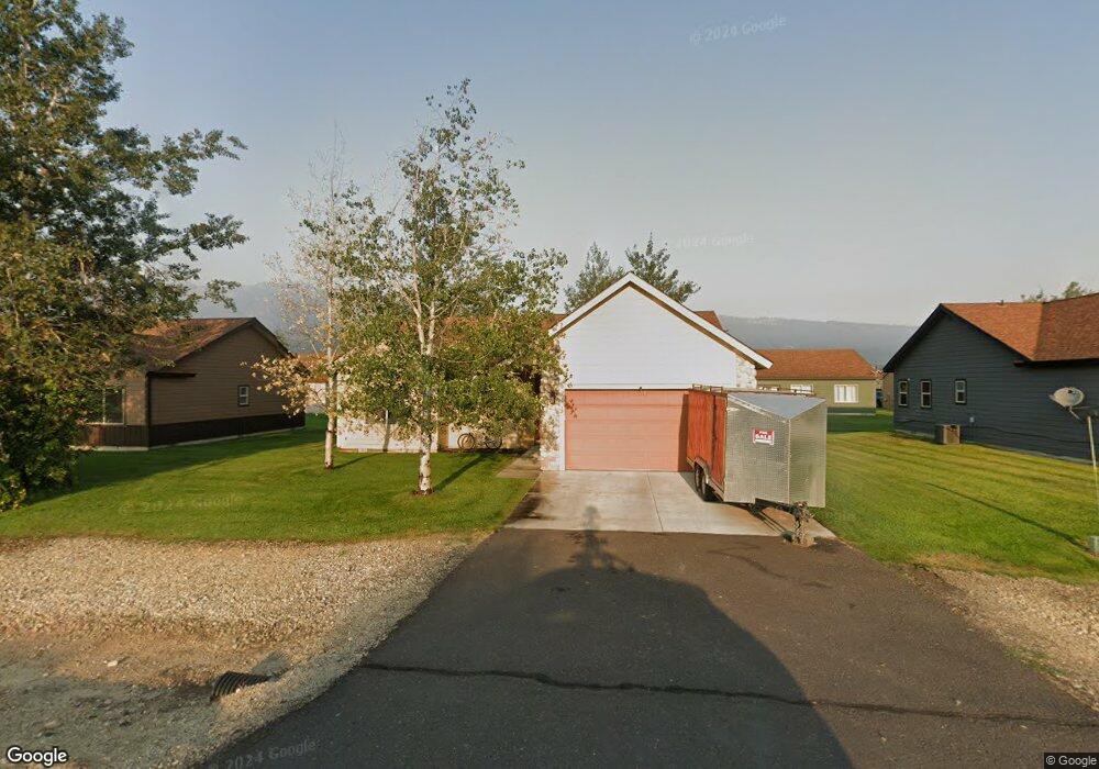
13 Charters Dr Donnelly, ID 83615
Estimated Value: $409,982 - $438,000
3
Beds
2
Baths
1,290
Sq Ft
$324/Sq Ft
Est. Value
About This Home
This home is located at 13 Charters Dr, Donnelly, ID 83615 and is currently estimated at $418,246, approximately $324 per square foot. 13 Charters Dr is a home located in Valley County with nearby schools including Donnelly Elementary School and McCall-Donnelly High School.
Ownership History
Date
Name
Owned For
Owner Type
Purchase Details
Closed on
May 21, 2021
Sold by
Schuler Dennis
Bought by
Cyb Properties Llc
Current Estimated Value
Home Financials for this Owner
Home Financials are based on the most recent Mortgage that was taken out on this home.
Original Mortgage
$153,510
Outstanding Balance
$138,681
Interest Rate
2.9%
Mortgage Type
New Conventional
Estimated Equity
$279,565
Purchase Details
Closed on
May 21, 2013
Sold by
Alderman Alan
Bought by
Schuler Dennis
Purchase Details
Closed on
May 28, 2009
Sold by
Schockling Dean and Schockling Kelly
Bought by
Alderman Alan
Purchase Details
Closed on
Aug 31, 2006
Sold by
Timberline Development Llc
Bought by
Schockling Deab and Schockling Kelly
Home Financials for this Owner
Home Financials are based on the most recent Mortgage that was taken out on this home.
Original Mortgage
$159,920
Interest Rate
6.76%
Mortgage Type
New Conventional
Create a Home Valuation Report for This Property
The Home Valuation Report is an in-depth analysis detailing your home's value as well as a comparison with similar homes in the area
Home Values in the Area
Average Home Value in this Area
Purchase History
| Date | Buyer | Sale Price | Title Company |
|---|---|---|---|
| Cyb Properties Llc | -- | Titleone Boise | |
| Schuler Dennis | -- | Amerititle Mccall | |
| Alderman Alan | -- | -- | |
| Schockling Deab | -- | -- |
Source: Public Records
Mortgage History
| Date | Status | Borrower | Loan Amount |
|---|---|---|---|
| Open | Cyb Properties Llc | $153,510 | |
| Previous Owner | Schockling Deab | $159,920 |
Source: Public Records
Tax History Compared to Growth
Tax History
| Year | Tax Paid | Tax Assessment Tax Assessment Total Assessment is a certain percentage of the fair market value that is determined by local assessors to be the total taxable value of land and additions on the property. | Land | Improvement |
|---|---|---|---|---|
| 2025 | $1,102 | $391,589 | $26,603 | $364,986 |
| 2023 | $1,102 | $447,426 | $27,448 | $419,978 |
| 2022 | $1,225 | $399,529 | $27,448 | $372,081 |
| 2021 | $615 | $232,672 | $21,114 | $211,558 |
| 2020 | $596 | $187,776 | $26,212 | $161,564 |
| 2019 | $516 | $146,180 | $24,964 | $121,216 |
| 2018 | $483 | $131,918 | $23,416 | $108,502 |
| 2017 | $521 | $131,162 | $26,806 | $104,356 |
| 2016 | $489 | $120,340 | $25,000 | $95,340 |
| 2015 | $219 | $100,144 | $0 | $0 |
| 2013 | -- | $97,540 | $0 | $0 |
Source: Public Records
Map
Nearby Homes
- 16 Buckskin Dr
- 22 Charters Dr
- 13111 Cameron Dr
- 13078 Hill House Loop
- 13076 Hill House Loop
- 13091 Hill House Loop
- 13098 Hill House Loop
- Lot 4 Hideout Dr Unit 4
- Lot 6 Hideout Dr Unit 6
- 24 Mangum Cir Unit 1
- 20 #5 W Mangum Cir Unit 5
- 106 Forest Place
- 24 Mangum Dr Unit # 1 Unit 1
- 20 Mangum Cir Unit 8
- 35 1 Mangum Cir
- 120 Forest Place
- 35 Mangum Cir Unit 1
- 32 Mangum Cir Unit 3
- 32 Mangum Cir
- 34 Mangum Cir Unit 8
- 11 Charters Dr
- 15 Charters Dr
- 14 Buckskin Rd
- 14 Buckskin Dr
- 16 Buckskin Rd
- 12 Buckskin Dr
- 12 Buckskin Dr
- 17 Charters Dr
- 17 Charters Dr
- 18 Buckskin Dr
- 18 Buckskin Rd
- 14 Charters Cir Unit 28
- 14 Charters Cir
- 12 Charters Dr
- 12 Charters Dr
- 14 Charters Dr
- 12 Charters Dr
- 16 Charters Dr
- 16 Charters Dr
- 19 Charters Dr