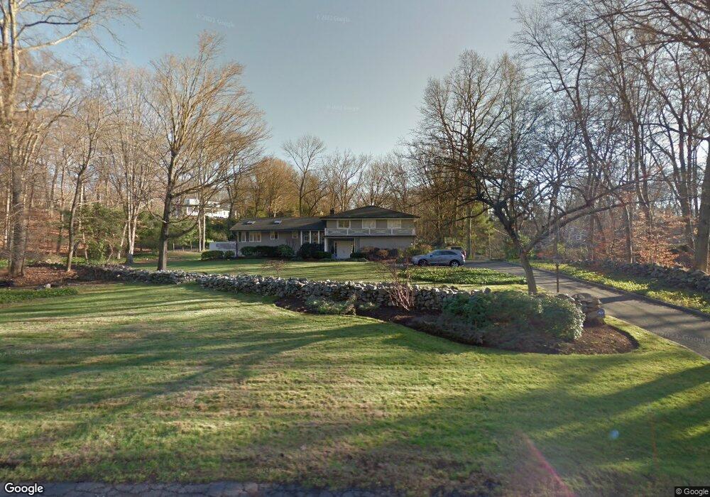
13 Cob Dr Westport, CT 06880
Coleytown NeighborhoodEstimated Value: $2,058,000 - $2,533,000
5
Beds
4
Baths
3,760
Sq Ft
$614/Sq Ft
Est. Value
About This Home
This home is located at 13 Cob Dr, Westport, CT 06880 and is currently estimated at $2,309,123, approximately $614 per square foot. 13 Cob Dr is a home located in Fairfield County with nearby schools including Coleytown Elementary School, Coleytown Middle School, and Staples High School.
Ownership History
Date
Name
Owned For
Owner Type
Purchase Details
Closed on
Feb 17, 2022
Sold by
Richlin Spencer S
Bought by
Richlin Danielle A
Current Estimated Value
Purchase Details
Closed on
Dec 18, 2020
Sold by
Richlin Spencer S and Richlin Danielle A
Bought by
Danielle Richlin Ret and Richlin
Home Financials for this Owner
Home Financials are based on the most recent Mortgage that was taken out on this home.
Original Mortgage
$1,000,000
Interest Rate
3.1%
Mortgage Type
Adjustable Rate Mortgage/ARM
Purchase Details
Closed on
Dec 21, 2009
Sold by
Agnes 3Rd Peter W and Agnes Dana R
Bought by
Richlin Spencer S and Richlin Danielle A
Home Financials for this Owner
Home Financials are based on the most recent Mortgage that was taken out on this home.
Original Mortgage
$1,000,000
Interest Rate
5.25%
Purchase Details
Closed on
Aug 25, 2006
Sold by
Porrino Peter R and Porrino Andrea D
Bought by
Agnes 3Rd Peter W and Agnes Dana R
Purchase Details
Closed on
Jul 7, 1993
Sold by
Miller Edith and Miller Arthur
Bought by
Porrino Peter and Porrino Andrea
Create a Home Valuation Report for This Property
The Home Valuation Report is an in-depth analysis detailing your home's value as well as a comparison with similar homes in the area
Home Values in the Area
Average Home Value in this Area
Purchase History
| Date | Buyer | Sale Price | Title Company |
|---|---|---|---|
| Richlin Danielle A | -- | None Available | |
| Danielle Richlin Ret | -- | None Available | |
| Danielle Richlin Ret | -- | None Available | |
| Richlin Spencer S | $1,285,000 | -- | |
| Richlin Spencer S | $1,285,000 | -- | |
| Agnes 3Rd Peter W | $1,350,000 | -- | |
| Agnes 3Rd Peter W | $1,350,000 | -- | |
| Porrino Peter | $585,000 | -- | |
| Porrino Peter | $585,000 | -- |
Source: Public Records
Mortgage History
| Date | Status | Borrower | Loan Amount |
|---|---|---|---|
| Previous Owner | Danielle Richlin Ret | $1,000,000 | |
| Previous Owner | Porrino Peter | $1,000,000 |
Source: Public Records
Tax History
| Year | Tax Paid | Tax Assessment Tax Assessment Total Assessment is a certain percentage of the fair market value that is determined by local assessors to be the total taxable value of land and additions on the property. | Land | Improvement |
|---|---|---|---|---|
| 2025 | $16,238 | $861,000 | $431,400 | $429,600 |
| 2024 | $16,032 | $861,000 | $431,400 | $429,600 |
| 2023 | $15,799 | $861,000 | $431,400 | $429,600 |
| 2022 | $15,558 | $861,000 | $431,400 | $429,600 |
| 2021 | $15,558 | $861,000 | $431,400 | $429,600 |
| 2020 | $15,744 | $942,200 | $453,500 | $488,700 |
| 2019 | $15,885 | $942,200 | $453,500 | $488,700 |
| 2018 | $15,885 | $942,200 | $453,500 | $488,700 |
| 2017 | $15,885 | $942,200 | $453,500 | $488,700 |
| 2016 | $15,885 | $942,200 | $453,500 | $488,700 |
| 2015 | $15,478 | $855,600 | $379,500 | $476,100 |
| 2014 | $15,349 | $855,600 | $379,500 | $476,100 |
Source: Public Records
Map
Nearby Homes
- 21 Warnock Dr
- 24 Warnock Dr
- 2 Rockyfield Rd
- 16 Gault Park Dr
- 53 Cross Hwy
- 44 Pumpkin Hill Rd
- 10 Charcoal Hill Rd
- 489 Main St
- 483 Main St
- 6 Nutcracker Ln
- 25 Maplewood Ave
- 118 Roseville Rd
- 116 Roseville Rd
- 9 Greenbrier Rd
- 80 Compo Rd N
- 13 Terhune Dr
- 278 North Ave
- 282 North Ave
- 15 Gorham Ave
- 2177 Cross Hwy
Your Personal Tour Guide
Ask me questions while you tour the home.