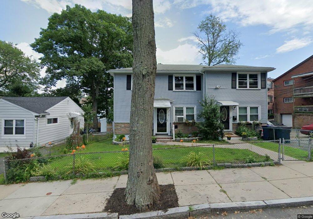
13 Corman Rd Mattapan, MA 02126
Southern Mattapan NeighborhoodEstimated Value: $692,376 - $881,000
6
Beds
2
Baths
2,176
Sq Ft
$347/Sq Ft
Est. Value
About This Home
This home is located at 13 Corman Rd, Mattapan, MA 02126 and is currently estimated at $754,094, approximately $346 per square foot. 13 Corman Rd is a home located in Suffolk County with nearby schools including KIPP Academy Boston Charter School, Boston Preparatory Charter Public School, and Berea Seventh-day Adventist Academy.
Ownership History
Date
Name
Owned For
Owner Type
Purchase Details
Closed on
Jul 8, 2011
Sold by
Small Sybil I and Small William C
Bought by
Pittman Charles and Pittman Janet
Current Estimated Value
Create a Home Valuation Report for This Property
The Home Valuation Report is an in-depth analysis detailing your home's value as well as a comparison with similar homes in the area
Home Values in the Area
Average Home Value in this Area
Purchase History
| Date | Buyer | Sale Price | Title Company |
|---|---|---|---|
| Pittman Charles | $265,000 | -- | |
| Pittman Charles | $265,000 | -- |
Source: Public Records
Tax History Compared to Growth
Tax History
| Year | Tax Paid | Tax Assessment Tax Assessment Total Assessment is a certain percentage of the fair market value that is determined by local assessors to be the total taxable value of land and additions on the property. | Land | Improvement |
|---|---|---|---|---|
| 2025 | $6,704 | $578,900 | $197,600 | $381,300 |
| 2024 | $6,765 | $620,600 | $177,300 | $443,300 |
| 2023 | $6,288 | $585,500 | $167,300 | $418,200 |
| 2022 | $6,370 | $585,500 | $167,300 | $418,200 |
| 2021 | $5,680 | $532,300 | $152,100 | $380,200 |
| 2020 | $4,435 | $420,000 | $148,400 | $271,600 |
| 2019 | $4,137 | $392,500 | $110,000 | $282,500 |
| 2018 | $3,673 | $350,500 | $110,000 | $240,500 |
| 2017 | $3,602 | $340,100 | $109,600 | $230,500 |
| 2016 | $3,401 | $309,200 | $109,600 | $199,600 |
| 2015 | $3,029 | $250,100 | $107,800 | $142,300 |
| 2014 | $2,914 | $231,600 | $107,800 | $123,800 |
Source: Public Records
Map
Nearby Homes
- 839-843 Cummins Hwy
- 770 Cummins Hwy Unit 1
- 770 Cummins Hwy Unit 22
- 231 Itasca St
- 10 Brockton St
- 34 Ridlon Rd
- 95 Woodhaven St
- 90 Hollingsworth St
- 179 Hebron St
- 100 Itasca St
- 72 Livermore St
- 48-50 Rockdale St
- 20 Monterey Ave
- 60 and 64 Monterey Ave
- 23 Caton St
- 265 Hebron St
- 14-14R Kennebec St
- 116 Almont St
- 25 Alpine St Unit 7
- 645 River St
- 3 Corman Rd
- 1 Corman Rd Unit 1
- 3 Corman Rd Unit 2
- 5 Corman Rd
- 734 Cummins Hwy Unit 736
- 728 Cummins Hwy Unit 8
- 728 Cummins Hwy Unit 7
- 736 Cummins Hwy
- 730 Cummins Hwy
- 730 Cummins Hwy Unit 6
- 730 Cummins Hwy Unit 5
- 730 Cummins Hwy Unit 4
- 730 Cummins Hwy Unit 3
- 730 Cummins Hwy Unit 2
- 730 Cummins Hwy Unit 1
- 2 Corman Rd
- 7 Corman Rd
- 4 Hallowell St
- 722 Cummins Hwy
- 738 Cummins Hwy Unit 740