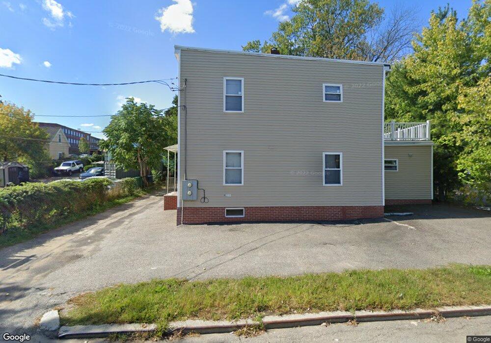
13 Dalby St Unit 2 Newton, MA 02458
Nonantum NeighborhoodEstimated Value: $956,362 - $1,148,000
2
Beds
3
Baths
1,500
Sq Ft
$692/Sq Ft
Est. Value
About This Home
This home is located at 13 Dalby St Unit 2, Newton, MA 02458 and is currently estimated at $1,038,091, approximately $692 per square foot. 13 Dalby St Unit 2 is a home located in Middlesex County with nearby schools including Lincoln-Eliot Elementary School, Bigelow Middle School, and Newton North High School.
Ownership History
Date
Name
Owned For
Owner Type
Purchase Details
Closed on
Nov 21, 2023
Sold by
Macdonald Kenneth S
Bought by
Ng Ranick and Liu Yingjie
Current Estimated Value
Home Financials for this Owner
Home Financials are based on the most recent Mortgage that was taken out on this home.
Original Mortgage
$612,500
Outstanding Balance
$600,747
Interest Rate
7.49%
Mortgage Type
Purchase Money Mortgage
Estimated Equity
$437,344
Purchase Details
Closed on
May 27, 1993
Sold by
Dalby St Rt and Olaughlin
Bought by
Macdonald Kenneth S
Home Financials for this Owner
Home Financials are based on the most recent Mortgage that was taken out on this home.
Original Mortgage
$120,000
Interest Rate
7.41%
Mortgage Type
Purchase Money Mortgage
Create a Home Valuation Report for This Property
The Home Valuation Report is an in-depth analysis detailing your home's value as well as a comparison with similar homes in the area
Home Values in the Area
Average Home Value in this Area
Purchase History
| Date | Buyer | Sale Price | Title Company |
|---|---|---|---|
| Ng Ranick | $875,000 | None Available | |
| Ng Ranick | $875,000 | None Available | |
| Macdonald Kenneth S | $168,000 | -- | |
| Macdonald Kenneth S | $168,000 | -- | |
| Macdonald Kenneth S | $168,000 | -- | |
| Macdonald Kenneth S | $168,000 | -- |
Source: Public Records
Mortgage History
| Date | Status | Borrower | Loan Amount |
|---|---|---|---|
| Open | Ng Ranick | $612,500 | |
| Previous Owner | Macdonald Kenneth S | $120,000 |
Source: Public Records
Tax History Compared to Growth
Tax History
| Year | Tax Paid | Tax Assessment Tax Assessment Total Assessment is a certain percentage of the fair market value that is determined by local assessors to be the total taxable value of land and additions on the property. | Land | Improvement |
|---|---|---|---|---|
| 2025 | $8,387 | $855,800 | $639,900 | $215,900 |
| 2024 | $7,654 | $784,200 | $584,000 | $200,200 |
| 2023 | $7,196 | $706,900 | $452,100 | $254,800 |
| 2022 | $6,885 | $654,500 | $418,600 | $235,900 |
| 2021 | $6,461 | $600,500 | $384,000 | $216,500 |
| 2020 | $5,041 | $600,500 | $384,000 | $216,500 |
| 2019 | $5,865 | $561,200 | $358,900 | $202,300 |
| 2018 | $5,723 | $528,900 | $334,000 | $194,900 |
| 2017 | $5,395 | $485,200 | $306,400 | $178,800 |
| 2016 | $5,065 | $445,100 | $281,100 | $164,000 |
| 2015 | $4,830 | $416,000 | $262,700 | $153,300 |
Source: Public Records
Map
Nearby Homes
- 44 Faxon St Unit 2
- 290 Watertown St Unit 3
- 290 Watertown St Unit 4
- 290 Pleasant St Unit 220
- 290 Pleasant St Unit 113
- 68 Los Angeles St Unit PH5
- 34 West St Unit A
- 158 Adams St
- 53 West St
- 191 Linwood Ave
- 282 Nevada St Unit 282
- 188-190 Adams St
- 286 Nevada St Unit 286
- 86 West St
- 49 Hawthorn St
- 11 Murphy Ct
- 338 Nevada St Unit 338
- 20 Rosedale Rd
- 27 Oakland St
- 3 Ashmont Ave
- 13 Dalby St
- 13 Dalby St Unit A
- 13 Dalby St Unit 3
- 13 Dalby St Unit 1
- 13 Dalby St Unit C
- 15 Dalby St Unit 17
- 9 Dalby St Unit 2
- 9 Dalby St Unit 11
- 9 Dalby St Unit 11
- 9 Dalby St Unit 9
- 9 Dalby St
- 316 California St
- 316 California St Unit 1
- 316 California St Unit 2
- 11 Dalby St
- 11 Dalby St Unit 11
- 11 Dalby St Unit 1
- 24 Chapel St
- 21 Dalby St
- 21 Dalby St Unit R