Estimated Value: $107,000 - $157,000
4
Beds
2
Baths
1,515
Sq Ft
$87/Sq Ft
Est. Value
About This Home
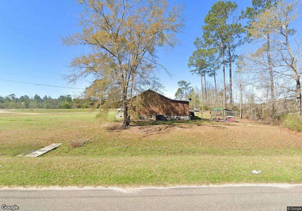
This home is located at 13 Daniel Hester Rd, Lenox, GA 31637 and is currently estimated at $131,917, approximately $87 per square foot. 13 Daniel Hester Rd is a home located in Cook County with nearby schools including Cook Primary School, Cook Elementary School, and Cook County Middle School.
Ownership History
Date
Name
Owned For
Owner Type
Purchase Details
Closed on
Mar 29, 2022
Sold by
Barber Jessie L
Bought by
Ball Austin Scott and Ball Cadie Lanae
Current Estimated Value
Home Financials for this Owner
Home Financials are based on the most recent Mortgage that was taken out on this home.
Original Mortgage
$46,566
Outstanding Balance
$10,876
Interest Rate
3.92%
Mortgage Type
Mortgage Modification
Estimated Equity
$121,041
Purchase Details
Closed on
Apr 1, 2014
Sold by
Barber Joshua M
Bought by
Barber Jessie L
Home Financials for this Owner
Home Financials are based on the most recent Mortgage that was taken out on this home.
Original Mortgage
$74,396
Interest Rate
4.33%
Mortgage Type
New Conventional
Create a Home Valuation Report for This Property
The Home Valuation Report is an in-depth analysis detailing your home's value as well as a comparison with similar homes in the area
Purchase History
| Date | Buyer | Sale Price | Title Company |
|---|---|---|---|
| Ball Austin Scott | $55,000 | -- | |
| Barber Jessie L | -- | -- |
Source: Public Records
Mortgage History
| Date | Status | Borrower | Loan Amount |
|---|---|---|---|
| Open | Ball Austin Scott | $46,566 | |
| Previous Owner | Barber Jessie L | $74,396 |
Source: Public Records
Tax History
| Year | Tax Paid | Tax Assessment Tax Assessment Total Assessment is a certain percentage of the fair market value that is determined by local assessors to be the total taxable value of land and additions on the property. | Land | Improvement |
|---|---|---|---|---|
| 2025 | $1,013 | $54,014 | $2,094 | $51,920 |
| 2024 | $1,097 | $42,736 | $1,656 | $41,080 |
| 2023 | $539 | $27,760 | $1,656 | $26,104 |
| 2022 | $783 | $29,070 | $2,966 | $26,104 |
| 2021 | $714 | $24,718 | $2,966 | $21,752 |
| 2020 | $714 | $24,718 | $2,966 | $21,752 |
| 2019 | $714 | $24,718 | $2,966 | $21,752 |
| 2018 | $715 | $24,718 | $2,966 | $21,752 |
| 2017 | $715 | $24,718 | $2,966 | $21,752 |
| 2016 | $716 | $24,718 | $2,966 | $21,752 |
| 2015 | $717 | $24,718 | $2,966 | $21,752 |
| 2014 | $662 | $24,718 | $2,966 | $21,752 |
| 2013 | -- | $24,718 | $2,966 | $21,752 |
Source: Public Records
Map
Nearby Homes
- 320 E Central Ave
- 83 W Gray Ave
- 0 Barneyville Rd Unit 149717
- 326 N Robinson St
- 8422 Massee Post Rd
- 1629 Baker Sawmill Rd
- 284 Barrett Rd
- 103 N College St
- 2696 Woodland Dr
- 14268 Georgia 125
- 2603 Dianne St
- 2304 Thomas St
- 1607 Jimmy St
- 59 McKentson Ln
- 134 Brandy Ct
- 1405 Pebblewood Dr
- 1402 Bear Creek Rd
- 349 Sand Ridge Ln
- 1002 Bear Creek Rd
- 131 Henry Poole Rd
- 6144 Brushy Creek Rd
- 90 Cranford Sumner Rd
- 134 Cranford Sumner Rd
- 6151 Brushy Creek Rd
- 6061 Brushy Creek Rd
- 6165 Brushy Creek Rd
- 95 Daniel Hester Rd
- 5975 Brushy Creek Rd
- 118 Daniel Hester Rd
- 5939 Brushy Creek Rd
- 6343 Brushy Creek Rd
- 5921 Brushy Creek Rd
- 343 Cranford Sumner Rd
- 5902 Brushy Creek Rd
- 6267 Brushy Creek Rd
- 6407 Brushy Creek Rd
- 5854 Brushy Creek Rd
- 409 Cranford Sumner Rd
- 515 Cranford Sumner Rd
- 5731 Brushy Creek Rd
Your Personal Tour Guide
Ask me questions while you tour the home.