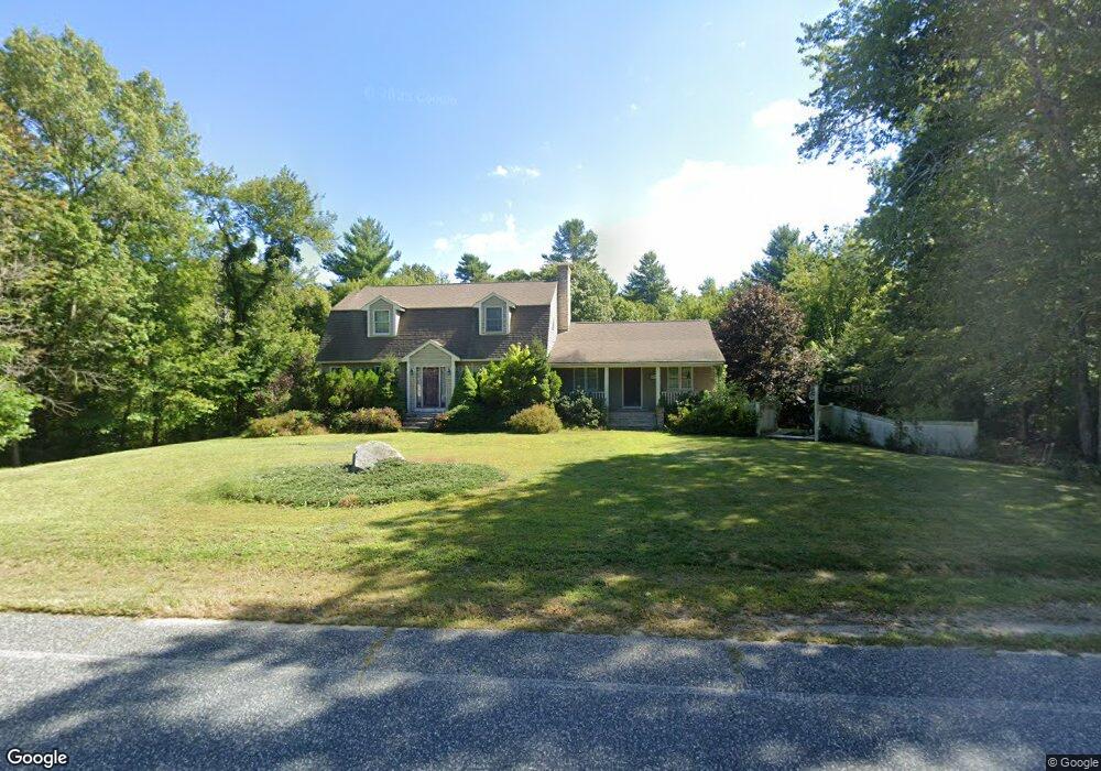
13 Dean St Rehoboth, MA 02769
Estimated Value: $700,108 - $913,000
3
Beds
3
Baths
2,830
Sq Ft
$285/Sq Ft
Est. Value
About This Home
This home is located at 13 Dean St, Rehoboth, MA 02769 and is currently estimated at $805,277, approximately $284 per square foot. 13 Dean St is a home located in Bristol County with nearby schools including Dighton-Rehoboth Regional High School, Grace Baptist Christian Academy, and The Pinecroft School.
Ownership History
Date
Name
Owned For
Owner Type
Purchase Details
Closed on
Jan 22, 2007
Sold by
Gallant William I and Gallant Andrea M
Bought by
Gallant Andrea M
Current Estimated Value
Home Financials for this Owner
Home Financials are based on the most recent Mortgage that was taken out on this home.
Original Mortgage
$230,000
Outstanding Balance
$136,911
Interest Rate
6.14%
Mortgage Type
Purchase Money Mortgage
Estimated Equity
$668,366
Purchase Details
Closed on
Mar 25, 1994
Sold by
Proulx Wayne J and Proulx Cynthia Ann
Bought by
Gallant William and Gallant Andrea M
Home Financials for this Owner
Home Financials are based on the most recent Mortgage that was taken out on this home.
Original Mortgage
$147,400
Interest Rate
7.15%
Mortgage Type
Purchase Money Mortgage
Create a Home Valuation Report for This Property
The Home Valuation Report is an in-depth analysis detailing your home's value as well as a comparison with similar homes in the area
Home Values in the Area
Average Home Value in this Area
Purchase History
| Date | Buyer | Sale Price | Title Company |
|---|---|---|---|
| Gallant Andrea M | -- | -- | |
| Gallant William | $35,000 | -- |
Source: Public Records
Mortgage History
| Date | Status | Borrower | Loan Amount |
|---|---|---|---|
| Open | Gallant Andrea M | $230,000 | |
| Previous Owner | Gallant William | $147,400 |
Source: Public Records
Tax History
| Year | Tax Paid | Tax Assessment Tax Assessment Total Assessment is a certain percentage of the fair market value that is determined by local assessors to be the total taxable value of land and additions on the property. | Land | Improvement |
|---|---|---|---|---|
| 2025 | $61 | $544,400 | $180,100 | $364,300 |
| 2024 | $5,766 | $507,600 | $180,100 | $327,500 |
| 2023 | $5,385 | $467,600 | $176,500 | $291,100 |
| 2022 | $5,385 | $425,000 | $176,500 | $248,500 |
| 2021 | $5,289 | $399,500 | $168,700 | $230,800 |
| 2020 | $5,241 | $399,500 | $168,700 | $230,800 |
| 2018 | $4,537 | $379,000 | $160,900 | $218,100 |
| 2017 | $4,449 | $354,200 | $160,900 | $193,300 |
| 2016 | $4,304 | $354,200 | $160,900 | $193,300 |
| 2015 | $4,276 | $347,400 | $153,700 | $193,700 |
| 2014 | $4,232 | $340,200 | $146,500 | $193,700 |
Source: Public Records
Map
Nearby Homes
- 1 Round Farm Rd
- 48 Round Farm Rd
- 52 Round Farm Rd
- 58 Peck St
- 23 Stockade Cir
- 168 Run Brook Cir
- 86 E Hodges St Unit 86
- 40 Duffy Dr
- 49 Teaberry Ln
- 3 Gilberts Way
- 240 Smith St
- 8 Kasmira Way
- 985 Glebe St
- 88 Morgan Dr
- 620 Burt St
- 43 Smith St
- 0 Kimberly Rd
- 47 Caroline Dr
- 125 John Scott Blvd
- 127 John Scott Blvd
Your Personal Tour Guide
Ask me questions while you tour the home.