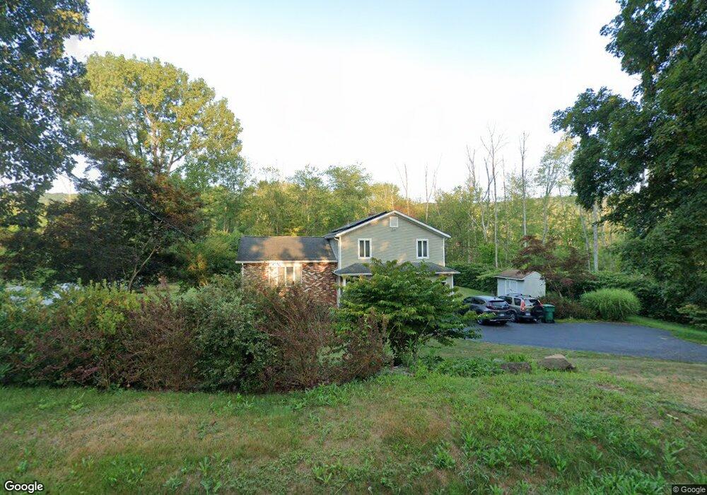
13 Duncaster Rd Bloomfield, CT 06002
Estimated Value: $410,000 - $439,029
3
Beds
3
Baths
1,485
Sq Ft
$287/Sq Ft
Est. Value
About This Home
This home is located at 13 Duncaster Rd, Bloomfield, CT 06002 and is currently estimated at $425,757, approximately $286 per square foot. 13 Duncaster Rd is a home located in Hartford County with nearby schools including Laurel School, Carmen Arace Intermediate School, and Metacomet School.
Ownership History
Date
Name
Owned For
Owner Type
Purchase Details
Closed on
Oct 6, 2020
Sold by
Rivera Oscar and Rivera Michelle
Bought by
Rivera Lt and Rivera
Current Estimated Value
Purchase Details
Closed on
Apr 2, 1997
Sold by
Kozloski Wendy
Bought by
Rivera Oscar and Rivera Michelle
Purchase Details
Closed on
Jul 27, 1992
Sold by
Barber Donna
Bought by
Kozloski Wendy
Create a Home Valuation Report for This Property
The Home Valuation Report is an in-depth analysis detailing your home's value as well as a comparison with similar homes in the area
Home Values in the Area
Average Home Value in this Area
Purchase History
| Date | Buyer | Sale Price | Title Company |
|---|---|---|---|
| Rivera Lt | -- | None Available | |
| Rivera Lt | -- | None Available | |
| Rivera Oscar | $131,900 | -- | |
| Rivera Oscar | $131,900 | -- | |
| Kozloski Wendy | $144,250 | -- |
Source: Public Records
Mortgage History
| Date | Status | Borrower | Loan Amount |
|---|---|---|---|
| Previous Owner | Kozloski Wendy | $50,000 | |
| Previous Owner | Kozloski Wendy | $78,700 | |
| Previous Owner | Kozloski Wendy | $25,000 |
Source: Public Records
Tax History
| Year | Tax Paid | Tax Assessment Tax Assessment Total Assessment is a certain percentage of the fair market value that is determined by local assessors to be the total taxable value of land and additions on the property. | Land | Improvement |
|---|---|---|---|---|
| 2025 | $10,560 | $281,610 | $70,630 | $210,980 |
| 2024 | $7,285 | $185,640 | $61,950 | $123,690 |
| 2023 | $7,153 | $185,640 | $61,950 | $123,690 |
| 2022 | $6,689 | $185,640 | $61,950 | $123,690 |
| 2021 | $6,837 | $185,640 | $61,950 | $123,690 |
| 2020 | $6,731 | $185,640 | $61,950 | $123,690 |
| 2019 | $7,125 | $184,310 | $61,950 | $122,360 |
| 2018 | $6,677 | $172,900 | $62,160 | $110,740 |
| 2017 | $6,667 | $172,900 | $62,160 | $110,740 |
| 2016 | $6,510 | $172,900 | $62,160 | $110,740 |
| 2015 | $6,389 | $172,900 | $62,160 | $110,740 |
| 2014 | $6,487 | $181,510 | $59,500 | $122,010 |
Source: Public Records
Map
Nearby Homes
- 36 Gale Rd
- 545 Simsbury Rd
- 170 Thistle Pond Dr Unit 170
- 162 Thistle Pond Dr
- 63 Duncaster Rd
- 26 Burnwood Dr
- 81 Silo Way Unit 81
- 3 Cobtail Way
- 5 Caramoor Park Unit 5
- 13 Hill Farm Rd
- 34 Cary Ln Unit 34
- 406 Tunxis Ave
- 79 Prospect St
- 322 Tunxis Ave
- 234 Woodland Ave
- 200 Castlewood Dr
- 15 Sand Hill Rd
- 2 Meadow Ct
- 126 Hopmeadow St Unit 3H
- 12 Filley St
Your Personal Tour Guide
Ask me questions while you tour the home.