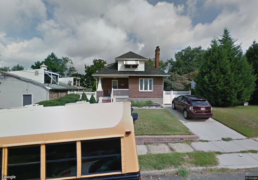
13 E 5th Ave Runnemede, NJ 08078
Estimated Value: $218,869 - $292,000
Studio
--
Bath
1,396
Sq Ft
$190/Sq Ft
Est. Value
About This Home
This home is located at 13 E 5th Ave, Runnemede, NJ 08078 and is currently estimated at $264,717, approximately $189 per square foot. 13 E 5th Ave is a home located in Camden County with nearby schools including Mary E. Volz Elementary School, Downing Elementary School, and Triton High School.
Ownership History
Date
Name
Owned For
Owner Type
Purchase Details
Closed on
Oct 19, 2021
Sold by
Henry P Menaldi Grantor Trust
Bought by
Menaldi Angela
Current Estimated Value
Purchase Details
Closed on
Oct 23, 2019
Sold by
Menaldi Henry P
Bought by
Menaldi Angela and Henry P Menaldi Grantor Trust
Create a Home Valuation Report for This Property
The Home Valuation Report is an in-depth analysis detailing your home's value as well as a comparison with similar homes in the area
Home Values in the Area
Average Home Value in this Area
Purchase History
| Date | Buyer | Sale Price | Title Company |
|---|---|---|---|
| Menaldi Angela | $100,000 | Tedesco Brittany | |
| Menaldi Angela | $100,000 | None Listed On Document | |
| Menaldi Angela | -- | None Available |
Source: Public Records
Tax History
| Year | Tax Paid | Tax Assessment Tax Assessment Total Assessment is a certain percentage of the fair market value that is determined by local assessors to be the total taxable value of land and additions on the property. | Land | Improvement |
|---|---|---|---|---|
| 2025 | $5,678 | $126,000 | $42,300 | $83,700 |
| 2024 | $5,505 | $126,000 | $42,300 | $83,700 |
Source: Public Records
Map
Nearby Homes
- 38 Robert Dr
- 29 W 4th Ave
- 39 E 2nd Ave
- 319 Bowers Ave
- 206 W 5th Ave
- 232 Garden Terrace
- 60 N Oakland Ave
- 308 Smith Ln
- 23 E 10th Ave
- 408 W 3rd Ave
- 850 Orchard Ave
- 1042 Central Ave
- 534 Blanchard Ave
- 37 S Read Ave
- 524 Hirsch Ave
- 141 Oak Ave
- 14 E Evesham Rd
- 411 Center Ave
- 1050 Woodland Ave
- 400 Jefferson Ct
- 508 N Black Horse Pike
- 15 E 5th Ave
- 518 N Black Horse Pike Unit 2
- 518 N Black Horse Pike
- 518 N Black Horse Pike Unit 1
- 518 N Black Horse Pike Unit 4
- 25 E 5th Ave
- 500 N Black Horse Pike
- 24 E 6th Ave
- 24 E 5th Ave
- 29 E 5th Ave
- 28 E 5th Ave
- 32 E 5th Ave
- 424 N Black Horse Pike
- 424 N Black Horse Pike Unit 470
- 424 N Black Horse Pike Unit 422
- 424 N Black Horse Pike Unit 472
- 424 N Black Horse Pike Unit 418
- 424 N Black Horse Pike
- 424 N Black Horse Pike Unit 426
Your Personal Tour Guide
Ask me questions while you tour the home.