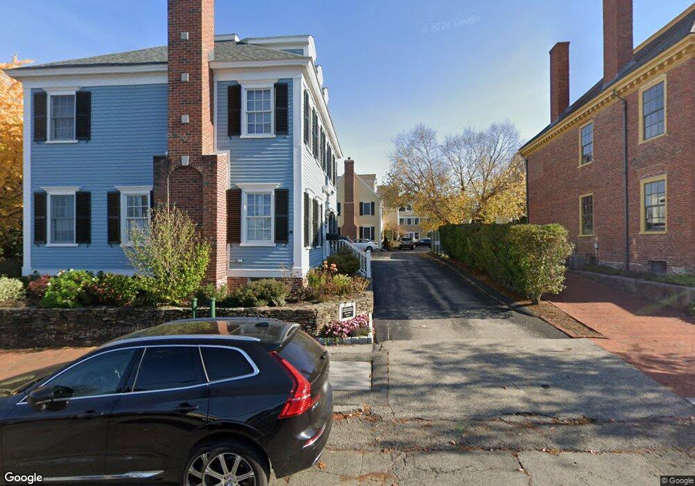
13 Federal St Unit A Newburyport, MA 01950
Estimated Value: $1,162,000 - $1,266,696
3
Beds
3
Baths
1,908
Sq Ft
$636/Sq Ft
Est. Value
About This Home
This home is located at 13 Federal St Unit A, Newburyport, MA 01950 and is currently estimated at $1,214,424, approximately $636 per square foot. 13 Federal St Unit A is a home located in Essex County with nearby schools including Francis T. Bresnahan Elementary School, Edward G. Molin Elementary School, and Rupert A. Nock Middle School.
Ownership History
Date
Name
Owned For
Owner Type
Purchase Details
Closed on
Jun 5, 2018
Sold by
Spalding A Tozzer A and Spalding Alfred T
Bought by
Tozzer and Tozzer Jane Spalding
Current Estimated Value
Purchase Details
Closed on
Nov 30, 2012
Sold by
Blanchette Paul and Blanchette Christine
Bought by
Dunn Mary C
Purchase Details
Closed on
Jan 16, 2004
Sold by
Kimberly Rt and Kutcher
Bought by
Spalding Alfred T
Create a Home Valuation Report for This Property
The Home Valuation Report is an in-depth analysis detailing your home's value as well as a comparison with similar homes in the area
Home Values in the Area
Average Home Value in this Area
Purchase History
| Date | Buyer | Sale Price | Title Company |
|---|---|---|---|
| Tozzer | -- | -- | |
| Dunn Mary C | $605,000 | -- | |
| Spalding Alfred T | $539,584 | -- |
Source: Public Records
Mortgage History
| Date | Status | Borrower | Loan Amount |
|---|---|---|---|
| Previous Owner | Spalding Alfred T | $70,000 |
Source: Public Records
Tax History Compared to Growth
Tax History
| Year | Tax Paid | Tax Assessment Tax Assessment Total Assessment is a certain percentage of the fair market value that is determined by local assessors to be the total taxable value of land and additions on the property. | Land | Improvement |
|---|---|---|---|---|
| 2025 | $10,051 | $1,049,200 | $0 | $1,049,200 |
| 2024 | $9,815 | $984,500 | $0 | $984,500 |
| 2023 | $9,783 | $910,900 | $0 | $910,900 |
| 2022 | $9,561 | $796,100 | $0 | $796,100 |
| 2021 | $9,609 | $760,200 | $0 | $760,200 |
| 2020 | $9,570 | $745,300 | $0 | $745,300 |
| 2019 | $9,242 | $706,600 | $0 | $706,600 |
| 2018 | $9,092 | $685,700 | $0 | $685,700 |
| 2017 | $8,823 | $656,000 | $0 | $656,000 |
| 2016 | $8,306 | $620,300 | $0 | $620,300 |
| 2015 | $8,004 | $600,000 | $0 | $600,000 |
Source: Public Records
Map
Nearby Homes
- 15 Beck St Unit 1
- 15 Beck St
- 42 Federal St Unit B
- 4 School St
- 14 Spring St
- 11 Orange St Unit 1
- 9 Orange St Unit 1
- 9 Orange St
- 58 Lime St Unit 5
- 166 Water St Unit B
- 164 Water St
- 164 Water St Unit A
- 111 Prospect St Unit A
- 113 Prospect St Unit B
- 10 10th St
- 78 High St
- 7 Parsons St
- 12 Parsons St Unit 2
- 65 Bromfield St
- 95 High St Unit 4