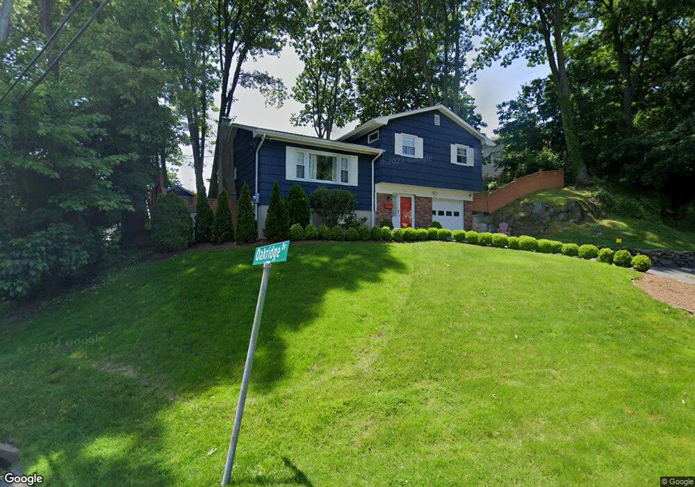
13 Greyrock Rd N Port Chester, NY 10573
Estimated Value: $760,135 - $903,000
3
Beds
3
Baths
1,480
Sq Ft
$556/Sq Ft
Est. Value
About This Home
This home is located at 13 Greyrock Rd N, Port Chester, NY 10573 and is currently estimated at $822,534, approximately $555 per square foot. 13 Greyrock Rd N is a home located in Westchester County with nearby schools including Port Chester Senior High School, Corpus Christi Holy Rosary School, and Resurrection Grammar School.
Ownership History
Date
Name
Owned For
Owner Type
Purchase Details
Closed on
Aug 25, 2008
Sold by
Vaccaro Francis A and Vaccaro Elaine M
Bought by
Mcelwee Colin and Mcelwee Carol
Current Estimated Value
Home Financials for this Owner
Home Financials are based on the most recent Mortgage that was taken out on this home.
Original Mortgage
$405,820
Outstanding Balance
$341,289
Interest Rate
6.69%
Mortgage Type
Unknown
Estimated Equity
$481,245
Create a Home Valuation Report for This Property
The Home Valuation Report is an in-depth analysis detailing your home's value as well as a comparison with similar homes in the area
Home Values in the Area
Average Home Value in this Area
Purchase History
| Date | Buyer | Sale Price | Title Company |
|---|---|---|---|
| Mcelwee Colin | $507,275 | Pro Title |
Source: Public Records
Mortgage History
| Date | Status | Borrower | Loan Amount |
|---|---|---|---|
| Open | Mcelwee Colin | $405,820 |
Source: Public Records
Tax History Compared to Growth
Tax History
| Year | Tax Paid | Tax Assessment Tax Assessment Total Assessment is a certain percentage of the fair market value that is determined by local assessors to be the total taxable value of land and additions on the property. | Land | Improvement |
|---|---|---|---|---|
| 2024 | $15,026 | $655,100 | $186,300 | $468,800 |
| 2023 | $13,941 | $629,900 | $177,400 | $452,500 |
| 2022 | $13,632 | $577,900 | $177,400 | $400,500 |
| 2021 | $14,342 | $555,700 | $177,400 | $378,300 |
| 2020 | $11,133 | $539,500 | $177,400 | $362,100 |
| 2019 | $12,952 | $426,900 | $201,000 | $225,900 |
| 2018 | $7,641 | $418,800 | $196,900 | $221,900 |
| 2017 | $1,733 | $403,700 | $183,700 | $220,000 |
| 2016 | $9,133 | $393,500 | $175,000 | $218,500 |
| 2015 | -- | $354,800 | $144,100 | $210,700 |
| 2014 | -- | $336,000 | $158,700 | $177,300 |
| 2013 | -- | $312,500 | $135,200 | $177,300 |
Source: Public Records
Map
Nearby Homes
- 33 Alto Ave
- 17 Edgar Place
- 9 Harbor Dr
- 455 Grace Church St
- 27 Fox Island Rd
- 6 N Island Dr
- 3 River Ave Unit 1A
- 255 Grace Church St
- 47 Smith St
- 13 Kirby Ln
- 2 Peck Ave Unit 25B
- 2 Peck Ave Unit 223B
- 111 Washington St
- 506 Midland Ave
- 2 Lavender Ln
- 43 Oak St
- 43 Washington St
- 21 Clinton St
- 111 Spring St
- 42 Mead Ave