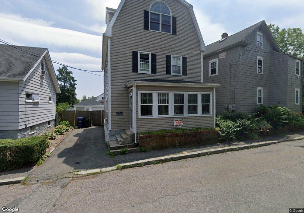
13 Harrod St Salem, MA 01970
Mack Park NeighborhoodEstimated Value: $638,000 - $712,000
5
Beds
3
Baths
2,001
Sq Ft
$341/Sq Ft
Est. Value
About This Home
This home is located at 13 Harrod St, Salem, MA 01970 and is currently estimated at $681,798, approximately $340 per square foot. 13 Harrod St is a home located in Essex County with nearby schools including Bates Elementary School, Witchcraft Heights Elementary School, and Saltonstall School.
Ownership History
Date
Name
Owned For
Owner Type
Purchase Details
Closed on
Dec 21, 2001
Sold by
Paquette Cynthia E
Bought by
Raymond Manuel J and Raymond Heidi J
Current Estimated Value
Purchase Details
Closed on
Jun 20, 1989
Sold by
Hereford Brice
Bought by
Paquette Cynthia
Create a Home Valuation Report for This Property
The Home Valuation Report is an in-depth analysis detailing your home's value as well as a comparison with similar homes in the area
Home Values in the Area
Average Home Value in this Area
Purchase History
| Date | Buyer | Sale Price | Title Company |
|---|---|---|---|
| Raymond Manuel J | $222,000 | -- | |
| Paquette Cynthia | $149,900 | -- |
Source: Public Records
Mortgage History
| Date | Status | Borrower | Loan Amount |
|---|---|---|---|
| Open | Paquette Cynthia | $75,000 | |
| Open | Paquette Cynthia | $251,500 | |
| Closed | Paquette Cynthia | $222,400 |
Source: Public Records
Tax History Compared to Growth
Tax History
| Year | Tax Paid | Tax Assessment Tax Assessment Total Assessment is a certain percentage of the fair market value that is determined by local assessors to be the total taxable value of land and additions on the property. | Land | Improvement |
|---|---|---|---|---|
| 2025 | $6,633 | $584,900 | $201,100 | $383,800 |
| 2024 | $6,422 | $552,700 | $191,100 | $361,600 |
| 2023 | $6,206 | $496,100 | $176,400 | $319,700 |
| 2022 | $5,907 | $445,800 | $170,500 | $275,300 |
| 2021 | $5,826 | $422,200 | $158,800 | $263,400 |
| 2020 | $5,527 | $382,500 | $149,900 | $232,600 |
| 2019 | $5,507 | $364,700 | $142,300 | $222,400 |
| 2018 | $5,345 | $347,500 | $135,200 | $212,300 |
| 2017 | $4,991 | $314,700 | $114,100 | $200,600 |
| 2016 | $4,848 | $309,400 | $108,800 | $200,600 |
| 2015 | $4,754 | $289,700 | $100,000 | $189,700 |
Source: Public Records
Map
Nearby Homes
- 43 Irving St
- 1 Dennis St
- 16 1/2 Symonds St
- 52 Dunlap St
- 8 Cushing St Unit 2
- 9 Shamrock St
- 75 Walnut St Unit 116
- 78 Northend St
- 5 Woodside St Unit 5-1
- 97 Mason St Unit 2
- 170 North St
- 14 Margin St
- 5 School St Unit 6
- 13 Oak St
- 8 Scotia St
- 9 Scotia St
- 143 North St Unit 2
- 22 Hanson St
- 6 Englewood Rd
- 144 North St