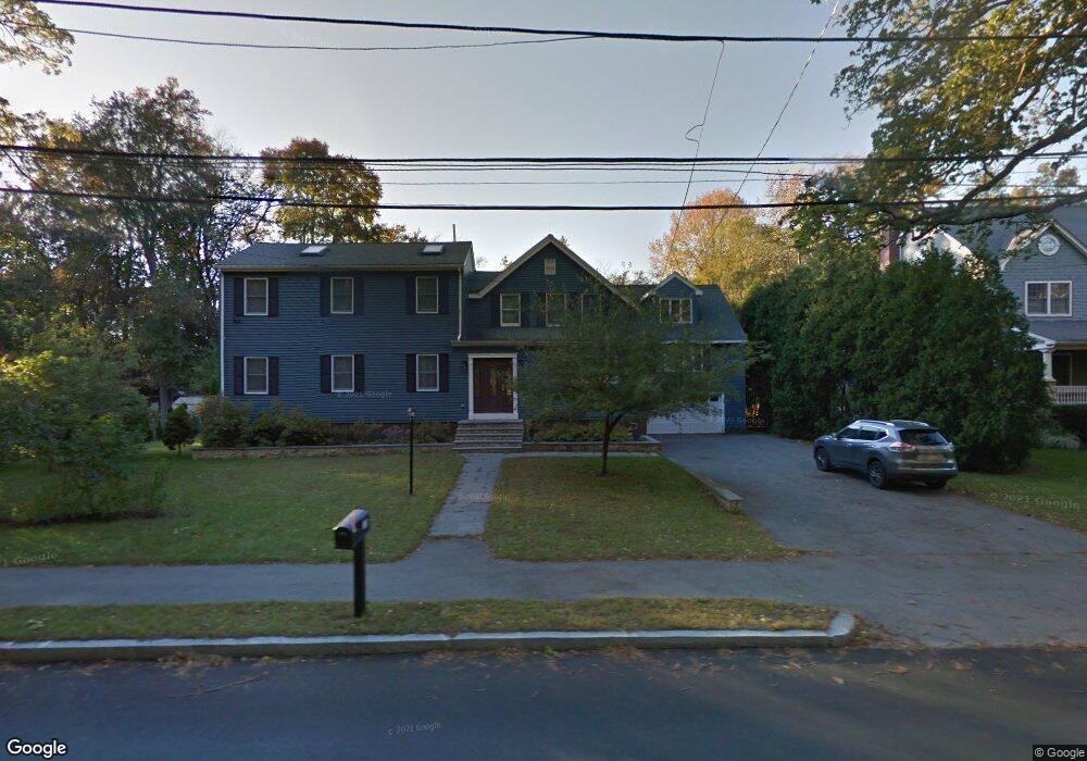
13 Hartwell Rd Bedford, MA 01730
Estimated Value: $1,145,000 - $1,366,000
4
Beds
3
Baths
3,588
Sq Ft
$357/Sq Ft
Est. Value
About This Home
This home is located at 13 Hartwell Rd, Bedford, MA 01730 and is currently estimated at $1,281,511, approximately $357 per square foot. 13 Hartwell Rd is a home located in Middlesex County with nearby schools including Lt. Elezer Davis Elementary School, Lt .Job Lane Elementary School, and John Glenn Middle School.
Ownership History
Date
Name
Owned For
Owner Type
Purchase Details
Closed on
Dec 21, 2017
Sold by
Blanchard Astrid
Bought by
Astrid Blanchard T
Current Estimated Value
Purchase Details
Closed on
Jun 26, 1989
Sold by
Sheehan Gregory H
Bought by
Blanchard Reginald F
Create a Home Valuation Report for This Property
The Home Valuation Report is an in-depth analysis detailing your home's value as well as a comparison with similar homes in the area
Home Values in the Area
Average Home Value in this Area
Purchase History
| Date | Buyer | Sale Price | Title Company |
|---|---|---|---|
| Astrid Blanchard T | -- | -- | |
| Blanchard Reginald F | $178,000 | -- |
Source: Public Records
Mortgage History
| Date | Status | Borrower | Loan Amount |
|---|---|---|---|
| Previous Owner | Blanchard Reginald F | $400,000 | |
| Previous Owner | Blanchard Reginald F | $101,000 | |
| Previous Owner | Blanchard Reginald F | $140,000 |
Source: Public Records
Tax History Compared to Growth
Tax History
| Year | Tax Paid | Tax Assessment Tax Assessment Total Assessment is a certain percentage of the fair market value that is determined by local assessors to be the total taxable value of land and additions on the property. | Land | Improvement |
|---|---|---|---|---|
| 2025 | $114 | $949,000 | $469,300 | $479,700 |
| 2024 | $10,737 | $903,800 | $447,000 | $456,800 |
| 2023 | $10,768 | $862,800 | $422,100 | $440,700 |
| 2022 | $10,711 | $788,700 | $405,600 | $383,100 |
| 2021 | $10,380 | $767,200 | $384,100 | $383,100 |
| 2020 | $10,112 | $767,200 | $384,100 | $383,100 |
| 2019 | $13,499 | $761,200 | $384,100 | $377,100 |
| 2018 | $13,228 | $743,100 | $381,100 | $362,000 |
| 2017 | $9,738 | $657,500 | $273,100 | $384,400 |
| 2016 | $8,213 | $537,510 | $248,300 | $289,210 |
| 2015 | $7,858 | $537,510 | $248,300 | $289,210 |
| 2014 | $7,633 | $485,900 | $215,200 | $270,700 |
Source: Public Records
Map
Nearby Homes
- 36 Loomis St Unit 104
- 36 Loomis St Unit 301
- 36 Loomis St Unit 404
- 10 Webber Ave Unit 1A
- 10 Webber Ave Unit 3C
- 10 Webber Ave Unit 4D
- 22 Springs Rd
- 39 Neillian St Unit 39
- 52 Summer St Unit B
- 50 Summer St Unit A
- 10 Nickerson Rd
- 37 Pine St
- 75 Westview St
- 22 Selfridge Rd
- 62 Carlisle Rd
- 83 Winter St
- 1 Harvard Dr
- 24 Dunelm Rd
- 55 Ivan St
- 25 Pickman Dr Unit 25
- 19 Hartwell Rd
- 2 Washington St
- 9 Hartwell Rd
- 4 Washington St
- 23 Hartwell Rd
- 1 Hartwell Rd
- 1 Washington St
- 6 Washington St
- 3 Washington St
- 25 Hartwell Rd
- 139 South Rd
- 5 Washington St
- 27 Hartwell Rd
- 7 Washington St
- 8 Washington St
- 152 South Rd
- 154 South Rd
- 9 Washington St
- 10 Washington St
- 156 South Rd