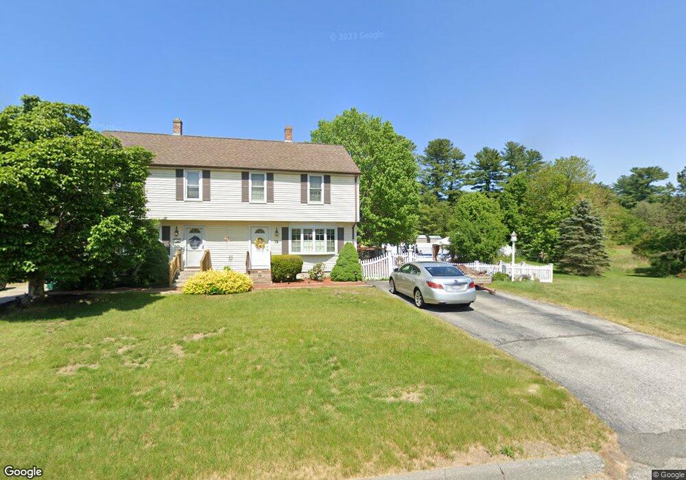
13 Harvest Rd Uxbridge, MA 01569
Estimated Value: $360,000 - $395,000
2
Beds
2
Baths
1,089
Sq Ft
$343/Sq Ft
Est. Value
About This Home
This home is located at 13 Harvest Rd, Uxbridge, MA 01569 and is currently estimated at $373,845, approximately $343 per square foot. 13 Harvest Rd is a home located in Worcester County with nearby schools including Uxbridge High School, Our Lady of the Valley Regional School, and Whitinsville Christian School.
Ownership History
Date
Name
Owned For
Owner Type
Purchase Details
Closed on
Aug 3, 2007
Sold by
Countrywide Gp Inc
Bought by
Evers Angela
Current Estimated Value
Home Financials for this Owner
Home Financials are based on the most recent Mortgage that was taken out on this home.
Original Mortgage
$190,000
Outstanding Balance
$120,728
Interest Rate
6.73%
Mortgage Type
Purchase Money Mortgage
Estimated Equity
$253,117
Purchase Details
Closed on
Jul 27, 2007
Sold by
Zanella Andrew B
Bought by
Bank Of New York
Home Financials for this Owner
Home Financials are based on the most recent Mortgage that was taken out on this home.
Original Mortgage
$190,000
Outstanding Balance
$120,728
Interest Rate
6.73%
Mortgage Type
Purchase Money Mortgage
Estimated Equity
$253,117
Purchase Details
Closed on
Apr 15, 2005
Sold by
Quinn Christopher M and Quinn Wendy A
Bought by
Zanella Andrew B and Zanella Kim M
Home Financials for this Owner
Home Financials are based on the most recent Mortgage that was taken out on this home.
Original Mortgage
$185,000
Interest Rate
5.78%
Mortgage Type
Purchase Money Mortgage
Purchase Details
Closed on
Aug 24, 2001
Sold by
Zani Caroline
Bought by
Quinn Christopher M and Quinn Wendy A
Home Financials for this Owner
Home Financials are based on the most recent Mortgage that was taken out on this home.
Original Mortgage
$137,750
Interest Rate
7.21%
Mortgage Type
Purchase Money Mortgage
Purchase Details
Closed on
Mar 4, 1999
Sold by
Singerle Joanne E
Bought by
Zani Caroline
Home Financials for this Owner
Home Financials are based on the most recent Mortgage that was taken out on this home.
Original Mortgage
$85,000
Interest Rate
6.76%
Mortgage Type
Purchase Money Mortgage
Purchase Details
Closed on
Mar 20, 1992
Sold by
Dime Sb New York
Bought by
Singerle Robert and Singerle Joanne
Home Financials for this Owner
Home Financials are based on the most recent Mortgage that was taken out on this home.
Original Mortgage
$57,750
Interest Rate
8.62%
Mortgage Type
Purchase Money Mortgage
Create a Home Valuation Report for This Property
The Home Valuation Report is an in-depth analysis detailing your home's value as well as a comparison with similar homes in the area
Home Values in the Area
Average Home Value in this Area
Purchase History
| Date | Buyer | Sale Price | Title Company |
|---|---|---|---|
| Evers Angela | $200,000 | -- | |
| Bank Of New York | $187,200 | -- | |
| Zanella Andrew B | $231,250 | -- | |
| Quinn Christopher M | $145,000 | -- | |
| Zani Caroline | $90,000 | -- | |
| Singerle Robert | $77,000 | -- |
Source: Public Records
Mortgage History
| Date | Status | Borrower | Loan Amount |
|---|---|---|---|
| Open | Evers Angela | $190,000 | |
| Previous Owner | Zanella Andrew B | $185,000 | |
| Previous Owner | Singerle Robert | $137,750 | |
| Previous Owner | Singerle Robert | $85,000 | |
| Previous Owner | Singerle Robert | $57,750 |
Source: Public Records
Tax History Compared to Growth
Tax History
| Year | Tax Paid | Tax Assessment Tax Assessment Total Assessment is a certain percentage of the fair market value that is determined by local assessors to be the total taxable value of land and additions on the property. | Land | Improvement |
|---|---|---|---|---|
| 2025 | $44 | $337,400 | $0 | $337,400 |
| 2024 | $3,678 | $284,700 | $0 | $284,700 |
| 2023 | $3,246 | $232,700 | $0 | $232,700 |
| 2022 | $3,146 | $207,500 | $0 | $207,500 |
| 2021 | $2,947 | $186,300 | $0 | $186,300 |
| 2020 | $3,388 | $202,400 | $0 | $202,400 |
| 2019 | $3,512 | $202,400 | $0 | $202,400 |
| 2018 | $3,180 | $185,200 | $0 | $185,200 |
| 2017 | $2,736 | $161,300 | $0 | $161,300 |
| 2016 | $2,720 | $154,800 | $0 | $154,800 |
| 2015 | $2,636 | $151,500 | $0 | $151,500 |
Source: Public Records
Map
Nearby Homes
- 304 W River Rd
- 41 Pouts Ln
- 390 Hartford Ave E
- 29 Pouts Ln Unit 29
- 46 Pouts Ln Unit 46
- 69 Pouts Ln
- 38 William Ward St
- 37 Elizabeth St
- 46 Capron St
- 94 Carrington Ln Unit 94
- 50 Carrington Ln
- 52 Homeward Ave
- 48 Homeward Ave
- 19 Harvard St
- 14 Brown Terrace
- 75 Chapin St
- 440 Quaker St
- 0 Louis St
- 7 Wall St
- 16 Pleasant St
- 11 Harvest Rd
- 224 W River Rd
- 222 W River Rd
- 17 Harvest Rd
- 17 Harvest Rd Unit 17
- 17 Harvest Rd Unit 27A,17
- 17 Harvest Rd Unit A
- 15 Harvest Rd
- 232 W River Rd
- 232 W River Rd Unit 232
- 12 Harvest Rd
- 230 W River Rd
- 21 Harvest Rd Unit A
- 21 Harvest Rd
- 21 Harvest Rd Unit 21
- 19 Harvest Rd
- 19 Harvest Rd Unit 19
- 18 Harvest Rd
- 240 W River Rd
- 217 W River Rd