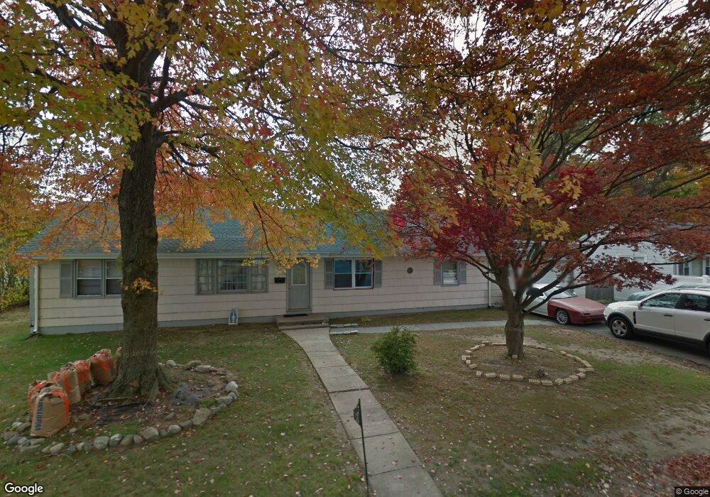
13 Jourmire Rd Bridgeport, CT 06606
North End NeighborhoodEstimated Value: $411,000 - $476,000
3
Beds
2
Baths
1,560
Sq Ft
$282/Sq Ft
Est. Value
About This Home
This home is located at 13 Jourmire Rd, Bridgeport, CT 06606 and is currently estimated at $439,306, approximately $281 per square foot. 13 Jourmire Rd is a home located in Fairfield County with nearby schools including John Winthrop School, Central High School, and St Andrew School.
Ownership History
Date
Name
Owned For
Owner Type
Purchase Details
Closed on
Mar 5, 1999
Sold by
G & G Dev Llc
Bought by
Otero Jose C and Otero Carmen
Current Estimated Value
Purchase Details
Closed on
Nov 6, 1998
Sold by
Gutierrez Basilio
Bought by
G & E Development Llc
Purchase Details
Closed on
Aug 28, 1998
Sold by
Peoples Bk
Bought by
Gutierrez Basilio
Create a Home Valuation Report for This Property
The Home Valuation Report is an in-depth analysis detailing your home's value as well as a comparison with similar homes in the area
Home Values in the Area
Average Home Value in this Area
Purchase History
| Date | Buyer | Sale Price | Title Company |
|---|---|---|---|
| Otero Jose C | $128,000 | -- | |
| Otero Jose C | $128,000 | -- | |
| G & E Development Llc | $63,000 | -- | |
| G & E Development Llc | $63,000 | -- | |
| Gutierrez Basilio | $63,000 | -- | |
| Gutierrez Basilio | $63,000 | -- |
Source: Public Records
Mortgage History
| Date | Status | Borrower | Loan Amount |
|---|---|---|---|
| Closed | Gutierrez Basilio | $15,929 | |
| Open | Gutierrez Basilio | $241,000 |
Source: Public Records
Tax History Compared to Growth
Tax History
| Year | Tax Paid | Tax Assessment Tax Assessment Total Assessment is a certain percentage of the fair market value that is determined by local assessors to be the total taxable value of land and additions on the property. | Land | Improvement |
|---|---|---|---|---|
| 2025 | $5,999 | $138,070 | $69,920 | $68,150 |
| 2024 | $5,999 | $138,070 | $69,920 | $68,150 |
| 2023 | $5,999 | $138,070 | $69,920 | $68,150 |
| 2022 | $5,999 | $138,070 | $69,920 | $68,150 |
| 2021 | $5,999 | $138,070 | $69,920 | $68,150 |
| 2020 | $6,134 | $113,620 | $54,750 | $58,870 |
| 2019 | $6,134 | $113,620 | $54,750 | $58,870 |
| 2018 | $6,178 | $113,620 | $54,750 | $58,870 |
| 2017 | $6,178 | $113,620 | $54,750 | $58,870 |
| 2016 | $6,178 | $113,620 | $54,750 | $58,870 |
| 2015 | $5,428 | $128,620 | $53,940 | $74,680 |
| 2014 | $5,428 | $128,620 | $53,940 | $74,680 |
Source: Public Records
Map
Nearby Homes
- 153 Seaver Cir
- 81 Lance Cir
- 44 Lance Cir Unit 44
- 66 Loftus Cir
- 65 Dobson St
- 64 Dobson St
- 2851 Old Town Rd
- 394 Anton Dr
- 236 Edgemoor Rd Unit D
- 9 Patricia Rd Unit C
- 87 Parkway Dr
- 50 Greenhouse Rd Unit 65D
- 50 Greenhouse Rd Unit 42C
- 173 Anton Dr
- 42 Wendy Rd
- 26 Wendy Rd
- 2998 Madison Ave Unit C
- 87 Oliver St
- 2955 Madison Ave Unit 40
- lot 194 Prospect Ave
- 3955 Madison Ave
- 29 Jourmire Rd
- 28 Jourmire Rd
- 3995 Madison Ave
- 3943 Madison Ave
- 45 Jourmire Rd
- 3990 Madison Ave
- 3980 Madison Ave
- 3960 Madison Ave
- 42 Jourmire Rd
- 3929 Madison Ave
- 3944 Madison Ave
- 4015 Madison Ave
- 58 Jourmire Rd
- 3395 Old Town Rd
- 4000 Madison Ave
- 63 Jourmire Rd
- 148 Leonard Dr
- 3919 Madison Ave
- 134 Leonard Dr