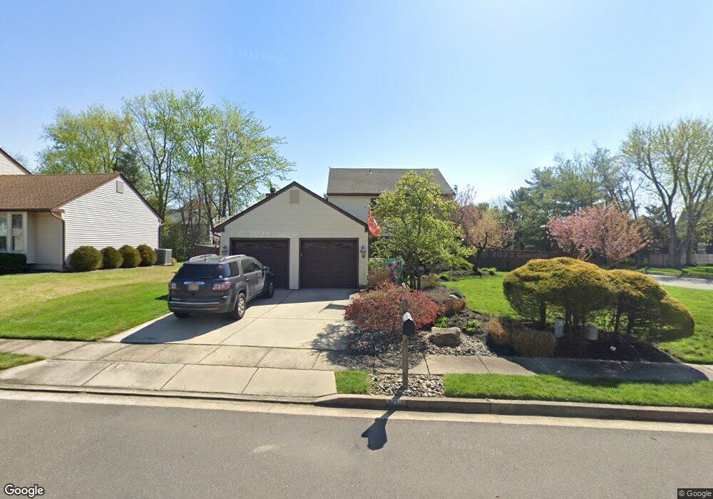
13 Juniper Dr Mount Laurel, NJ 08054
Estimated Value: $466,889 - $516,000
Studio
--
Bath
1,949
Sq Ft
$253/Sq Ft
Est. Value
About This Home
This home is located at 13 Juniper Dr, Mount Laurel, NJ 08054 and is currently estimated at $493,972, approximately $253 per square foot. 13 Juniper Dr is a home located in Burlington County with nearby schools including Parkway Elementary School, T.E. Harrington Middle School, and Mount Laurel Hartford School.
Ownership History
Date
Name
Owned For
Owner Type
Purchase Details
Closed on
Jun 30, 2003
Sold by
Warner Christopher R and Warner Melodye P
Bought by
Roskoph John P and Roskoph Tracy K
Current Estimated Value
Home Financials for this Owner
Home Financials are based on the most recent Mortgage that was taken out on this home.
Original Mortgage
$196,000
Outstanding Balance
$84,522
Interest Rate
5.45%
Mortgage Type
Stand Alone First
Estimated Equity
$409,450
Purchase Details
Closed on
May 20, 1994
Sold by
Waugaman Ronald K
Bought by
Warner Christopher R and Warner Melodye P
Create a Home Valuation Report for This Property
The Home Valuation Report is an in-depth analysis detailing your home's value as well as a comparison with similar homes in the area
Home Values in the Area
Average Home Value in this Area
Purchase History
| Date | Buyer | Sale Price | Title Company |
|---|---|---|---|
| Roskoph John P | $245,000 | Weichert Title Agency | |
| Warner Christopher R | $151,500 | National Title Agency |
Source: Public Records
Mortgage History
| Date | Status | Borrower | Loan Amount |
|---|---|---|---|
| Open | Roskoph John P | $196,000 |
Source: Public Records
Tax History Compared to Growth
Tax History
| Year | Tax Paid | Tax Assessment Tax Assessment Total Assessment is a certain percentage of the fair market value that is determined by local assessors to be the total taxable value of land and additions on the property. | Land | Improvement |
|---|---|---|---|---|
| 2025 | $7,334 | $232,300 | $79,500 | $152,800 |
| 2024 | $7,057 | $232,300 | $79,500 | $152,800 |
| 2023 | $7,057 | $232,300 | $79,500 | $152,800 |
| 2022 | $7,034 | $232,300 | $79,500 | $152,800 |
| 2021 | $6,902 | $232,300 | $79,500 | $152,800 |
| 2020 | $6,767 | $232,300 | $79,500 | $152,800 |
| 2019 | $6,697 | $232,300 | $79,500 | $152,800 |
| 2018 | $6,646 | $232,300 | $79,500 | $152,800 |
| 2017 | $6,474 | $232,300 | $79,500 | $152,800 |
| 2016 | $6,377 | $232,300 | $79,500 | $152,800 |
| 2015 | $6,302 | $232,300 | $79,500 | $152,800 |
| 2014 | $6,240 | $232,300 | $79,500 | $152,800 |
Source: Public Records
Map
Nearby Homes
- 130B Birchfield Ct Unit 130B
- 104B Sumac Ct Unit 104B
- 23 E Oleander Dr
- 123A Birchfield Ct Unit 123A
- 3 Avandale Ct
- 21 Zinnia Ct
- 29 E Daisy Ln Unit B
- 31 Quince Ct
- 78 Watson Dr
- 53 Saw Mill Dr
- 907A Oliphant Ln Unit 907A
- 58 Watson Dr
- 1201A Ginger Ct
- 33 W Berwin Way
- 506 Oliphant Ln Unit 506
- 205 Kirby Way Unit 205
- 2507A Bluegrass Dr
- 2 Watson Dr
- 20 Raleigh Dr
- 17 White Stone Ct