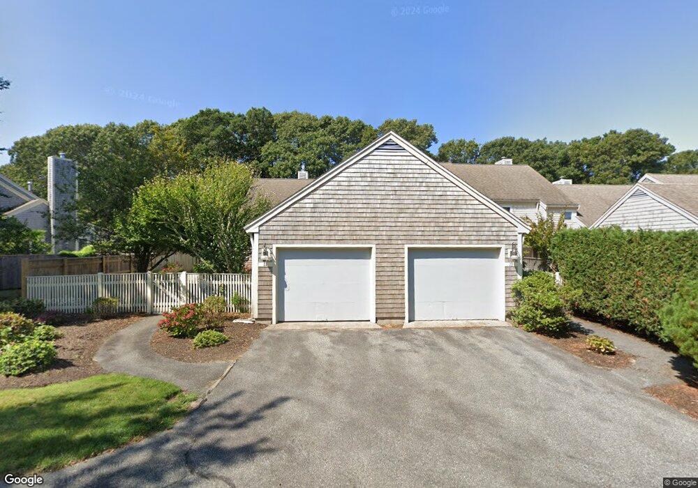
13 Kates Path Unit 13 Yarmouth Port, MA 02675
Yarmouth Port NeighborhoodEstimated Value: $566,719 - $574,000
2
Beds
3
Baths
1,460
Sq Ft
$390/Sq Ft
Est. Value
About This Home
This home is located at 13 Kates Path Unit 13, Yarmouth Port, MA 02675 and is currently estimated at $569,430, approximately $390 per square foot. 13 Kates Path Unit 13 is a home located in Barnstable County with nearby schools including Dennis-Yarmouth Regional High School.
Ownership History
Date
Name
Owned For
Owner Type
Purchase Details
Closed on
Oct 29, 2003
Sold by
Patterson Carol R
Bought by
Rocco Deloi Ret
Current Estimated Value
Purchase Details
Closed on
Jun 27, 2001
Sold by
Robak Patricia N
Bought by
Patterson Carol R
Purchase Details
Closed on
Sep 9, 1991
Sold by
Green Co Inc
Bought by
Robak Theodore J
Home Financials for this Owner
Home Financials are based on the most recent Mortgage that was taken out on this home.
Original Mortgage
$50,000
Interest Rate
9.43%
Mortgage Type
Purchase Money Mortgage
Create a Home Valuation Report for This Property
The Home Valuation Report is an in-depth analysis detailing your home's value as well as a comparison with similar homes in the area
Home Values in the Area
Average Home Value in this Area
Purchase History
| Date | Buyer | Sale Price | Title Company |
|---|---|---|---|
| Rocco Deloi Ret | $379,900 | -- | |
| Patterson Carol R | $241,000 | -- | |
| Robak Theodore J | $165,000 | -- |
Source: Public Records
Mortgage History
| Date | Status | Borrower | Loan Amount |
|---|---|---|---|
| Previous Owner | Robak Theodore J | $50,000 |
Source: Public Records
Tax History Compared to Growth
Tax History
| Year | Tax Paid | Tax Assessment Tax Assessment Total Assessment is a certain percentage of the fair market value that is determined by local assessors to be the total taxable value of land and additions on the property. | Land | Improvement |
|---|---|---|---|---|
| 2025 | $3,432 | $484,800 | $0 | $484,800 |
| 2024 | $3,221 | $436,500 | $0 | $436,500 |
| 2023 | $2,902 | $357,800 | $0 | $357,800 |
| 2022 | $3,544 | $386,100 | $0 | $386,100 |
| 2021 | $3,448 | $360,700 | $0 | $360,700 |
| 2020 | $3,480 | $348,000 | $0 | $348,000 |
| 2019 | $3,263 | $323,100 | $0 | $323,100 |
| 2018 | $3,067 | $298,100 | $0 | $298,100 |
| 2017 | $2,863 | $285,700 | $0 | $285,700 |
| 2016 | $2,727 | $273,200 | $0 | $273,200 |
| 2015 | $2,706 | $269,500 | $0 | $269,500 |
Source: Public Records
Map
Nearby Homes
- 17 Kates Path Unit A
- 228 Kates Path
- 64 Kates Path
- 158 Kates Path
- 43 Canterbury Rd
- 19 John Halls Cartpath Village Unit E
- 19 John Hall Cartway Unit E
- 50 John Hall Cartway
- 50 John Hall Cartway Unit 50
- 42 John Hall Cartway Unit 42
- 28 Oak Glen
- 44 Stratford Ln
- 25 Oak Glen Village Unit 25
- 25 Oak Glen
- 17 Nottingham Dr
- 30 W Woods
- 30 W Woods Cir Unit 30
- 2 Pine Grove
- 800 Route 6a
- 800 Route 6a
- 21 Kates Path
- 19 Kates Path
- 17 Kates Path
- 15 Kates Path
- 13 Kates Path
- 11 Kates Path
- 19 Kate's Path Unit 19
- 13 Kate's Point Unit 13
- 11 Kate's Point Unit 11
- 21 Kates Path Unit 21-D
- 11 Kates Path Unit E
- 15 Kates Path Unit B
- 79 Kates Path
- 79 Kates Path Unit B
- 17 Kate's Path
- 17 Kate's Path Unit 17
- 29 Kates Path
- 27 Kates Path
- 25 Kates Path
- 23 Kates Path