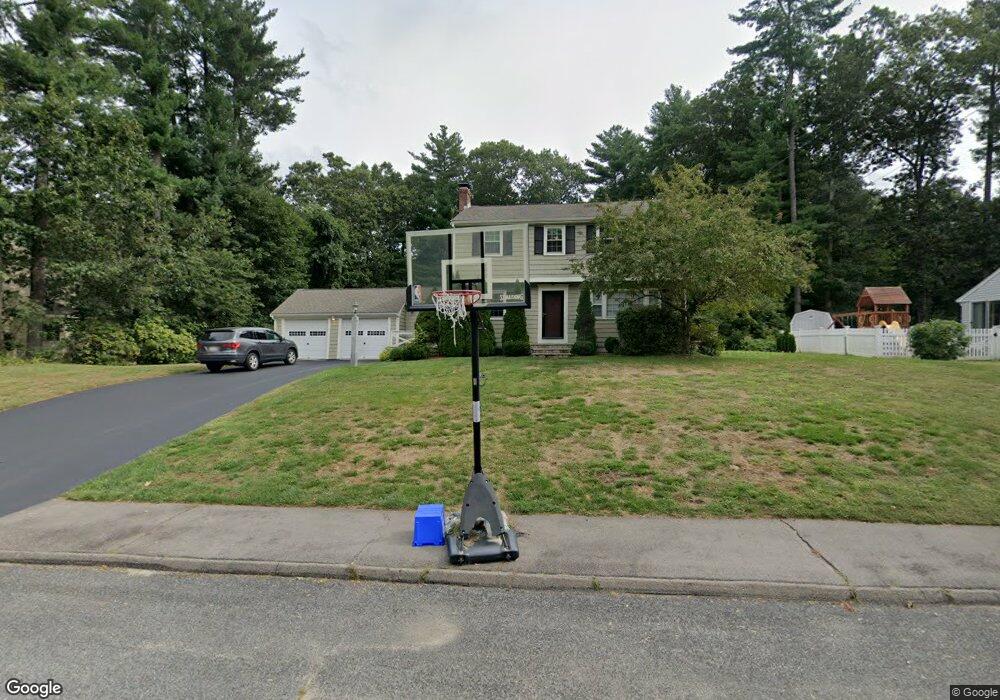
13 Laurel Dr Medfield, MA 02052
Estimated Value: $1,149,000 - $1,254,000
4
Beds
3
Baths
3,000
Sq Ft
$396/Sq Ft
Est. Value
About This Home
This home is located at 13 Laurel Dr, Medfield, MA 02052 and is currently estimated at $1,186,959, approximately $395 per square foot. 13 Laurel Dr is a home located in Norfolk County with nearby schools including Memorial School, Ralph Wheelock School, and Dale Street School.
Ownership History
Date
Name
Owned For
Owner Type
Purchase Details
Closed on
Jun 25, 2008
Sold by
Giggi Gail E and Giggi William M
Bought by
Bligh Anthony and Bligh Sinead
Current Estimated Value
Home Financials for this Owner
Home Financials are based on the most recent Mortgage that was taken out on this home.
Original Mortgage
$368,000
Outstanding Balance
$237,408
Interest Rate
6.07%
Mortgage Type
Purchase Money Mortgage
Estimated Equity
$949,551
Purchase Details
Closed on
Jan 29, 1999
Sold by
Burke Charles E and Burke Brenda L
Bought by
Giggi William M and Giggi Gail E
Home Financials for this Owner
Home Financials are based on the most recent Mortgage that was taken out on this home.
Original Mortgage
$170,000
Interest Rate
6.67%
Mortgage Type
Purchase Money Mortgage
Create a Home Valuation Report for This Property
The Home Valuation Report is an in-depth analysis detailing your home's value as well as a comparison with similar homes in the area
Home Values in the Area
Average Home Value in this Area
Purchase History
| Date | Buyer | Sale Price | Title Company |
|---|---|---|---|
| Bligh Anthony | $618,000 | -- | |
| Bligh Anthony | $618,000 | -- | |
| Giggi William M | $295,000 | -- |
Source: Public Records
Mortgage History
| Date | Status | Borrower | Loan Amount |
|---|---|---|---|
| Open | Giggi William M | $120,000 | |
| Open | Bligh Anthony | $368,000 | |
| Closed | Giggi William M | $368,000 | |
| Previous Owner | Giggi William M | $170,000 | |
| Previous Owner | Giggi William M | $166,500 |
Source: Public Records
Tax History Compared to Growth
Tax History
| Year | Tax Paid | Tax Assessment Tax Assessment Total Assessment is a certain percentage of the fair market value that is determined by local assessors to be the total taxable value of land and additions on the property. | Land | Improvement |
|---|---|---|---|---|
| 2025 | $12,842 | $930,600 | $452,800 | $477,800 |
| 2024 | $12,333 | $842,400 | $408,400 | $434,000 |
| 2023 | $12,035 | $780,000 | $390,600 | $389,400 |
| 2022 | $11,720 | $672,800 | $372,900 | $299,900 |
| 2021 | $11,514 | $648,300 | $369,300 | $279,000 |
| 2020 | $11,384 | $638,500 | $367,600 | $270,900 |
| 2019 | $11,083 | $620,200 | $351,600 | $268,600 |
| 2018 | $10,146 | $595,800 | $342,000 | $253,800 |
| 2017 | $10,977 | $649,900 | $337,400 | $312,500 |
| 2016 | $10,767 | $642,800 | $330,300 | $312,500 |
| 2015 | $9,962 | $621,100 | $321,100 | $300,000 |
| 2014 | $9,707 | $602,200 | $302,200 | $300,000 |
Source: Public Records
Map
Nearby Homes
- 56 Spring St
- 34 Frairy St
- 94 Pleasant St
- 46 Frairy St
- 431 Main St Unit 5
- 3 Hennery Way Bld E Unit 3
- 8 Turtlebrook Way
- 43 Green St Unit 43
- 23 Cross St
- 80 West St
- 10 Hillcrest Rd
- 270 South St
- 18 Hearthstone Dr
- 37 Crestview Dr
- 111 Elm St
- 3 Shining Valley Cir
- 26 Rocky Ln
- 6 Alcott Way
- 485 Main St
- 18 Village St