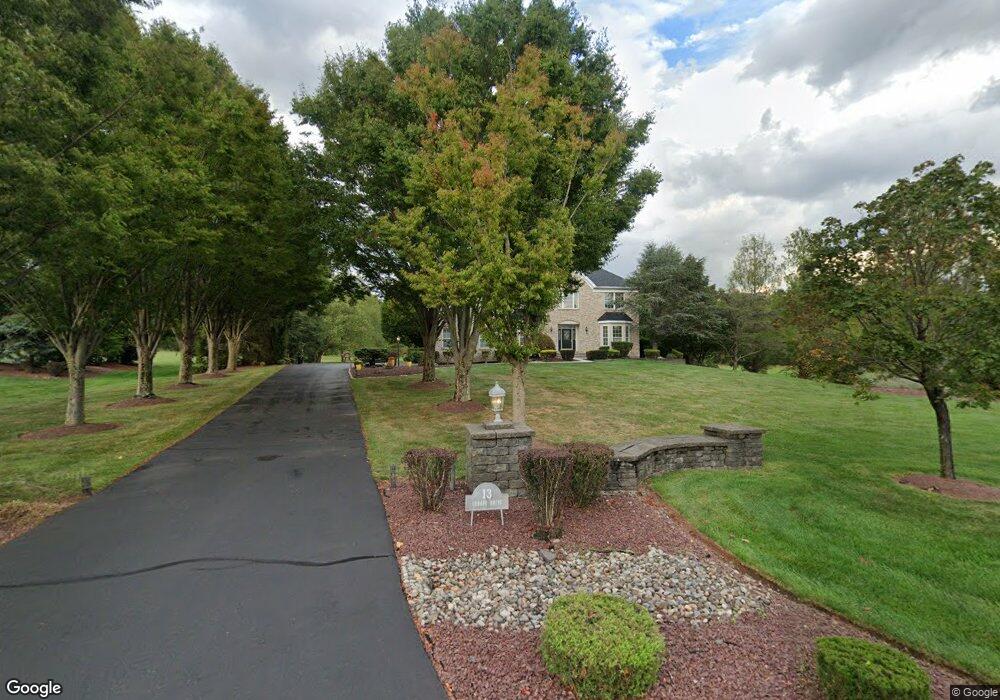
13 Lenape Dr Somerset, NJ 08873
Estimated Value: $1,119,000 - $1,412,000
--
Bed
--
Bath
5,450
Sq Ft
$223/Sq Ft
Est. Value
About This Home
This home is located at 13 Lenape Dr, Somerset, NJ 08873 and is currently estimated at $1,216,903, approximately $223 per square foot. 13 Lenape Dr is a home located in Somerset County with nearby schools including Franklin High School, St. Augustine of Canterbury School, and Cheder Menachem.
Ownership History
Date
Name
Owned For
Owner Type
Purchase Details
Closed on
Sep 6, 2024
Sold by
Nix Richard and Philp Heather B
Bought by
Nix Richard and Philp Heather B
Current Estimated Value
Purchase Details
Closed on
Jul 15, 2003
Sold by
Venditti Maria
Bought by
Nix Richard and Philip Heather
Home Financials for this Owner
Home Financials are based on the most recent Mortgage that was taken out on this home.
Original Mortgage
$465,000
Interest Rate
5.34%
Purchase Details
Closed on
Sep 17, 1998
Sold by
Hovnanian K
Bought by
Venditti Maria Simpson
Home Financials for this Owner
Home Financials are based on the most recent Mortgage that was taken out on this home.
Original Mortgage
$105,000
Interest Rate
6.64%
Create a Home Valuation Report for This Property
The Home Valuation Report is an in-depth analysis detailing your home's value as well as a comparison with similar homes in the area
Home Values in the Area
Average Home Value in this Area
Purchase History
| Date | Buyer | Sale Price | Title Company |
|---|---|---|---|
| Nix Richard | -- | Coastal Title Agency | |
| Nix Richard | -- | Coastal Title Agency | |
| Nix Richard | $665,000 | -- | |
| Venditti Maria Simpson | $445,517 | -- |
Source: Public Records
Mortgage History
| Date | Status | Borrower | Loan Amount |
|---|---|---|---|
| Previous Owner | Nix Richard | $465,000 | |
| Previous Owner | Venditti Maria Simpson | $105,000 |
Source: Public Records
Tax History Compared to Growth
Tax History
| Year | Tax Paid | Tax Assessment Tax Assessment Total Assessment is a certain percentage of the fair market value that is determined by local assessors to be the total taxable value of land and additions on the property. | Land | Improvement |
|---|---|---|---|---|
| 2025 | $15,931 | $1,096,800 | $412,100 | $684,700 |
| 2024 | $15,931 | $883,600 | $372,100 | $511,500 |
| 2023 | $16,022 | $833,600 | $322,100 | $511,500 |
| 2022 | $15,384 | $758,600 | $247,100 | $511,500 |
| 2021 | $15,860 | $718,600 | $207,100 | $511,500 |
| 2020 | $16,007 | $708,600 | $197,100 | $511,500 |
| 2019 | $15,520 | $678,600 | $167,100 | $511,500 |
| 2018 | $15,676 | $678,600 | $167,100 | $511,500 |
| 2017 | $15,737 | $678,600 | $167,100 | $511,500 |
| 2016 | $15,872 | $678,600 | $167,100 | $511,500 |
| 2015 | $16,228 | $698,600 | $187,100 | $511,500 |
| 2014 | $15,380 | $672,200 | $187,100 | $485,100 |
Source: Public Records
Map
Nearby Homes
- 75 Pear Tree Ln Unit 10C
- 10 Julie Ct
- 130 Lindsey Ct
- 44 Crabapple Ln
- 7 Edith Dr
- 7 Edith Place
- 8 Amethyst Way
- 65 Townsend Ct Unit 213
- 65 Townsend Ct
- 21 Gregory Ln Unit F1
- 1 Lyon La
- 1 Lyon Ln
- 205 Rachel Ct
- 13 Brook St
- 33 Spencer St
- 167 Rachel Ct
- 124 Edward Dr
- 29 Spencer St
- 22 Arthur Glick Blvd Unit 2506
- 139 Rachel Ct Unit D1
- 9 Lenape Dr
- 17 Lenape Dr
- 10 Lenape Dr
- 5 Lenape Dr
- 6 Lenape Dr
- 21 Lenape Dr
- 14 Lenape Dr
- 1 Lenape Dr
- 2 Lenape Dr
- 18 Lenape Dr
- 34 Mattawang Dr
- 30 Mattawang Dr
- 730 S Middlebush Rd Unit 44.01
- 730 S Middlebush Rd
- 37 Mattawang Dr
- 33 Mattawang Dr
- 630 S Middlebush Rd
- 658 S Middlebush Rd
- 29 Mattawang Dr
- 42 Mattawang Dr