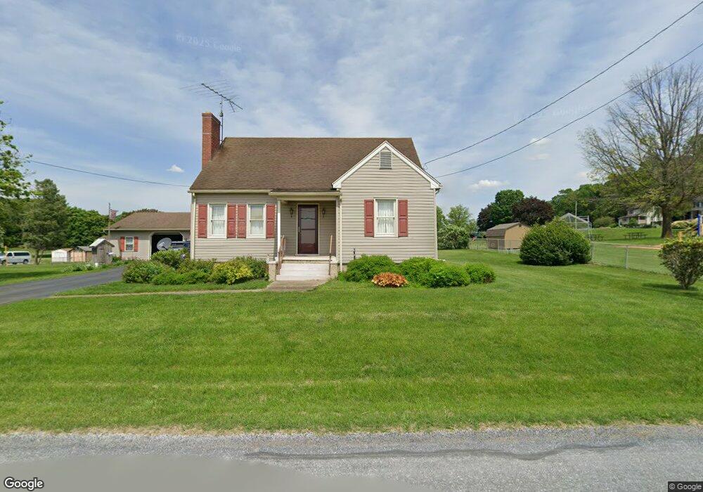
13 Liberty Ln Kirkwood, PA 17536
Estimated Value: $284,000 - $567,000
3
Beds
2
Baths
1,282
Sq Ft
$293/Sq Ft
Est. Value
About This Home
This home is located at 13 Liberty Ln, Kirkwood, PA 17536 and is currently estimated at $375,916, approximately $293 per square foot. 13 Liberty Ln is a home located in Lancaster County with nearby schools including Solanco High School.
Ownership History
Date
Name
Owned For
Owner Type
Purchase Details
Closed on
Nov 3, 2025
Sold by
Harvey Dorothy C
Bought by
Smyth Kaden Robert and Green Rianna Grace
Current Estimated Value
Home Financials for this Owner
Home Financials are based on the most recent Mortgage that was taken out on this home.
Original Mortgage
$343,660
Outstanding Balance
$343,660
Interest Rate
6.26%
Mortgage Type
FHA
Estimated Equity
$32,256
Create a Home Valuation Report for This Property
The Home Valuation Report is an in-depth analysis detailing your home's value as well as a comparison with similar homes in the area
Home Values in the Area
Average Home Value in this Area
Purchase History
| Date | Buyer | Sale Price | Title Company |
|---|---|---|---|
| Smyth Kaden Robert | $350,000 | None Listed On Document |
Source: Public Records
Mortgage History
| Date | Status | Borrower | Loan Amount |
|---|---|---|---|
| Open | Smyth Kaden Robert | $343,660 |
Source: Public Records
Tax History Compared to Growth
Tax History
| Year | Tax Paid | Tax Assessment Tax Assessment Total Assessment is a certain percentage of the fair market value that is determined by local assessors to be the total taxable value of land and additions on the property. | Land | Improvement |
|---|---|---|---|---|
| 2025 | $2,469 | $157,300 | $58,900 | $98,400 |
| 2024 | $2,469 | $157,300 | $58,900 | $98,400 |
| 2023 | $2,395 | $157,300 | $58,900 | $98,400 |
| 2022 | $2,324 | $157,300 | $58,900 | $98,400 |
| 2021 | $2,242 | $157,300 | $58,900 | $98,400 |
| 2020 | $2,242 | $157,300 | $58,900 | $98,400 |
| 2019 | $2,185 | $157,300 | $58,900 | $98,400 |
| 2018 | $539 | $157,300 | $58,900 | $98,400 |
| 2017 | $1,833 | $108,800 | $32,800 | $76,000 |
| 2016 | $1,833 | $108,800 | $32,800 | $76,000 |
| 2015 | $478 | $108,800 | $32,800 | $76,000 |
| 2014 | $1,212 | $108,800 | $32,800 | $76,000 |
Source: Public Records
Map
Nearby Homes
- 1751 Kirkwood Pike
- 1751 Kirkwood Pike
- 15 Phillip Dr
- 1201 Spruce Grove Rd
- 1881 Georgetown Rd
- 675 Lancaster Pike
- 4635 Newark Rd
- 0 Wickmere Street #F - Empire Unit PACT2103136
- 161 Groff Rd
- 261 Meadow Ln
- 403 S Summit Ave
- 110 Green Ln
- 187 Collamer Rd
- 620 S Smith Dr Unit (FLETCHER)
- 620 S Smith Dr Unit (NORWAY)
- 620 S Smith Dr Unit (DOUGLAS)
- 620 S Smith Dr Unit (JUNIPER)
- 620 S Smith Dr Unit (HEMLOCK)
- 620 S Smith Dr Unit (BALSAM)
- 371 Wickmere St
- 36 Buttermilk Ln
- 424 Maple Shade Rd
- 39 Buttermilk Ln
- 416 Maple Shade Rd Unit . 2
- 416 Maple Shade Rd
- 423 Maple Shade Rd
- 419 Maple Shade Rd
- 417 Maple Shade Rd
- 425 Maple Shade Rd
- 29 Buttermilk Ln
- 415 Maple Shade Rd
- 410 Maple Shade Rd
- 25 Buttermilk Ln
- 35 Liberty Ln
- 409 Maple Shade Rd
- 406 Maple Shade Rd
- 15 Buttermilk Ln
- 407 Maple Shade Rd
- 405 Maple Shade Rd
- 7 Buttermilk Ln