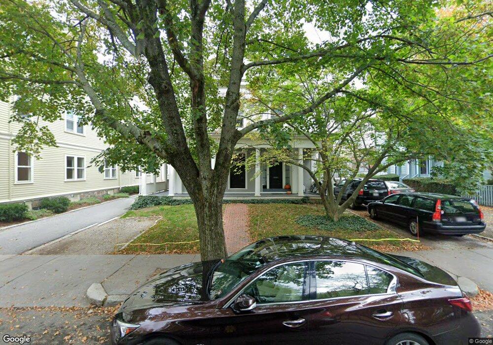
13 Linden St Unit 2 Brookline, MA 02445
Brookline Village NeighborhoodEstimated Value: $755,779 - $918,000
3
Beds
1
Bath
987
Sq Ft
$831/Sq Ft
Est. Value
About This Home
This home is located at 13 Linden St Unit 2, Brookline, MA 02445 and is currently estimated at $820,445, approximately $831 per square foot. 13 Linden St Unit 2 is a home located in Norfolk County with nearby schools including Pierce School, St. Mary of the Assumption Elementary School, and Winsor School.
Ownership History
Date
Name
Owned For
Owner Type
Purchase Details
Closed on
Aug 9, 2018
Sold by
Valery Polyakov
Bought by
Connelly Joseph
Current Estimated Value
Home Financials for this Owner
Home Financials are based on the most recent Mortgage that was taken out on this home.
Original Mortgage
$603,750
Outstanding Balance
$525,363
Interest Rate
4.59%
Estimated Equity
$295,082
Purchase Details
Closed on
May 19, 2011
Sold by
Hanssen Marsha A
Bought by
Hanssen Ft
Purchase Details
Closed on
Nov 1, 1982
Bought by
Hanssen Ft
Create a Home Valuation Report for This Property
The Home Valuation Report is an in-depth analysis detailing your home's value as well as a comparison with similar homes in the area
Home Values in the Area
Average Home Value in this Area
Purchase History
| Date | Buyer | Sale Price | Title Company |
|---|---|---|---|
| Connelly Joseph | $865,000 | -- | |
| Hanssen Ft | -- | -- | |
| Hanssen Ft | $25,000 | -- |
Source: Public Records
Mortgage History
| Date | Status | Borrower | Loan Amount |
|---|---|---|---|
| Open | Hanssen Ft | $603,750 | |
| Closed | Hanssen Ft | -- | |
| Previous Owner | Hanssen Ft | $15,000 |
Source: Public Records
Tax History Compared to Growth
Tax History
| Year | Tax Paid | Tax Assessment Tax Assessment Total Assessment is a certain percentage of the fair market value that is determined by local assessors to be the total taxable value of land and additions on the property. | Land | Improvement |
|---|---|---|---|---|
| 2025 | $6,966 | $705,800 | $0 | $705,800 |
| 2024 | $6,761 | $692,000 | $0 | $692,000 |
| 2023 | $6,675 | $669,500 | $0 | $669,500 |
| 2022 | $6,689 | $656,400 | $0 | $656,400 |
| 2021 | $6,369 | $649,900 | $0 | $649,900 |
| 2020 | $6,081 | $643,500 | $0 | $643,500 |
| 2019 | $5,743 | $612,900 | $0 | $612,900 |
| 2018 | $5,530 | $584,600 | $0 | $584,600 |
| 2017 | $5,348 | $541,300 | $0 | $541,300 |
| 2016 | $5,128 | $492,100 | $0 | $492,100 |
| 2015 | $4,778 | $447,400 | $0 | $447,400 |
| 2014 | $4,584 | $402,500 | $0 | $402,500 |
Source: Public Records
Map
Nearby Homes
- 14 Linden St Unit 8
- 39 Kent St Unit B
- 58 Kent St Unit 302
- 58 Kent St Unit 404
- 58 Kent St Unit 305
- 58 Kent St Unit 303
- 120 Brook St Unit 1
- 106 Brook St
- 216 Aspinwall Ave
- 214 Aspinwall Ave Unit 2
- 12 Goodwin Place Unit 12-1
- 12 Goodwin Place Unit 12-2
- 11 Goodwin Place Unit 11-2
- 37 Waverly St Unit 39
- 44 Washington St Unit 501
- 6 Juniper St Unit 16
- 5 Auburn Ct Unit 1
- 57 Saint Paul St Unit 19
- 33 Pond Ave Unit 422
- 33 Pond Ave Unit 709
- 13 Linden St Unit 1
- 13 Linden St Unit 8
- 13 Linden St Unit 7
- 13 Linden St Unit 6
- 13 Linden St Unit 5
- 13 Linden St Unit 4
- 13 Linden St Unit 3
- 13 Linden St Unit 13-4
- 13 Linden St Unit 1,1
- 13 Linden St Unit 4,13
- 14 Linden St Unit 7
- 14 Linden St Unit 6
- 14 Linden St Unit 5
- 14 Linden St Unit 4
- 14 Linden St Unit 3
- 14 Linden St Unit 2
- 14 Linden St Unit 1
- 14 Linden St Unit 14, 1
- 12 Linden St Unit 1
- 12 Linden St