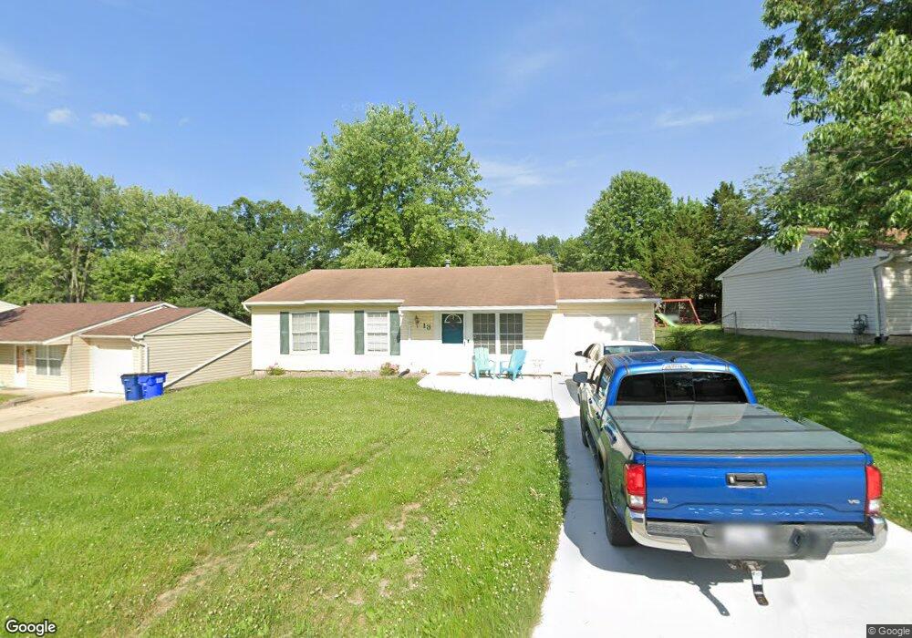
13 Lone Elk Ln Saint Peters, MO 63376
Estimated Value: $238,000 - $246,879
3
Beds
1
Bath
980
Sq Ft
$247/Sq Ft
Est. Value
About This Home
This home is located at 13 Lone Elk Ln, Saint Peters, MO 63376 and is currently estimated at $241,970, approximately $246 per square foot. 13 Lone Elk Ln is a home located in St. Charles County with nearby schools including Progress South Elementary School, Fort Zumwalt South Middle School, and Fort Zumwalt South High School.
Ownership History
Date
Name
Owned For
Owner Type
Purchase Details
Closed on
Feb 25, 2004
Sold by
Sapp Chad D and Sapp Amy C
Bought by
Groff Carrie M
Current Estimated Value
Home Financials for this Owner
Home Financials are based on the most recent Mortgage that was taken out on this home.
Original Mortgage
$97,440
Outstanding Balance
$45,475
Interest Rate
5.65%
Mortgage Type
FHA
Estimated Equity
$196,495
Purchase Details
Closed on
Nov 30, 2000
Sold by
Fischer Dennis S
Bought by
Sapp Chad D and Sapp Amy C
Home Financials for this Owner
Home Financials are based on the most recent Mortgage that was taken out on this home.
Original Mortgage
$73,500
Interest Rate
7.72%
Create a Home Valuation Report for This Property
The Home Valuation Report is an in-depth analysis detailing your home's value as well as a comparison with similar homes in the area
Home Values in the Area
Average Home Value in this Area
Purchase History
| Date | Buyer | Sale Price | Title Company |
|---|---|---|---|
| Groff Carrie M | $111,000 | Ust | |
| Sapp Chad D | -- | -- |
Source: Public Records
Mortgage History
| Date | Status | Borrower | Loan Amount |
|---|---|---|---|
| Open | Groff Carrie M | $97,440 | |
| Previous Owner | Sapp Chad D | $73,500 |
Source: Public Records
Tax History Compared to Growth
Tax History
| Year | Tax Paid | Tax Assessment Tax Assessment Total Assessment is a certain percentage of the fair market value that is determined by local assessors to be the total taxable value of land and additions on the property. | Land | Improvement |
|---|---|---|---|---|
| 2025 | $2,069 | $37,335 | -- | -- |
| 2024 | $2,069 | $33,887 | -- | -- |
| 2023 | $2,067 | $33,887 | $0 | $0 |
| 2022 | $1,780 | $27,174 | $0 | $0 |
| 2021 | $1,779 | $27,174 | $0 | $0 |
| 2020 | $1,555 | $22,967 | $0 | $0 |
| 2019 | $1,550 | $22,967 | $0 | $0 |
| 2018 | $1,456 | $20,642 | $0 | $0 |
| 2017 | $1,449 | $20,642 | $0 | $0 |
| 2016 | $1,273 | $18,106 | $0 | $0 |
| 2015 | $1,179 | $18,106 | $0 | $0 |
| 2014 | $1,336 | $20,028 | $0 | $0 |
Source: Public Records
Map
Nearby Homes
- 146 Huntington Crossing Dr
- 113 Stage Coach Landing Dr
- 307 Santa Fe Trail Dr
- 114 Knaust Rd
- 211 Butternut Stage Dr
- 42 Kingspointe Dr
- 110 Westgate Dr Unit 34A
- 2 Laura Hill Rd
- 5 Arborgate Dr Unit 69A
- 8201 Bristol Valley Dr
- 2068 Williamstown Dr
- 7 Park City Ct
- Adams Plan at Strawberry Farms - Liberty Series
- Franklin Plan at Strawberry Farms - Liberty Series
- Madison Plan at Strawberry Farms - Liberty Series
- Hamilton II Plan at Strawberry Farms - Liberty Series
- Washington Plan at Strawberry Farms - Liberty Series
- 32 Gulf Shores Dr
- 5 Wood Oaks Dr
- 41 Oakridge Dr W