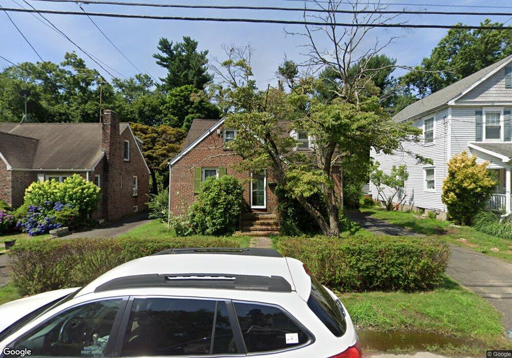
13 Melrose Ave Norwalk, CT 06855
East Norwalk NeighborhoodEstimated Value: $755,000 - $816,000
4
Beds
2
Baths
1,562
Sq Ft
$508/Sq Ft
Est. Value
About This Home
This home is located at 13 Melrose Ave, Norwalk, CT 06855 and is currently estimated at $793,130, approximately $507 per square foot. 13 Melrose Ave is a home located in Fairfield County with nearby schools including Marvin Elementary School, Nathan Hale Middle School, and Norwalk High School.
Ownership History
Date
Name
Owned For
Owner Type
Purchase Details
Closed on
Jan 19, 2022
Sold by
Goodnow Stacey and Goodnow Daniel E
Bought by
Strand Stacey
Current Estimated Value
Purchase Details
Closed on
Jun 26, 1997
Sold by
Nastrahoswki Scott and Nastrahowski Colleen
Bought by
Goodnow Daniel and Goodnow Stacey J
Purchase Details
Closed on
Apr 29, 1993
Sold by
Jermoluk Henrietta
Bought by
Nastahowski Scott and Nastahowski Colleen
Create a Home Valuation Report for This Property
The Home Valuation Report is an in-depth analysis detailing your home's value as well as a comparison with similar homes in the area
Home Values in the Area
Average Home Value in this Area
Purchase History
| Date | Buyer | Sale Price | Title Company |
|---|---|---|---|
| Strand Stacey | -- | None Available | |
| Strand Stacey | -- | None Available | |
| Goodnow Daniel | $228,000 | -- | |
| Goodnow Daniel | $228,000 | -- | |
| Nastahowski Scott | $149,500 | -- | |
| Nastahowski Scott | $149,500 | -- |
Source: Public Records
Mortgage History
| Date | Status | Borrower | Loan Amount |
|---|---|---|---|
| Previous Owner | Nastahowski Scott | $310,000 | |
| Previous Owner | Nastahowski Scott | $290,000 | |
| Previous Owner | Nastahowski Scott | $240,000 |
Source: Public Records
Tax History Compared to Growth
Tax History
| Year | Tax Paid | Tax Assessment Tax Assessment Total Assessment is a certain percentage of the fair market value that is determined by local assessors to be the total taxable value of land and additions on the property. | Land | Improvement |
|---|---|---|---|---|
| 2025 | $9,113 | $381,300 | $172,240 | $209,060 |
| 2024 | $8,978 | $381,300 | $172,240 | $209,060 |
| 2023 | $7,318 | $291,730 | $133,600 | $158,130 |
| 2022 | $7,161 | $291,730 | $133,600 | $158,130 |
| 2021 | $6,992 | $291,730 | $133,600 | $158,130 |
| 2020 | $6,989 | $291,730 | $133,600 | $158,130 |
| 2019 | $6,802 | $291,730 | $133,600 | $158,130 |
| 2018 | $6,434 | $241,840 | $119,700 | $122,140 |
| 2017 | $6,211 | $241,830 | $119,700 | $122,130 |
| 2016 | $6,152 | $241,840 | $119,700 | $122,140 |
| 2015 | $6,135 | $241,840 | $119,700 | $122,140 |
| 2014 | $6,056 | $241,840 | $119,700 | $122,140 |
Source: Public Records
Map
Nearby Homes
- 12 Pine Hill Ave
- 38 Gregory Blvd
- 14 Scofield Place
- 26 Rowan St
- 281 East Ave
- 18 Roxbury Rd
- 189 East Ave
- 301 East Ave
- 14 3rd St
- 100 Seaview Ave Unit 3I
- 26 Cove Ave Unit 3B
- 26 Cove Ave Unit 2D
- 6 Willow St
- 108 Gregory Blvd
- 17 Pequot Dr
- 1 1/2 Colony Place
- 4 van Zant St Unit B8
- 25 Dairy Farm Rd
- 14 Dairy Farm Rd
- 54 Cove Ave
- 15 Melrose Ave
- 11 Melrose Ave
- 17 Melrose Ave
- 9 Melrose Ave
- 7 Melrose Ave
- 19 Melrose Ave
- 14 Melrose Ave
- 5 Melrose Ave
- 10 Melrose Ave
- 16 Melrose Ave
- 21 Melrose Ave
- 8 Cloverly Cir
- 10 Cloverly Cir
- 18 Melrose Ave
- 6 Melrose Ave
- 23 Melrose Ave
- 27 Old Saugatuck Rd
- 23 Old Saugatuck Rd
- 20 Melrose Ave
- 21 Old Saugatuck Rd