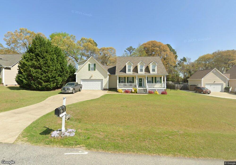
13 Mineral Ct Benson, NC 27504
Pleasant Grove NeighborhoodEstimated Value: $419,000 - $428,000
3
Beds
3
Baths
2,235
Sq Ft
$189/Sq Ft
Est. Value
About This Home
This home is located at 13 Mineral Ct, Benson, NC 27504 and is currently estimated at $422,458, approximately $189 per square foot. 13 Mineral Ct is a home located in Johnston County with nearby schools including McGee's Crossroads Elementary School, McGee's Crossroads Middle School, and West Johnston High School.
Ownership History
Date
Name
Owned For
Owner Type
Purchase Details
Closed on
Mar 1, 2007
Sold by
Son Lan Development Co Inc
Bought by
Thomas James W and Thomas Jessica E
Current Estimated Value
Home Financials for this Owner
Home Financials are based on the most recent Mortgage that was taken out on this home.
Original Mortgage
$45,500
Interest Rate
6.27%
Mortgage Type
Stand Alone Second
Create a Home Valuation Report for This Property
The Home Valuation Report is an in-depth analysis detailing your home's value as well as a comparison with similar homes in the area
Home Values in the Area
Average Home Value in this Area
Purchase History
| Date | Buyer | Sale Price | Title Company |
|---|---|---|---|
| Thomas James W | $228,000 | None Available |
Source: Public Records
Mortgage History
| Date | Status | Borrower | Loan Amount |
|---|---|---|---|
| Closed | Thomas James W | $45,500 | |
| Open | Thomas James W | $182,320 |
Source: Public Records
Tax History Compared to Growth
Tax History
| Year | Tax Paid | Tax Assessment Tax Assessment Total Assessment is a certain percentage of the fair market value that is determined by local assessors to be the total taxable value of land and additions on the property. | Land | Improvement |
|---|---|---|---|---|
| 2025 | $2,577 | $405,810 | $85,000 | $320,810 |
| 2024 | $2,066 | $255,000 | $44,000 | $211,000 |
| 2023 | $2,002 | $255,000 | $44,000 | $211,000 |
| 2022 | $2,066 | $255,000 | $44,000 | $211,000 |
| 2021 | $2,066 | $255,000 | $44,000 | $211,000 |
| 2020 | $2,142 | $255,000 | $44,000 | $211,000 |
| 2019 | $2,091 | $255,000 | $44,000 | $211,000 |
| 2018 | $1,892 | $225,260 | $31,000 | $194,260 |
| 2017 | $1,892 | $225,260 | $31,000 | $194,260 |
| 2016 | $1,892 | $225,260 | $31,000 | $194,260 |
| 2015 | $1,892 | $225,260 | $31,000 | $194,260 |
| 2014 | $1,892 | $225,260 | $31,000 | $194,260 |
Source: Public Records
Map
Nearby Homes
- 47 Billet Ct
- 100 Parrish Farm Ln
- 400 Rose Ct
- 687 W Watson Rd
- 687 W West Watson Rd
- 67 Cedarbrook Dr
- 162 Cedarbrook Dr
- 381 Gray Ghost St
- 154 Winter Red Way
- 296 Gordon Farm Dr
- 701 Highview Dr
- 691 Highview Dr
- 244 Combine Trail Unit Dm 108
- 300 Still Meadows Ct
- 129 Stallion Way
- 38 Gander Dr Unit 70
- 62 Pelt Place
- 576 Highview Dr Unit 40
- 82 Gander Dr
- 96 Church Rd
- 10 Billet Ct
- 35 Mineral Ct
- 32 Billet Ct
- 51 Mineral Ct
- 28 Mineral Ct
- 160 Parrish Farm Ln
- 140 Parrish Farm Ln
- 19 Billet Ct
- 180 Parrish Farm Ln
- 61 Stone Gate Dr
- 120 Parrish Farm Ln
- 61 Mineral Ct
- 44 Billet Ct
- 56 Mineral Ct
- 44 Stone Gate Dr
- 194 Parrish Farm Ln
- 62 Mineral Ct
- 48 Billet Ct
- 39 Billet Ct
- 23 Stone Gate Dr