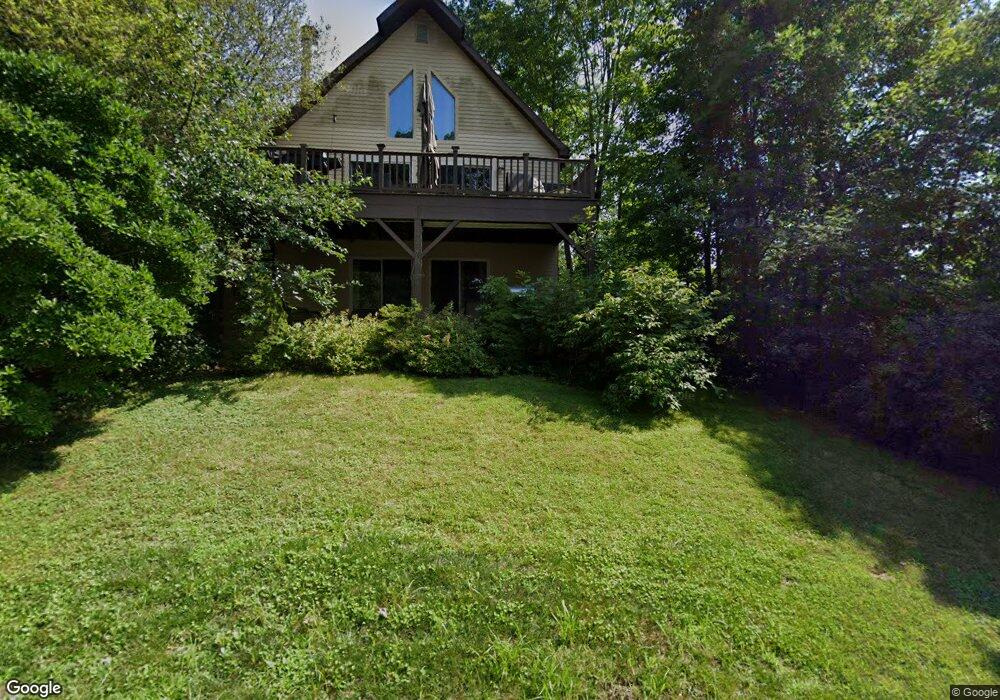
13 Mountain Trail Guilford, CT 06437
Estimated Value: $393,000 - $594,000
3
Beds
2
Baths
1,620
Sq Ft
$313/Sq Ft
Est. Value
About This Home
This home is located at 13 Mountain Trail, Guilford, CT 06437 and is currently estimated at $506,340, approximately $312 per square foot. 13 Mountain Trail is a home located in New Haven County with nearby schools including A. Baldwin Middle School, E.C. Adams Middle School, and Guilford High School.
Ownership History
Date
Name
Owned For
Owner Type
Purchase Details
Closed on
Aug 24, 2006
Sold by
Poole Christopher B and Poole Carolyn P
Bought by
Maynard Donald
Current Estimated Value
Purchase Details
Closed on
May 24, 2004
Sold by
Yard Mark and Bruion Lucie I
Bought by
Poole Christopher B and Poole Carolyn P
Home Financials for this Owner
Home Financials are based on the most recent Mortgage that was taken out on this home.
Original Mortgage
$252,000
Interest Rate
5.75%
Purchase Details
Closed on
Dec 1, 1999
Sold by
Mckernan Douglas B and Mckernan Mary P
Bought by
Yard Mark and Buijn Lucie I
Purchase Details
Closed on
Dec 17, 1993
Sold by
Craddock Joseph D and Craddock Leslie A
Bought by
Mckernan Douglas B
Purchase Details
Closed on
Nov 25, 1991
Sold by
Boguski Bryan J
Bought by
Croddock Joseph D and Croddock Leslie A
Create a Home Valuation Report for This Property
The Home Valuation Report is an in-depth analysis detailing your home's value as well as a comparison with similar homes in the area
Home Values in the Area
Average Home Value in this Area
Purchase History
| Date | Buyer | Sale Price | Title Company |
|---|---|---|---|
| Maynard Donald | $372,500 | -- | |
| Poole Christopher B | $315,000 | -- | |
| Yard Mark | $195,000 | -- | |
| Mckernan Douglas B | $165,300 | -- | |
| Croddock Joseph D | $175,000 | -- |
Source: Public Records
Mortgage History
| Date | Status | Borrower | Loan Amount |
|---|---|---|---|
| Open | Croddock Joseph D | $100,000 | |
| Previous Owner | Croddock Joseph D | $252,000 | |
| Previous Owner | Croddock Joseph D | $87,950 |
Source: Public Records
Tax History
| Year | Tax Paid | Tax Assessment Tax Assessment Total Assessment is a certain percentage of the fair market value that is determined by local assessors to be the total taxable value of land and additions on the property. | Land | Improvement |
|---|---|---|---|---|
| 2025 | $7,080 | $256,060 | $103,250 | $152,810 |
| 2024 | $6,806 | $256,060 | $103,250 | $152,810 |
| 2023 | $6,627 | $256,060 | $103,250 | $152,810 |
| 2022 | $6,967 | $209,540 | $102,850 | $106,690 |
| 2021 | $6,835 | $209,540 | $102,850 | $106,690 |
| 2020 | $6,770 | $209,540 | $102,850 | $106,690 |
| 2019 | $6,712 | $209,540 | $102,850 | $106,690 |
| 2018 | $6,554 | $209,540 | $102,850 | $106,690 |
| 2017 | $6,556 | $223,280 | $107,800 | $115,480 |
| 2016 | $6,401 | $223,280 | $107,800 | $115,480 |
| 2015 | $6,305 | $223,280 | $107,800 | $115,480 |
| 2014 | $6,122 | $223,280 | $107,800 | $115,480 |
Source: Public Records
Map
Nearby Homes
- 2064 Long Hill Rd
- 0 Tamarack Ln Unit Lot 23 24071362
- 0 Tamarack Ln Unit Lot 19 24071360
- 1092 Durham Rd
- 250 Elm St
- 360 Jefferson Dr
- 15 Pomps Ln
- 72 Notch Hill Rd
- LOT 28B Bruce Ln Unit MAP 83
- 154 Wilburs Ln
- 20 Long Hill Farm
- 83 Long Hill Farm Unit 83
- LOT #22 Kenneth Cir Unit MAP 77
- 126 Stepstone Hill Rd
- 75 Hart Rd
- 229 Branford Rd Unit 520
- 18 Lea Rd
- 10 Lea Rd
- 24 Echo Point Rd
- 874 Nut Plains Rd Unit Lot 2 - Style A
- 7 Mountain View Estates
- 203 Shore Dr
- 5 Mountain View Estates
- 215 Shore Dr
- 7 Mountain Trail
- 6 Mountain Trail
- 3 Mountain View Estates
- 48 Lone Pine Trail
- 5 Mountain Trail
- 4 Mountain Trail
- 3 Mountain Trail
- 2 Mountain View Estates
- 2 Mountain Trail
- 181 Shore Dr
- 1 Mountain Trail
- 48 Mountain Trail
- 000 Mountain View Estates
- 000 Mountain Trail
- 39 Mountain Trail
- 59 Lone Pine Trail