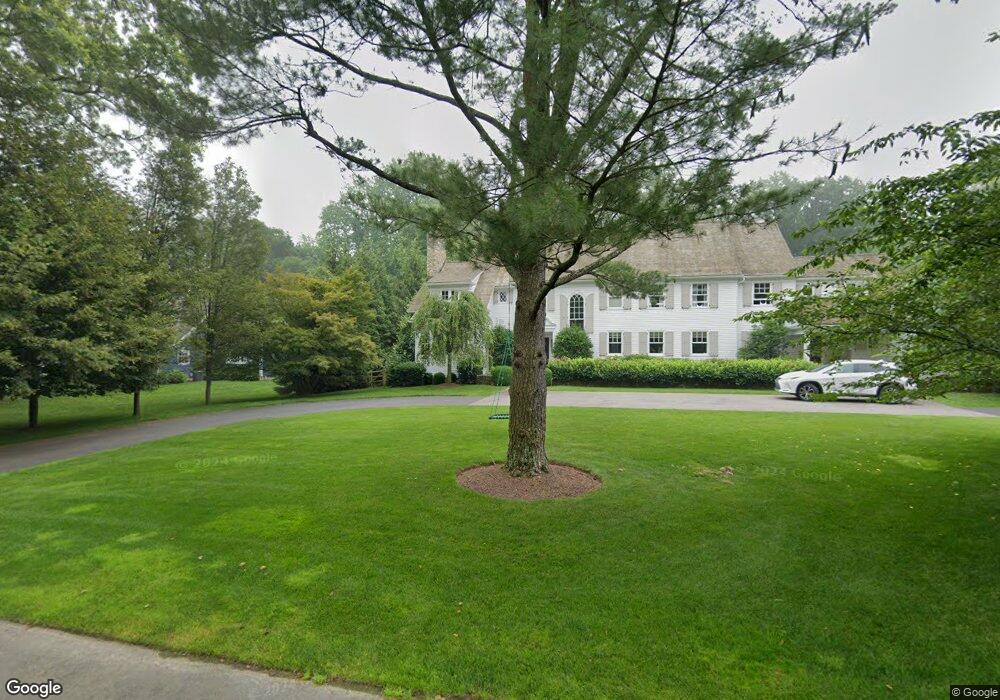
13 Parsons Walk Darien, CT 06820
Estimated Value: $2,668,000 - $4,265,000
5
Beds
7
Baths
6,082
Sq Ft
$597/Sq Ft
Est. Value
About This Home
This home is located at 13 Parsons Walk, Darien, CT 06820 and is currently estimated at $3,631,343, approximately $597 per square foot. 13 Parsons Walk is a home with nearby schools including Royle Elementary School, Middlesex Middle School, and Darien High School.
Ownership History
Date
Name
Owned For
Owner Type
Purchase Details
Closed on
Dec 2, 2005
Sold by
Bekas Michael and Koppulman Jay
Bought by
Andren Karl Mikael and Andren Lynne G
Current Estimated Value
Home Financials for this Owner
Home Financials are based on the most recent Mortgage that was taken out on this home.
Original Mortgage
$1,092,000
Interest Rate
5.5%
Purchase Details
Closed on
May 21, 1997
Sold by
Falljames Gregory and Fulljames Grace
Bought by
Kock Robert M and Kock Sherry T
Purchase Details
Closed on
Feb 15, 1990
Sold by
Bantle Louis
Bought by
Fulljames Gregory
Create a Home Valuation Report for This Property
The Home Valuation Report is an in-depth analysis detailing your home's value as well as a comparison with similar homes in the area
Home Values in the Area
Average Home Value in this Area
Purchase History
| Date | Buyer | Sale Price | Title Company |
|---|---|---|---|
| Andren Karl Mikael | $1,560,000 | -- | |
| Kock Robert M | $634,000 | -- | |
| Fulljames Gregory | $642,500 | -- |
Source: Public Records
Mortgage History
| Date | Status | Borrower | Loan Amount |
|---|---|---|---|
| Open | Fulljames Gregory | $1,250,000 | |
| Closed | Fulljames Gregory | $1,250,000 | |
| Closed | Fulljames Gregory | $1,092,000 |
Source: Public Records
Tax History Compared to Growth
Tax History
| Year | Tax Paid | Tax Assessment Tax Assessment Total Assessment is a certain percentage of the fair market value that is determined by local assessors to be the total taxable value of land and additions on the property. | Land | Improvement |
|---|---|---|---|---|
| 2025 | $38,471 | $2,485,210 | $758,380 | $1,726,830 |
| 2024 | $36,508 | $2,485,210 | $758,380 | $1,726,830 |
| 2023 | $35,431 | $2,012,010 | $541,730 | $1,470,280 |
| 2022 | $34,667 | $2,012,010 | $541,730 | $1,470,280 |
| 2021 | $33,882 | $2,012,010 | $541,730 | $1,470,280 |
| 2020 | $32,916 | $2,012,010 | $541,730 | $1,470,280 |
| 2019 | $5,903 | $1,835,330 | $537,600 | $1,297,730 |
| 2018 | $25,433 | $1,952,300 | $625,030 | $1,327,270 |
| 2017 | $5,847 | $1,952,300 | $625,030 | $1,327,270 |
| 2016 | $30,788 | $1,952,300 | $625,030 | $1,327,270 |
| 2015 | $29,968 | $1,952,300 | $625,030 | $1,327,270 |
| 2014 | $29,304 | $1,952,300 | $625,030 | $1,327,270 |
Source: Public Records
Map
Nearby Homes
- 130 West Ave
- 128 West Ave
- 311 Noroton Ave
- 10 Stony Brook Rd
- 45 Hecker Ave
- 261 Hollow Tree Ridge Rd
- 51 Hale Ln Unit 51
- 6 Priscilla Ln
- 166 Hollow Tree Ridge Rd
- 77 Maple St
- 53 Noroton Ave
- 17 Brushy Hill Rd
- 10 Prospect Ave
- 333 West Ave Unit 3
- 76 Deepwood Rd
- 20 Locust Hill Rd
- 8 Sedgewick Village Ln
- 17 Pine Brook Ln Unit 17
- 98 Holmes Ave
- 47 Hollow Tree Ridge Rd
- 11 Parsons Walk
- 26 Parsons Walk
- 7 Parsons Walk
- 12 Parsons Walk
- 10 Scout Trail
- 16 Parsons Walk
- 4 Scout Trail
- 8 Parsons Walk
- 20 Parsons Walk
- 12 Scout Trail
- 40 Shields Rd
- 36 Shields Rd
- 44 Shields Rd
- 26 Old Parish Rd
- 30 Old Parish Rd
- 4 Parsons Walk
- 5 Parsons Walk
- 48 Shields Rd
- 9 Shields Ln
- 14 Old Parish Rd