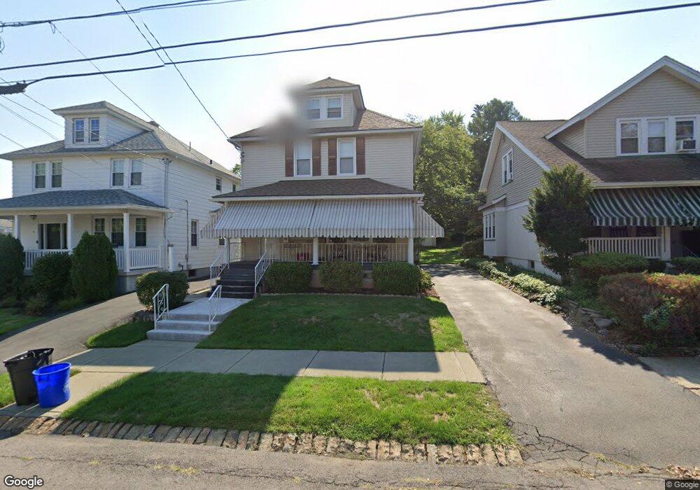
13 Stafford Ave Scranton, PA 18505
South Side NeighborhoodEstimated Value: $165,726 - $240,000
4
Beds
1
Bath
1,350
Sq Ft
$145/Sq Ft
Est. Value
About This Home
This home is located at 13 Stafford Ave, Scranton, PA 18505 and is currently estimated at $196,182, approximately $145 per square foot. 13 Stafford Ave is a home located in Lackawanna County with nearby schools including Jackson Davis Elementary School, Longdale Elementary School, and Pinchbeck Elementary School.
Ownership History
Date
Name
Owned For
Owner Type
Purchase Details
Closed on
Aug 5, 2011
Sold by
Cusick Janet A
Bought by
Rorick Christopher and Rorick Heather
Current Estimated Value
Home Financials for this Owner
Home Financials are based on the most recent Mortgage that was taken out on this home.
Original Mortgage
$102,338
Outstanding Balance
$71,449
Interest Rate
4.75%
Mortgage Type
FHA
Estimated Equity
$124,733
Create a Home Valuation Report for This Property
The Home Valuation Report is an in-depth analysis detailing your home's value as well as a comparison with similar homes in the area
Home Values in the Area
Average Home Value in this Area
Purchase History
| Date | Buyer | Sale Price | Title Company |
|---|---|---|---|
| Rorick Christopher | $105,000 | None Available |
Source: Public Records
Mortgage History
| Date | Status | Borrower | Loan Amount |
|---|---|---|---|
| Open | Rorick Christopher | $102,338 |
Source: Public Records
Tax History Compared to Growth
Tax History
| Year | Tax Paid | Tax Assessment Tax Assessment Total Assessment is a certain percentage of the fair market value that is determined by local assessors to be the total taxable value of land and additions on the property. | Land | Improvement |
|---|---|---|---|---|
| 2025 | $3,219 | $10,000 | $1,600 | $8,400 |
| 2024 | $2,942 | $10,000 | $1,600 | $8,400 |
| 2023 | $2,942 | $10,000 | $1,600 | $8,400 |
| 2022 | $2,877 | $10,000 | $1,600 | $8,400 |
| 2021 | $2,877 | $10,000 | $1,600 | $8,400 |
| 2020 | $2,823 | $10,000 | $1,600 | $8,400 |
| 2019 | $2,656 | $10,000 | $1,600 | $8,400 |
| 2018 | $2,656 | $10,000 | $1,600 | $8,400 |
| 2017 | $2,609 | $10,000 | $1,600 | $8,400 |
| 2016 | $797 | $10,000 | $1,600 | $8,400 |
| 2015 | $1,630 | $10,000 | $1,600 | $8,400 |
| 2014 | -- | $10,000 | $1,600 | $8,400 |
Source: Public Records
Map
Nearby Homes
- 24 Stafford Ave
- 910 Orchard St
- 307 Crown Ave
- 824 Hemlock St
- 228 Prescott Ave
- 342 Harrison Ave
- 933 Hickory St
- 329 Prescott Ave
- 741 River St
- 414 Wintermantle Ave
- 316 Taylor Ave
- 0 Colfax Ave
- 1025 Willow St
- 917 Willow St
- 516 Harrison Ave
- 610 Moosic St
- 432 Taylor Ave
- 728 Alder St
- 321 Prospect Ave
- 545 Prescott Ave
- 9 Stafford Ave
- 19 Stafford Ave
- 5 Stafford Ave
- 21 Stafford Ave
- 21 Stafford Ave
- 1005 Moosic St
- 1003 Moosic St
- 1001 Moosic St
- 1015 Moosic St
- 1007 Moosic St
- 16 Stafford Ave
- 1019 Moosic St
- 20 Stafford Ave
- 2 Stafford Ave
- 10 Stafford Ave
- 945 947 Moosic St
- 945 Moosic St Unit 947
- 945 Moosic St
- 1021 Moosic St
- 8 Stafford Ave