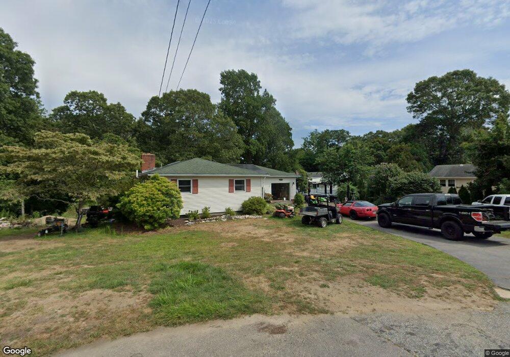
13 Steven Cir Wakefield, RI 02879
Estimated Value: $587,000 - $726,000
3
Beds
2
Baths
1,758
Sq Ft
$363/Sq Ft
Est. Value
About This Home
This home is located at 13 Steven Cir, Wakefield, RI 02879 and is currently estimated at $638,981, approximately $363 per square foot. 13 Steven Cir is a home located in Washington County with nearby schools including South Kingstown High School, Monsignor Matthew Clarke Catholic Regional School, and Bradley School-South.
Ownership History
Date
Name
Owned For
Owner Type
Purchase Details
Closed on
Mar 31, 2016
Sold by
Bradley Sally
Bought by
Bradley Sally
Current Estimated Value
Purchase Details
Closed on
May 15, 1997
Sold by
Andrews Kevin J and Andrews Donna
Bought by
Bradley Raymond H and Bradley Sally
Home Financials for this Owner
Home Financials are based on the most recent Mortgage that was taken out on this home.
Original Mortgage
$136,900
Interest Rate
8.12%
Purchase Details
Closed on
Mar 10, 1997
Sold by
Mairs David Allan and Aukerman James V
Bought by
Andrews Kevin D and Andrews Donna
Home Financials for this Owner
Home Financials are based on the most recent Mortgage that was taken out on this home.
Original Mortgage
$183,000
Interest Rate
7.77%
Create a Home Valuation Report for This Property
The Home Valuation Report is an in-depth analysis detailing your home's value as well as a comparison with similar homes in the area
Home Values in the Area
Average Home Value in this Area
Purchase History
| Date | Buyer | Sale Price | Title Company |
|---|---|---|---|
| Bradley Sally | -- | -- | |
| Bradley Raymond H | $142,000 | -- | |
| Andrews Kevin D | $145,000 | -- |
Source: Public Records
Mortgage History
| Date | Status | Borrower | Loan Amount |
|---|---|---|---|
| Previous Owner | Andrews Kevin D | $124,027 | |
| Previous Owner | Andrews Kevin D | $136,900 | |
| Previous Owner | Andrews Kevin D | $183,000 |
Source: Public Records
Tax History Compared to Growth
Tax History
| Year | Tax Paid | Tax Assessment Tax Assessment Total Assessment is a certain percentage of the fair market value that is determined by local assessors to be the total taxable value of land and additions on the property. | Land | Improvement |
|---|---|---|---|---|
| 2025 | $4,134 | $462,400 | $177,400 | $285,000 |
| 2024 | $3,996 | $361,600 | $136,400 | $225,200 |
| 2023 | $3,996 | $361,600 | $136,400 | $225,200 |
| 2022 | $3,960 | $361,600 | $136,400 | $225,200 |
| 2021 | $4,081 | $282,400 | $118,500 | $163,900 |
| 2020 | $4,081 | $282,400 | $118,500 | $163,900 |
| 2019 | $4,081 | $282,400 | $118,500 | $163,900 |
| 2018 | $3,958 | $252,400 | $110,100 | $142,300 |
| 2017 | $3,864 | $252,400 | $110,100 | $142,300 |
| 2016 | $3,809 | $252,400 | $110,100 | $142,300 |
| 2015 | $3,869 | $249,300 | $107,800 | $141,500 |
| 2014 | $3,859 | $249,300 | $107,800 | $141,500 |
Source: Public Records
Map
Nearby Homes
- 40 Amos St
- 70 Broad Rock Rd
- 156 River St Unit B
- 10 Hendricks St
- 37 Columbia St
- 3 Larkin St
- 45 Cherry Ln Unit C
- 48 Stone Bridge Dr
- 39 Hazard Ave
- 128 North Rd
- 38 Eisenhower Place
- 128 Camden Ct
- 73 Camden Ct
- 98 Meadow Ave
- 228 Rodman St
- 128 Rodman St
- 17 Celestial Heights Dr
- 23 Rockland Dr
- 53 Rocky Brook Way
- 918 Saugatucket Rd