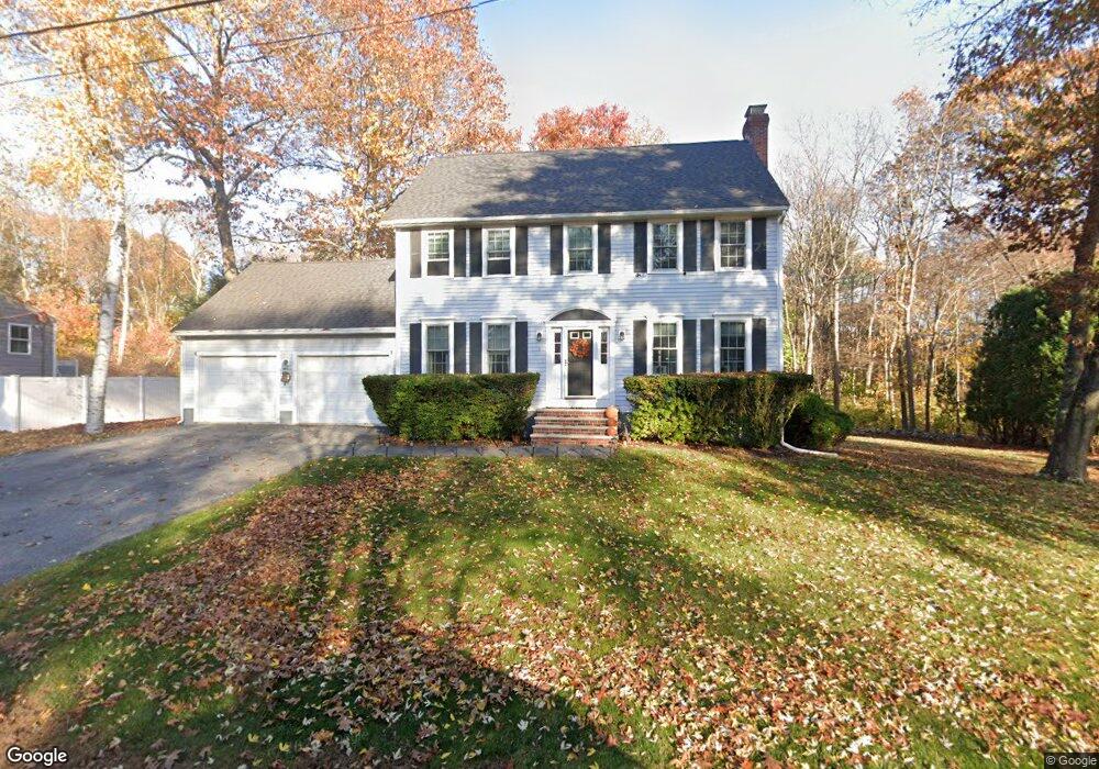
13 Storeybrook Dr Newburyport, MA 01950
Estimated Value: $1,107,000 - $1,154,000
4
Beds
3
Baths
2,016
Sq Ft
$557/Sq Ft
Est. Value
About This Home
This home is located at 13 Storeybrook Dr, Newburyport, MA 01950 and is currently estimated at $1,123,369, approximately $557 per square foot. 13 Storeybrook Dr is a home located in Essex County with nearby schools including Francis T. Bresnahan Elementary School, Edward G. Molin Elementary School, and Rupert A. Nock Middle School.
Ownership History
Date
Name
Owned For
Owner Type
Purchase Details
Closed on
Oct 17, 1994
Sold by
Old County Nt
Bought by
Gogolas Steve J and Gogolas Helen
Current Estimated Value
Purchase Details
Closed on
Mar 21, 1994
Sold by
Est Marcellos Angela and Marcellos George
Bought by
Old County Nt and Fortunata Felix
Create a Home Valuation Report for This Property
The Home Valuation Report is an in-depth analysis detailing your home's value as well as a comparison with similar homes in the area
Home Values in the Area
Average Home Value in this Area
Purchase History
| Date | Buyer | Sale Price | Title Company |
|---|---|---|---|
| Gogolas Steve J | $229,000 | -- | |
| Old County Nt | $75,000 | -- |
Source: Public Records
Mortgage History
| Date | Status | Borrower | Loan Amount |
|---|---|---|---|
| Open | Old County Nt | $396,000 | |
| Closed | Old County Nt | $415,700 |
Source: Public Records
Tax History Compared to Growth
Tax History
| Year | Tax Paid | Tax Assessment Tax Assessment Total Assessment is a certain percentage of the fair market value that is determined by local assessors to be the total taxable value of land and additions on the property. | Land | Improvement |
|---|---|---|---|---|
| 2025 | $9,254 | $966,000 | $484,500 | $481,500 |
| 2024 | $8,952 | $897,900 | $440,400 | $457,500 |
| 2023 | $8,102 | $754,400 | $383,000 | $371,400 |
| 2022 | $8,043 | $669,700 | $319,100 | $350,600 |
| 2021 | $7,830 | $619,500 | $290,100 | $329,400 |
| 2020 | $7,763 | $604,600 | $290,100 | $314,500 |
| 2019 | $7,908 | $604,600 | $290,100 | $314,500 |
| 2018 | $7,506 | $566,100 | $276,400 | $289,700 |
| 2017 | $7,505 | $558,000 | $263,300 | $294,700 |
| 2016 | $7,235 | $540,300 | $250,700 | $289,600 |
| 2015 | $7,208 | $540,300 | $250,700 | $289,600 |
Source: Public Records
Map
Nearby Homes
- 10 Clipper Way
- 6 Woodman Way Unit 122
- 6 Woodman Way Unit 402
- 231 Storey Ave
- 17 Lavalley Ln
- 16 Newhall Ln
- 6 Boyd Dr
- 42 Myrtle Ave
- 8 Brown Ave
- 43 Ferry Rd
- 100 Turkey Hill Rd
- 6 Doe Run Dr
- 12 Roosevelt Place
- 2 Hunter Dr
- 138 Low St
- 29 Columbus Ave
- 20 Cushing Ave
- 30 Dorothy e Lucey Dr
- 510 Merrimac St Unit 512
- 10 Rawson Hill Rd
- 11 Storeybrook Dr
- 15 Storeybrook Dr
- 10 Storeybrook Dr
- 14 Storeybrook Dr
- 9 Storeybrook Dr
- 8 Storeybrook Dr
- 17 Storeybrook Dr
- 11 Virginia Ln
- 13 Virginia Ln
- 16 Storeybrook Dr
- 7 Storeybrook Dr
- 7 Storeybrooke Rd
- 6 Storeybrook Dr
- 19 Storeybrooke Rd
- 9 Virginia Ln
- 19 Storeybrook Dr
- 18 Storeybrooke Rd
- 5 Storeybrook Dr
- 18 Storeybrook Dr
- 15 Virginia Ln