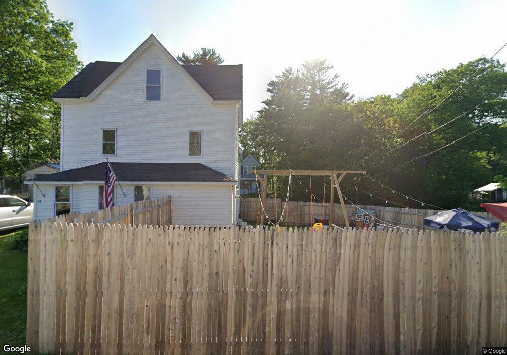
13 Toncer Rd Livermore, ME 04253
Estimated Value: $162,000 - $241,000
3
Beds
2
Baths
1,600
Sq Ft
$120/Sq Ft
Est. Value
About This Home
This home is located at 13 Toncer Rd, Livermore, ME 04253 and is currently estimated at $192,415, approximately $120 per square foot. 13 Toncer Rd is a home located in Androscoggin County with nearby schools including Spruce Mountain Primary School, Spruce Mountain Elementary School, and Spruce Mountain Middle School.
Ownership History
Date
Name
Owned For
Owner Type
Purchase Details
Closed on
Aug 13, 2020
Sold by
Frechette Tammy
Bought by
Giasson Paul L and Mercier Megan M
Current Estimated Value
Home Financials for this Owner
Home Financials are based on the most recent Mortgage that was taken out on this home.
Original Mortgage
$161,616
Outstanding Balance
$142,718
Interest Rate
3%
Mortgage Type
New Conventional
Estimated Equity
$49,697
Create a Home Valuation Report for This Property
The Home Valuation Report is an in-depth analysis detailing your home's value as well as a comparison with similar homes in the area
Home Values in the Area
Average Home Value in this Area
Purchase History
| Date | Buyer | Sale Price | Title Company |
|---|---|---|---|
| Giasson Paul L | -- | None Available |
Source: Public Records
Mortgage History
| Date | Status | Borrower | Loan Amount |
|---|---|---|---|
| Open | Giasson Paul L | $161,616 |
Source: Public Records
Tax History Compared to Growth
Tax History
| Year | Tax Paid | Tax Assessment Tax Assessment Total Assessment is a certain percentage of the fair market value that is determined by local assessors to be the total taxable value of land and additions on the property. | Land | Improvement |
|---|---|---|---|---|
| 2025 | $1,875 | $99,229 | $29,510 | $69,719 |
| 2024 | $1,697 | $99,229 | $29,510 | $69,719 |
| 2023 | $1,612 | $99,229 | $29,510 | $69,719 |
| 2022 | $1,588 | $99,229 | $29,510 | $69,719 |
| 2021 | $1,588 | $99,229 | $29,510 | $69,719 |
| 2020 | $1,513 | $99,229 | $29,510 | $69,719 |
| 2019 | $810 | $49,871 | $21,510 | $28,361 |
| 2018 | $1,319 | $82,419 | $25,510 | $56,909 |
| 2017 | $1,352 | $82,419 | $25,510 | $56,909 |
| 2016 | $1,319 | $82,419 | $25,510 | $56,909 |
| 2015 | $1,319 | $82,419 | $25,510 | $56,909 |
| 2014 | $1,170 | $82,419 | $25,510 | $56,909 |
Source: Public Records
Map
Nearby Homes
- 84 Botka Hill Rd
- 85 Botka Hill Rd
- 83 Botka Hill Rd
- 91 Botka Hill Rd
- 98 Botka Hill Rd
- 102 Botka Hill Rd Unit rd
- 102 Botka Hill Rd
- 108 Botka Hill Rd
- 115 Botka Hill Rd
- 0 Botka Hill
- 41 Federal Rd
- 25 Federal Rd
- 98 Goding Rd
- 58 Federal Rd
- 32 Federal Rd
- 86 Goding Rd
- Lot 5 River
- Lot 1 River
- Lot 3 River
- 27 River Rd