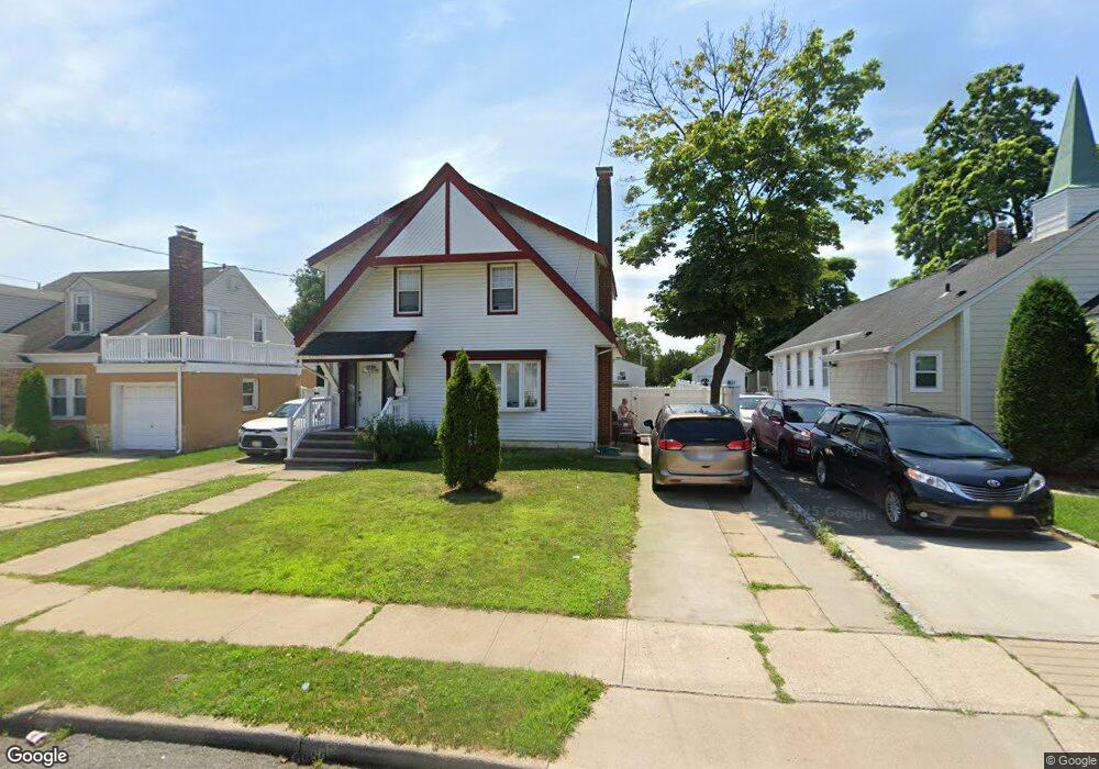
13 W Dean St Freeport, NY 11520
Estimated Value: $549,203 - $589,000
--
Bed
1
Bath
1,248
Sq Ft
$456/Sq Ft
Est. Value
About This Home
This home is located at 13 W Dean St, Freeport, NY 11520 and is currently estimated at $569,102, approximately $456 per square foot. 13 W Dean St is a home located in Nassau County with nearby schools including Caroline G. Atkinson Intermediate School, Columbus Avenue School, and John W Dodd Middle School.
Ownership History
Date
Name
Owned For
Owner Type
Purchase Details
Closed on
May 10, 2019
Sold by
Pena Jaime and Pena Jaime Luis
Bought by
Canela Miriam and Abreu Franklin Canela
Current Estimated Value
Home Financials for this Owner
Home Financials are based on the most recent Mortgage that was taken out on this home.
Original Mortgage
$358,388
Outstanding Balance
$318,498
Interest Rate
4.75%
Mortgage Type
FHA
Estimated Equity
$250,604
Purchase Details
Closed on
Apr 15, 2003
Sold by
Arias Francisco
Purchase Details
Closed on
Dec 20, 2002
Sold by
Pena Jaime
Bought by
Pena Jaime Luis and Pena Jaime
Create a Home Valuation Report for This Property
The Home Valuation Report is an in-depth analysis detailing your home's value as well as a comparison with similar homes in the area
Home Values in the Area
Average Home Value in this Area
Purchase History
| Date | Buyer | Sale Price | Title Company |
|---|---|---|---|
| Canela Miriam | $365,000 | Judicial Title | |
| -- | $115,000 | -- | |
| Pena Jaime Luis | -- | -- |
Source: Public Records
Mortgage History
| Date | Status | Borrower | Loan Amount |
|---|---|---|---|
| Open | Canela Miriam | $358,388 |
Source: Public Records
Tax History Compared to Growth
Tax History
| Year | Tax Paid | Tax Assessment Tax Assessment Total Assessment is a certain percentage of the fair market value that is determined by local assessors to be the total taxable value of land and additions on the property. | Land | Improvement |
|---|---|---|---|---|
| 2025 | $8,194 | $380 | $137 | $243 |
| 2024 | $834 | $380 | $137 | $243 |
| 2023 | $7,989 | $380 | $137 | $243 |
| 2022 | $7,989 | $380 | $137 | $243 |
| 2021 | $11,583 | $364 | $131 | $233 |
| 2020 | $7,785 | $483 | $310 | $173 |
| 2019 | $801 | $483 | $310 | $173 |
| 2018 | $4,031 | $483 | $0 | $0 |
| 2017 | $5,813 | $483 | $310 | $173 |
| 2016 | $6,538 | $483 | $310 | $173 |
| 2015 | $698 | $483 | $310 | $173 |
| 2014 | $698 | $483 | $310 | $173 |
| 2013 | $659 | $483 | $310 | $173 |
Source: Public Records
Map
Nearby Homes
- 222 N Ocean Ave
- 27 W Woodbine Dr
- 45 Dehnhoff Ave
- 67 E Dean St
- 70 N Grove St Unit 1R
- 101 Wallace St
- 100 Randall Ave Unit 1E
- 99 Randall Ave Unit 1Q
- 47 Harding Place
- 101 Harris Ave
- 21 Connecticut Ave
- 29 Wilson Place
- 112 E Seaman Ave
- 110 Brooklyn Ave Unit 1D
- 6 New York Ave
- 92 Leonard Ave
- 161 Grand Ave
- 18 Evans Ave
- 26 Rosedale Ave
- 98 N Columbus Ave