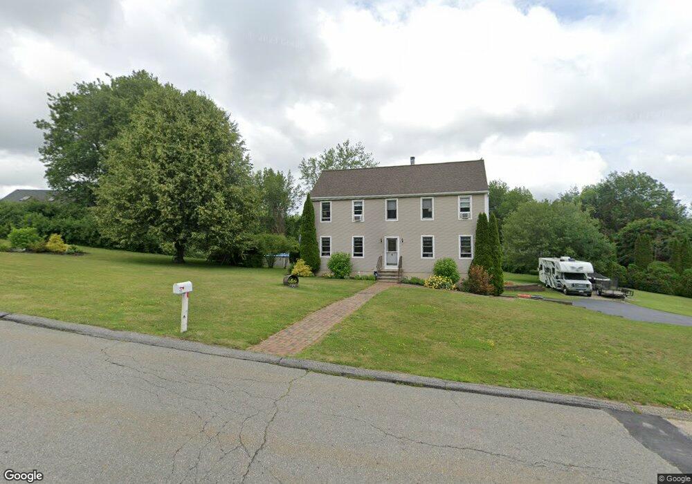
13 Whitby Rd Charlton, MA 01507
Estimated Value: $507,989 - $570,000
3
Beds
2
Baths
1,820
Sq Ft
$293/Sq Ft
Est. Value
About This Home
This home is located at 13 Whitby Rd, Charlton, MA 01507 and is currently estimated at $533,247, approximately $292 per square foot. 13 Whitby Rd is a home located in Worcester County with nearby schools including Shepherd Hill Regional High School.
Ownership History
Date
Name
Owned For
Owner Type
Purchase Details
Closed on
Oct 2, 2000
Sold by
Cmg Dev Corp
Bought by
Hicks John C and Lindahl Laurie
Current Estimated Value
Home Financials for this Owner
Home Financials are based on the most recent Mortgage that was taken out on this home.
Original Mortgage
$161,400
Outstanding Balance
$58,945
Interest Rate
7.94%
Mortgage Type
Purchase Money Mortgage
Estimated Equity
$474,302
Create a Home Valuation Report for This Property
The Home Valuation Report is an in-depth analysis detailing your home's value as well as a comparison with similar homes in the area
Home Values in the Area
Average Home Value in this Area
Purchase History
| Date | Buyer | Sale Price | Title Company |
|---|---|---|---|
| Hicks John C | $169,940 | -- | |
| Hicks John C | $169,940 | -- |
Source: Public Records
Mortgage History
| Date | Status | Borrower | Loan Amount |
|---|---|---|---|
| Open | Hicks John C | $40,000 | |
| Open | Hicks John C | $161,400 | |
| Closed | Hicks John C | $161,400 |
Source: Public Records
Tax History Compared to Growth
Tax History
| Year | Tax Paid | Tax Assessment Tax Assessment Total Assessment is a certain percentage of the fair market value that is determined by local assessors to be the total taxable value of land and additions on the property. | Land | Improvement |
|---|---|---|---|---|
| 2025 | $4,667 | $419,300 | $82,700 | $336,600 |
| 2024 | $4,551 | $401,300 | $82,700 | $318,600 |
| 2023 | $4,441 | $364,900 | $80,000 | $284,900 |
| 2022 | $4,375 | $329,200 | $74,400 | $254,800 |
| 2021 | $4,129 | $275,100 | $71,700 | $203,400 |
| 2020 | $4,068 | $272,300 | $68,900 | $203,400 |
| 2019 | $4,022 | $272,300 | $68,900 | $203,400 |
| 2018 | $3,676 | $272,300 | $68,900 | $203,400 |
| 2017 | $3,587 | $254,400 | $68,900 | $185,500 |
| 2016 | $3,481 | $252,600 | $68,900 | $183,700 |
| 2015 | $3,390 | $252,600 | $68,900 | $183,700 |
| 2014 | $3,245 | $256,300 | $70,600 | $185,700 |
Source: Public Records
Map
Nearby Homes
- 27 W Applewood Dr
- 39 Hycrest Rd
- Lot 3 Smith Rd
- Lot 5 Smith Rd
- Lot 4 Smith Rd
- 44 Hycrest Rd
- 1 Deer Run
- 8 Hycrest Rd
- 7 Hycrest Rd
- 3 Michelle Ln
- 1098 Stafford St Unit 9
- 20 Leela Ln
- 15 Priscilla Ln
- 2 Wendy Place
- 40 Carroll Hill Rd
- 0 Oxbow Rd
- 24 Thayer Pond Dr Unit 16
- 28 Thayer Pond Dr Unit 12
- 34 Thayer Pond Dr Unit 8
- 45 Leicester St