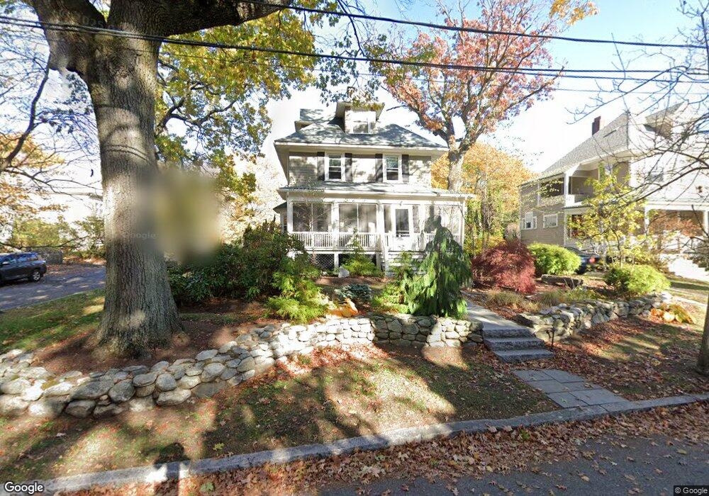
13 Woodland St Arlington, MA 02476
Arlington Center NeighborhoodEstimated Value: $1,483,000 - $1,861,000
4
Beds
2
Baths
2,704
Sq Ft
$620/Sq Ft
Est. Value
About This Home
This home is located at 13 Woodland St, Arlington, MA 02476 and is currently estimated at $1,675,691, approximately $619 per square foot. 13 Woodland St is a home located in Middlesex County with nearby schools including Brackett Elementary School, Bishop Elementary School, and Ottoson Middle School.
Ownership History
Date
Name
Owned For
Owner Type
Purchase Details
Closed on
Mar 3, 2008
Sold by
Berenberg Lorri B and Wilstein Robert A
Bought by
13 Woodland Street Rt and Berenberg Lorri B Est
Current Estimated Value
Purchase Details
Closed on
Jul 26, 1996
Sold by
Rosenfield James and Sanders Deborah
Bought by
Berenberg Lorri B and Wilstein Robert
Home Financials for this Owner
Home Financials are based on the most recent Mortgage that was taken out on this home.
Original Mortgage
$331,600
Interest Rate
8.37%
Mortgage Type
Purchase Money Mortgage
Purchase Details
Closed on
Aug 24, 1990
Sold by
Mcdonald Phillip A
Bought by
Rosenfield James
Home Financials for this Owner
Home Financials are based on the most recent Mortgage that was taken out on this home.
Original Mortgage
$270,000
Interest Rate
10.01%
Mortgage Type
Purchase Money Mortgage
Purchase Details
Closed on
Nov 1, 1989
Sold by
Wright Paul J
Bought by
Mcdonald Phillip A
Create a Home Valuation Report for This Property
The Home Valuation Report is an in-depth analysis detailing your home's value as well as a comparison with similar homes in the area
Home Values in the Area
Average Home Value in this Area
Purchase History
| Date | Buyer | Sale Price | Title Company |
|---|---|---|---|
| 13 Woodland Street Rt | -- | -- | |
| Berenberg Lorri B | $414,500 | -- | |
| Rosenfield James | $375,000 | -- | |
| Mcdonald Phillip A | $210,000 | -- |
Source: Public Records
Mortgage History
| Date | Status | Borrower | Loan Amount |
|---|---|---|---|
| Previous Owner | Mcdonald Phillip A | $331,600 | |
| Previous Owner | Mcdonald Phillip A | $202,000 | |
| Previous Owner | Mcdonald Phillip A | $270,000 | |
| Previous Owner | Mcdonald Phillip A | $10,000 |
Source: Public Records
Tax History Compared to Growth
Tax History
| Year | Tax Paid | Tax Assessment Tax Assessment Total Assessment is a certain percentage of the fair market value that is determined by local assessors to be the total taxable value of land and additions on the property. | Land | Improvement |
|---|---|---|---|---|
| 2025 | $15,718 | $1,459,400 | $661,300 | $798,100 |
| 2024 | $14,579 | $1,376,700 | $637,200 | $739,500 |
| 2023 | $14,120 | $1,259,600 | $583,100 | $676,500 |
| 2022 | $13,159 | $1,152,300 | $541,100 | $611,200 |
| 2021 | $12,849 | $1,133,100 | $541,100 | $592,000 |
| 2020 | $12,531 | $1,133,000 | $541,100 | $591,900 |
| 2019 | $11,545 | $1,025,300 | $571,100 | $454,200 |
| 2018 | $10,614 | $875,000 | $420,800 | $454,200 |
| 2017 | $10,764 | $857,000 | $402,800 | $454,200 |
| 2016 | $10,584 | $826,900 | $372,700 | $454,200 |
| 2015 | $10,138 | $748,200 | $312,600 | $435,600 |
Source: Public Records
Map
Nearby Homes
- 36 Churchill Ave Unit 1
- 10 Plymouth St Unit 10
- 53 Highland Ave
- 39 Newport St
- 7 Mill St Unit 7
- 7 Court Street Place Unit 7
- 975 Mass Ave Unit 106
- 975 Massachusetts Ave Unit 307
- 242 Claflin St
- 995 Massachusetts Ave Unit 404
- 200 Claflin St
- 52-56 Dudley St
- 1025 Massachusetts Ave Unit 204
- 204 Plan at Majestic Mill Brook
- 1025 Massachusetts Ave Unit 404
- 1025 Massachusetts Ave Unit 506
- 1025 Massachusetts Ave Unit 401
- 1025 Massachusetts Ave Unit 210
- 1025 Massachusetts Ave Unit 402
- 1025 Massachusetts Ave Unit 308
- 9 Woodland St
- 106 Bartlett Ave
- 12 Woodland St
- 6 Woodland St
- 111 Jason St
- 104 Bartlett Ave
- 16 Woodland St
- 109 Bartlett Ave
- 21 Woodland St Unit 23
- 20 Woodland St
- 107 Jason St
- 24 Woodland St
- 103 Bartlett Ave
- 103 Jason St
- 100 Bartlett Ave Unit 102
- 125 Jason St
- 116 Jason St
- 116 Jason St Unit 1
- 120 Jason St
- 99 Bartlett Ave