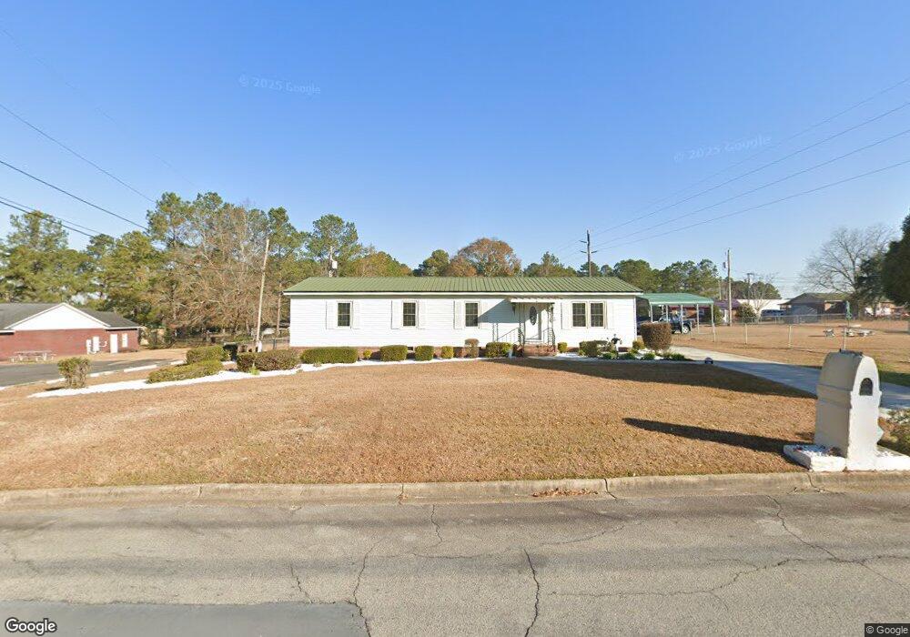
130 9th Ave NW Moultrie, GA 31768
Estimated Value: $71,000 - $96,000
--
Bed
2
Baths
1,425
Sq Ft
$57/Sq Ft
Est. Value
About This Home
This home is located at 130 9th Ave NW, Moultrie, GA 31768 and is currently estimated at $80,996, approximately $56 per square foot. 130 9th Ave NW is a home located in Colquitt County with nearby schools including C.A. Gray Junior High School, Willie J. Williams Middle School, and Colquitt County High School.
Ownership History
Date
Name
Owned For
Owner Type
Purchase Details
Closed on
Oct 9, 2009
Sold by
Evans Sharon
Bought by
Evans Sharon
Current Estimated Value
Home Financials for this Owner
Home Financials are based on the most recent Mortgage that was taken out on this home.
Original Mortgage
$25,977
Interest Rate
5%
Mortgage Type
Future Advance Clause Open End Mortgage
Purchase Details
Closed on
Oct 4, 2008
Sold by
Hanks Ellis
Bought by
Evans Sharon L
Purchase Details
Closed on
Dec 21, 1971
Bought by
Hanks Ellis
Create a Home Valuation Report for This Property
The Home Valuation Report is an in-depth analysis detailing your home's value as well as a comparison with similar homes in the area
Home Values in the Area
Average Home Value in this Area
Purchase History
| Date | Buyer | Sale Price | Title Company |
|---|---|---|---|
| Evans Sharon | -- | -- | |
| Evans Sharon L | $53,000 | -- | |
| Hanks Ellis | -- | -- |
Source: Public Records
Mortgage History
| Date | Status | Borrower | Loan Amount |
|---|---|---|---|
| Closed | Evans Sharon | $25,977 |
Source: Public Records
Tax History Compared to Growth
Tax History
| Year | Tax Paid | Tax Assessment Tax Assessment Total Assessment is a certain percentage of the fair market value that is determined by local assessors to be the total taxable value of land and additions on the property. | Land | Improvement |
|---|---|---|---|---|
| 2024 | $527 | $20,996 | $2,800 | $18,196 |
| 2023 | $589 | $23,600 | $2,800 | $20,800 |
| 2022 | $716 | $22,907 | $2,800 | $20,107 |
| 2021 | $654 | $20,797 | $2,800 | $17,997 |
| 2020 | $664 | $20,797 | $2,800 | $17,997 |
| 2019 | $749 | $20,797 | $2,800 | $17,997 |
| 2018 | $831 | $20,797 | $2,800 | $17,997 |
| 2017 | $742 | $20,797 | $2,800 | $17,997 |
| 2016 | $776 | $20,797 | $2,800 | $17,997 |
| 2015 | $778 | $20,797 | $2,800 | $17,997 |
| 2014 | $797 | $20,797 | $2,800 | $17,997 |
| 2013 | -- | $20,796 | $2,800 | $17,996 |
Source: Public Records
Map
Nearby Homes
- 615 1st St NW
- 503 2nd St NW
- 316 5th Ave NW
- 1208 Maple St
- 521 5th Ave NW
- 722 Martin Luther King jr Dr
- 408 9th St NW
- 417 9th St NW
- 614 2nd Ave NW
- 610 1st Ave NW
- 310 1st Ave SW
- 00 1st Ave SW
- 0 S U Highway 319 N
- 118 5th St SW
- 618 2nd Ave SW
- 407 1st Ave SE
- 410 W Bypass Pass NW
- 221 6th St SW
- 619 E Central Ave
- 410 West Bypass NW
- 122 9th Ave NW
- 123 Old Doerun Rd
- 131 Old Doerun Rd
- 118 9th Ave NW
- 129 9th Ave NW
- 125 9th Ave NW
- 133 9th Ave NW
- 908 3rd St NW
- 119 Old Doerun Rd
- 121 9th Ave NW
- 137 9th Ave NW
- 114 9th Ave NW
- 119 9th Ave NW
- 115 Old Doerun Rd
- 133 Old Doerun Rd
- 141 9th Ave NW
- 728 2nd St
- 732 2nd St
- 115 9th Ave NW
- 724 2nd St