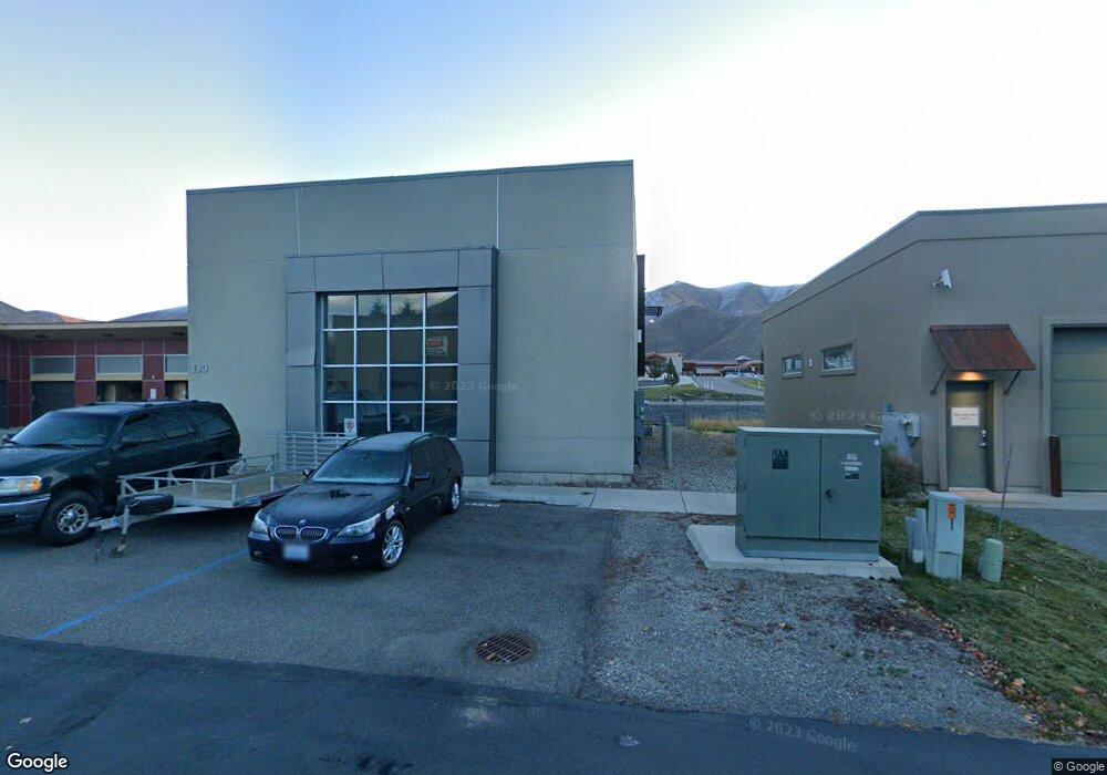
130 Airport Cir Hailey, ID 83333
Estimated Value: $1,859,429
--
Bed
3
Baths
5,982
Sq Ft
$311/Sq Ft
Est. Value
About This Home
This home is located at 130 Airport Cir, Hailey, ID 83333 and is currently estimated at $1,859,429, approximately $310 per square foot. 130 Airport Cir is a home located in Blaine County with nearby schools including Syringa Mountain School, The Mountain School, and The Sage School.
Ownership History
Date
Name
Owned For
Owner Type
Purchase Details
Closed on
Jun 2, 2020
Sold by
Portage Bay Partners Llc
Bought by
Dream Alive Llc
Current Estimated Value
Home Financials for this Owner
Home Financials are based on the most recent Mortgage that was taken out on this home.
Original Mortgage
$1,000,000
Outstanding Balance
$888,076
Interest Rate
3.3%
Mortgage Type
Commercial
Estimated Equity
$971,353
Purchase Details
Closed on
Jul 10, 2013
Sold by
Ayliffe Piyakanya
Bought by
Ayliffe Ted
Home Financials for this Owner
Home Financials are based on the most recent Mortgage that was taken out on this home.
Original Mortgage
$1,350,000
Interest Rate
3.92%
Mortgage Type
Commercial
Create a Home Valuation Report for This Property
The Home Valuation Report is an in-depth analysis detailing your home's value as well as a comparison with similar homes in the area
Home Values in the Area
Average Home Value in this Area
Purchase History
| Date | Buyer | Sale Price | Title Company |
|---|---|---|---|
| Dream Alive Llc | -- | Blaine County Title | |
| Ayliffe Ted | -- | Blaine County Title |
Source: Public Records
Mortgage History
| Date | Status | Borrower | Loan Amount |
|---|---|---|---|
| Open | Dream Alive Llc | $1,000,000 | |
| Previous Owner | Ayliffe Ted | $1,350,000 |
Source: Public Records
Tax History Compared to Growth
Tax History
| Year | Tax Paid | Tax Assessment Tax Assessment Total Assessment is a certain percentage of the fair market value that is determined by local assessors to be the total taxable value of land and additions on the property. | Land | Improvement |
|---|---|---|---|---|
| 2024 | $8,259 | $2,165,078 | $618,937 | $1,546,141 |
| 2023 | $8,259 | $2,024,522 | $618,939 | $1,405,583 |
| 2022 | $6,177 | $1,405,270 | $324,052 | $1,081,218 |
| 2021 | $6,738 | $1,217,852 | $270,043 | $947,809 |
| 2020 | $5,623 | $850,990 | $225,036 | $625,954 |
| 2019 | $6,609 | $840,274 | $0 | $0 |
| 2018 | $6,965 | $840,274 | $0 | $0 |
| 2017 | $7,465 | $817,311 | $0 | $0 |
| 2016 | $7,065 | $757,205 | $0 | $0 |
| 2013 | -- | $797,805 | $0 | $0 |
Source: Public Records
Map
Nearby Homes
- 1371 Silver Star Dr
- 1600 Red Feather Way
- 1511 Baldy View Dr
- 1321 Creekside Dr
- 1555 Baldy View Dr
- 1261 Snowfly Dr
- 1240 Snowfly Dr
- 740 Red Ash Dr Unit D2
- 740 Red Ash Dr Unit E3
- 740 Red Ash Dr Unit F2
- 740 Red Ash Dr Unit F4
- 740 Red Ash Dr Unit D1
- 1510 Kestrel St
- 1611 Kestrel St
- 1540 Kestrel St
- 1620 Whitebark Rd
- 1520 Kestrel St
- 941 Eastridge Dr
- 2011 Wimbledon Ct
- 2021 Wimbledon Ct
- 1451 Aviation Dr
- 1451 Aviation Dr
- 131 Gulf Stream Ln
- 1501 Red Feather Way
- 1500 Red Feather Way
- 130 Gulf Stream Ln Unit 1
- 130 Gulf Stream Ln
- 1511 Red Feather Way
- 1251 Aviation Dr
- 43 Broadford Rd
- 1730 Lear Ln
- 1730 Lear Ln Unit C
- 1730 Lear Ln Unit D
- 1521 Red Feather Way
- 1340 Queen of the Hills Dr
- 1350 Queen of the Hills Dr
- 801 Arrowhead Ct
- 820 Arrowhead Ct
- 1531 Red Feather Way
- 000 Airport Way