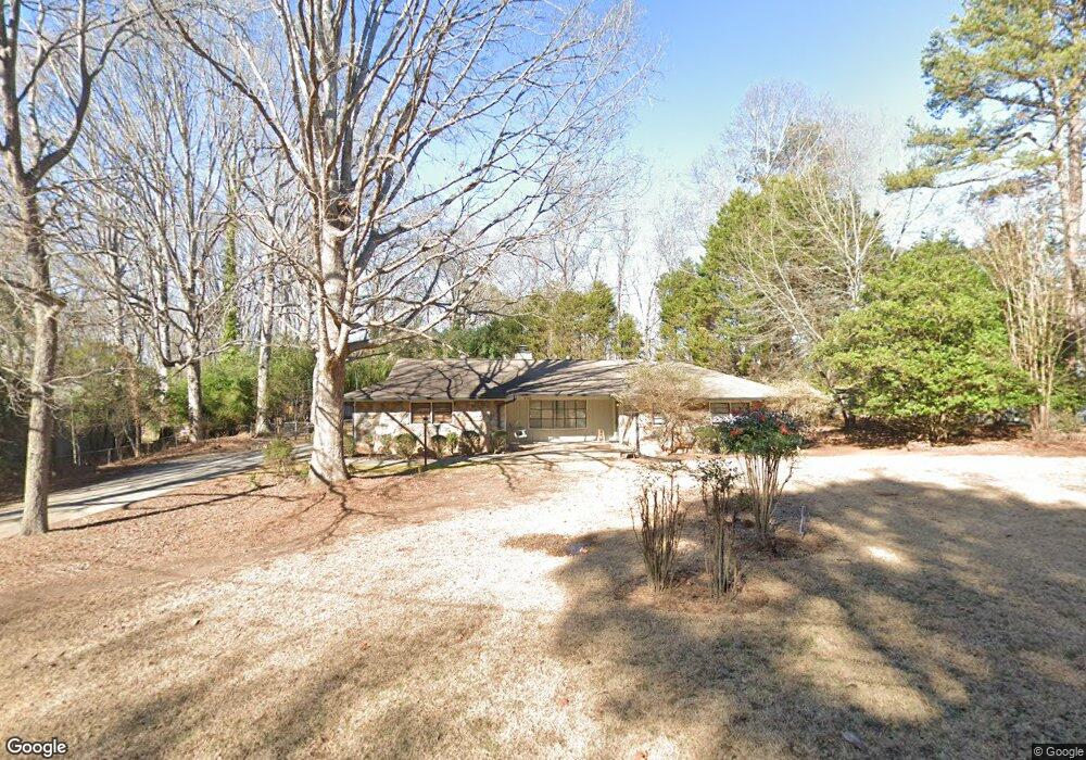
130 Austin Dr Athens, GA 30606
Estimated Value: $318,000 - $384,000
3
Beds
2
Baths
1,906
Sq Ft
$182/Sq Ft
Est. Value
About This Home
This home is located at 130 Austin Dr, Athens, GA 30606 and is currently estimated at $346,223, approximately $181 per square foot. 130 Austin Dr is a home located in Clarke County with nearby schools including Timothy Elementary School, Clarke Middle School, and Clarke Central High School.
Ownership History
Date
Name
Owned For
Owner Type
Purchase Details
Closed on
Oct 3, 2013
Sold by
Gossard Melissa Lee
Bought by
Macgossard Troy Mac
Current Estimated Value
Purchase Details
Closed on
Jan 7, 2009
Sold by
Dover Andrew L
Bought by
Gossard Troy M
Home Financials for this Owner
Home Financials are based on the most recent Mortgage that was taken out on this home.
Original Mortgage
$124,400
Interest Rate
5.43%
Mortgage Type
New Conventional
Purchase Details
Closed on
Mar 25, 2005
Sold by
Paul Patricia H
Bought by
Dover Andrew L and Dover Kelly M
Home Financials for this Owner
Home Financials are based on the most recent Mortgage that was taken out on this home.
Original Mortgage
$139,583
Interest Rate
5.62%
Mortgage Type
New Conventional
Purchase Details
Closed on
Aug 25, 2000
Sold by
Paul Wilbur and Paul Patricia H
Bought by
Paul Patricia H
Create a Home Valuation Report for This Property
The Home Valuation Report is an in-depth analysis detailing your home's value as well as a comparison with similar homes in the area
Purchase History
| Date | Buyer | Sale Price | Title Company |
|---|---|---|---|
| Macgossard Troy Mac | -- | -- | |
| Gossard Troy M | $155,500 | -- | |
| Dover Andrew L | $143,900 | -- | |
| Paul Patricia H | -- | -- |
Source: Public Records
Mortgage History
| Date | Status | Borrower | Loan Amount |
|---|---|---|---|
| Open | Gossard Troy M | $113,336 | |
| Previous Owner | Gossard Troy M | $124,400 | |
| Previous Owner | Dover Andrew L | $139,583 |
Source: Public Records
Tax History
| Year | Tax Paid | Tax Assessment Tax Assessment Total Assessment is a certain percentage of the fair market value that is determined by local assessors to be the total taxable value of land and additions on the property. | Land | Improvement |
|---|---|---|---|---|
| 2025 | $2,877 | $111,017 | $12,000 | $99,017 |
| 2024 | $2,877 | $104,834 | $12,000 | $92,834 |
| 2023 | $1,937 | $96,995 | $12,000 | $84,995 |
| 2022 | $2,302 | $82,174 | $12,000 | $70,174 |
| 2021 | $2,021 | $69,971 | $12,000 | $57,971 |
| 2020 | $1,940 | $67,573 | $12,000 | $55,573 |
| 2019 | $1,892 | $65,731 | $12,000 | $53,731 |
| 2018 | $1,628 | $57,959 | $10,400 | $47,559 |
| 2017 | $0 | $55,697 | $10,400 | $45,297 |
| 2016 | $1,450 | $52,698 | $10,400 | $42,298 |
| 2015 | $1,404 | $51,288 | $10,400 | $40,888 |
| 2014 | $1,367 | $50,110 | $10,400 | $39,710 |
Source: Public Records
Map
Nearby Homes
- 175 New Haven Dr
- 306 Providence Rd
- 400 Providence Rd
- 118 Woodhaven Terrace
- 860 Mitchell Bridge Rd Unit 8
- 164 Lucy Ln
- 256 Cherokee Ridge
- 150 The Preserve Dr Unit H2
- 184 Hillsborough Dr
- 134 Bent Tree Dr
- 236 Melba Ln
- 532 Huntington Rd Unit 7
- 128 Russell Way
- 470 Huntington Rd Unit 5
- 460 Huntington Rd
- 212 Huntington Shoals Dr
- 575 Vaughn Rd
- 637 Huntington Rd Unit C2
- 637 Huntington Rd Unit 2
- 637 Huntington Rd Unit B1
- 150 Austin Dr
- 265 Auburn Pkwy
- 275 Auburn Pkwy
- 122 Austin Ct
- 295 Auburn Pkwy
- 135 Austin Dr
- 145 Austin Dr
- 245 Auburn Pkwy
- 305 Auburn Pkwy
- 132 Austin Ct
- 225 Austin Dr
- 155 Austin Dr
- 185 Bloomington Dr
- 270 Auburn Pkwy
- 260 Auburn Pkwy
- 150 Kingston Way
- 165 Austin Dr
- 311 Auburn Pkwy
- 235 Auburn Pkwy
- 250 Auburn Pkwy
Your Personal Tour Guide
Ask me questions while you tour the home.