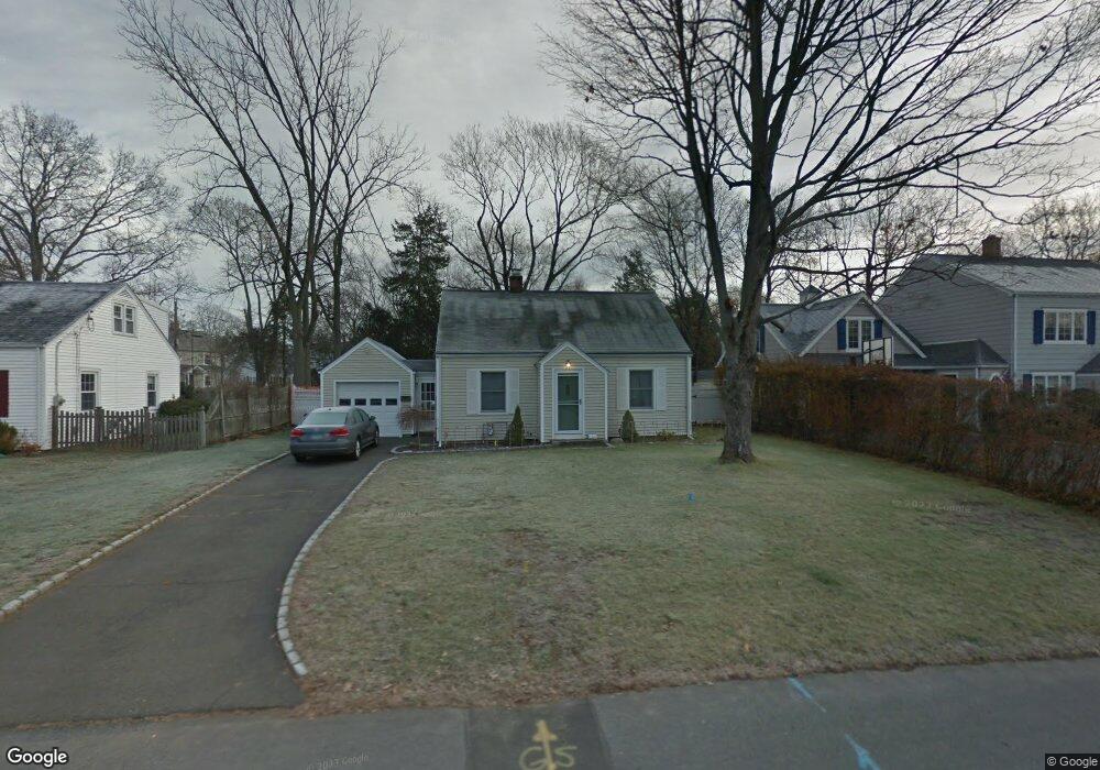
130 Dunnlea Rd Fairfield, CT 06824
University NeighborhoodEstimated Value: $866,000 - $1,248,000
3
Beds
2
Baths
1,276
Sq Ft
$803/Sq Ft
Est. Value
About This Home
This home is located at 130 Dunnlea Rd, Fairfield, CT 06824 and is currently estimated at $1,024,980, approximately $803 per square foot. 130 Dunnlea Rd is a home located in Fairfield County with nearby schools including Riverfield Elementary School, Roger Ludlowe Middle School, and Fairfield Ludlowe High School.
Ownership History
Date
Name
Owned For
Owner Type
Purchase Details
Closed on
Jun 16, 2008
Sold by
Lubarsky Jesse and Lubarsky Jennifer
Bought by
Palumbo Chantelle A and Palumbo John P
Current Estimated Value
Home Financials for this Owner
Home Financials are based on the most recent Mortgage that was taken out on this home.
Original Mortgage
$417,000
Interest Rate
6.13%
Purchase Details
Closed on
Sep 1, 2004
Sold by
Hedman Carl E and Spring-Hedman Jill L
Bought by
Lubarsky Jesse and Lubarsky Jennifer
Purchase Details
Closed on
Jul 14, 2000
Sold by
Waiksnis Leonard G and Waiksnis Elizabeth F
Bought by
Hedman Carl E and Spring-Hedman Jill L
Purchase Details
Closed on
Oct 10, 1990
Sold by
Walksnis Albert V
Bought by
Walksnis Leonard G
Create a Home Valuation Report for This Property
The Home Valuation Report is an in-depth analysis detailing your home's value as well as a comparison with similar homes in the area
Home Values in the Area
Average Home Value in this Area
Purchase History
| Date | Buyer | Sale Price | Title Company |
|---|---|---|---|
| Palumbo Chantelle A | $529,000 | -- | |
| Palumbo Chantelle A | $529,000 | -- | |
| Lubarsky Jesse | $510,000 | -- | |
| Lubarsky Jesse | $510,000 | -- | |
| Hedman Carl E | $339,000 | -- | |
| Hedman Carl E | $339,000 | -- | |
| Walksnis Leonard G | $170,000 | -- |
Source: Public Records
Mortgage History
| Date | Status | Borrower | Loan Amount |
|---|---|---|---|
| Open | Walksnis Leonard G | $608,566 | |
| Closed | Walksnis Leonard G | $417,000 |
Source: Public Records
Tax History Compared to Growth
Tax History
| Year | Tax Paid | Tax Assessment Tax Assessment Total Assessment is a certain percentage of the fair market value that is determined by local assessors to be the total taxable value of land and additions on the property. | Land | Improvement |
|---|---|---|---|---|
| 2025 | $11,077 | $390,180 | $253,680 | $136,500 |
| 2024 | $10,560 | $378,490 | $253,680 | $124,810 |
| 2023 | $10,412 | $378,490 | $253,680 | $124,810 |
| 2022 | $10,310 | $378,490 | $253,680 | $124,810 |
| 2021 | $10,212 | $378,490 | $253,680 | $124,810 |
| 2020 | $9,585 | $357,770 | $251,020 | $106,750 |
| 2019 | $9,585 | $357,770 | $251,020 | $106,750 |
| 2018 | $9,431 | $357,770 | $251,020 | $106,750 |
| 2017 | $9,238 | $357,770 | $251,020 | $106,750 |
| 2016 | $8,562 | $336,420 | $251,020 | $85,400 |
| 2015 | $8,576 | $345,940 | $272,020 | $73,920 |
| 2014 | $8,441 | $345,940 | $272,020 | $73,920 |
Source: Public Records
Map
Nearby Homes
- 232 Pell Meadow Dr
- 83 Pell Meadow Dr
- 647 Bronson Rd
- 476 Mill Hill Terrace
- 105 Charter Oak Rd
- 53 Hilltop Dr
- 245 Unquowa Rd Unit 34
- 245 Unquowa Rd Unit 11
- 245 Unquowa Rd Unit 33
- 20 Ermine St
- 1135 Mill Hill Rd
- 44 Deer Run Rd
- 21 Beaumont St
- 844 Mill Hill Terrace
- 43 Helen St
- 160 Cedar Rd
- 88 Overhill Rd
- 100 Overhill Rd
- 28 Mill Hill Rd Unit 28
- 360 Duck Farm Rd