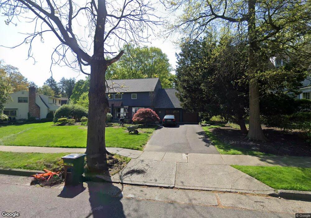
130 E Maple Ave Moorestown, NJ 08057
Estimated Value: $906,000 - $1,118,000
Studio
--
Bath
2,944
Sq Ft
$343/Sq Ft
Est. Value
About This Home
This home is located at 130 E Maple Ave, Moorestown, NJ 08057 and is currently estimated at $1,009,086, approximately $342 per square foot. 130 E Maple Ave is a home located in Burlington County with nearby schools including George C. Baker Elementary School, Moorestown Upper Elementary School, and William Allen Middle School.
Ownership History
Date
Name
Owned For
Owner Type
Purchase Details
Closed on
Jul 21, 2005
Sold by
Lipkin Philip and Lipkin Susan K
Bought by
Maroney Brian J and Maroney Christina M
Current Estimated Value
Home Financials for this Owner
Home Financials are based on the most recent Mortgage that was taken out on this home.
Original Mortgage
$300,000
Outstanding Balance
$156,300
Interest Rate
5.63%
Mortgage Type
Fannie Mae Freddie Mac
Estimated Equity
$852,786
Create a Home Valuation Report for This Property
The Home Valuation Report is an in-depth analysis detailing your home's value as well as a comparison with similar homes in the area
Home Values in the Area
Average Home Value in this Area
Purchase History
| Date | Buyer | Sale Price | Title Company |
|---|---|---|---|
| Maroney Brian J | $615,000 | Infinity Title Agency Inc | |
| Lipkin Md Philip | -- | Infinity Title Agency Inc |
Source: Public Records
Mortgage History
| Date | Status | Borrower | Loan Amount |
|---|---|---|---|
| Open | Lipkin Md Philip | $300,000 |
Source: Public Records
Tax History
| Year | Tax Paid | Tax Assessment Tax Assessment Total Assessment is a certain percentage of the fair market value that is determined by local assessors to be the total taxable value of land and additions on the property. | Land | Improvement |
|---|---|---|---|---|
| 2025 | $14,367 | $506,400 | $210,200 | $296,200 |
| 2024 | $13,931 | $506,400 | $210,200 | $296,200 |
| 2023 | $13,931 | $506,400 | $210,200 | $296,200 |
| 2022 | $13,789 | $506,400 | $210,200 | $296,200 |
| 2021 | $13,595 | $506,400 | $210,200 | $296,200 |
| 2020 | $13,521 | $506,400 | $210,200 | $296,200 |
| 2019 | $12,764 | $486,600 | $210,200 | $276,400 |
| 2018 | $12,418 | $486,600 | $210,200 | $276,400 |
| 2017 | $12,525 | $486,600 | $210,200 | $276,400 |
| 2016 | $12,481 | $486,600 | $210,200 | $276,400 |
| 2015 | $12,330 | $486,600 | $210,200 | $276,400 |
| 2014 | $11,708 | $486,600 | $210,200 | $276,400 |
Source: Public Records
Map
Nearby Homes
- 205 E Central Ave
- 308 Elm St
- 133 Plum St Unit 6
- 80 E 3rd St
- 66 E 3rd St
- 408 N Stanwick Rd
- 700 Lippincott Ave
- 127 Schooley St
- 863 Golf View Rd
- 228 Mill St
- 325 E 2nd St
- 744 Signal Light Rd
- 337 E 2nd St
- 104 Mount Laurel Rd
- 437 Windrow Clusters Dr
- 451 E 2nd St
- 543 Bethel Ave
- 526 E Main St
- 15 W Close Unit 15
- 22 E Close Unit 22
- 134 E Maple Ave
- 126 E Maple Ave
- 520 Chestnut St
- 137 E Oak Ave
- 118 E Maple Ave
- 133 E Oak Ave
- 125 E Maple Ave
- 141 E Oak Ave
- 600 Chestnut St
- 129 E Oak Ave
- 123 E Maple Ave
- 525 Chestnut St
- 125 E Oak Ave
- 527 Chestnut St
- 116 E Maple Ave
- 119 E Maple Ave
- 201 E Maple Ave
- 201 E Oak Ave
- 121 E Oak Ave
- 610 Chestnut St
Your Personal Tour Guide
Ask me questions while you tour the home.