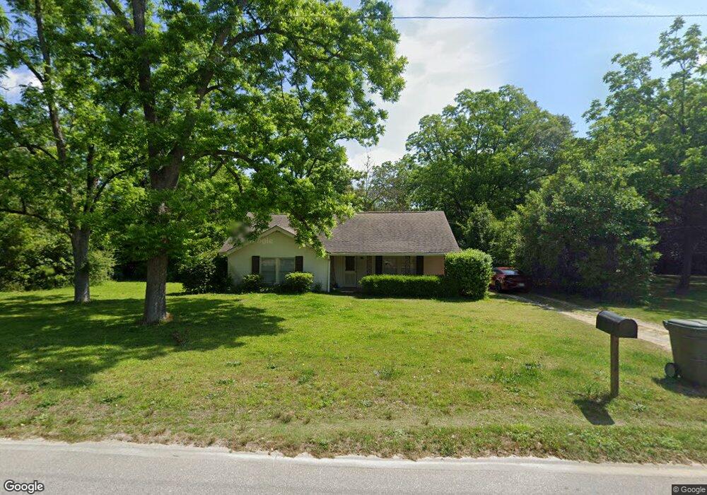
130 Elam St Gordon, GA 31031
Estimated Value: $81,000 - $109,000
3
Beds
1
Bath
1,386
Sq Ft
$69/Sq Ft
Est. Value
About This Home
This home is located at 130 Elam St, Gordon, GA 31031 and is currently estimated at $96,295, approximately $69 per square foot. 130 Elam St is a home located in Wilkinson County with nearby schools including Wilkinson County Primary School, Wilkinson County Elementary School, and Wilkinson County Middle School.
Ownership History
Date
Name
Owned For
Owner Type
Purchase Details
Closed on
Jul 24, 2019
Sold by
Brown Thomas E
Bought by
K And T Rental And Leasing Llc
Current Estimated Value
Purchase Details
Closed on
Nov 18, 2016
Sold by
Davidson Andrea D
Bought by
Brown Thomas E and Brown Kimberly
Home Financials for this Owner
Home Financials are based on the most recent Mortgage that was taken out on this home.
Original Mortgage
$32,725
Interest Rate
3.52%
Mortgage Type
New Conventional
Purchase Details
Closed on
May 21, 1998
Bought by
Drake Katherine B
Create a Home Valuation Report for This Property
The Home Valuation Report is an in-depth analysis detailing your home's value as well as a comparison with similar homes in the area
Home Values in the Area
Average Home Value in this Area
Purchase History
| Date | Buyer | Sale Price | Title Company |
|---|---|---|---|
| K And T Rental And Leasing Llc | -- | -- | |
| Brown Thomas E | $38,500 | -- | |
| Drake Katherine B | $43,000 | -- |
Source: Public Records
Mortgage History
| Date | Status | Borrower | Loan Amount |
|---|---|---|---|
| Previous Owner | Brown Thomas E | $32,725 |
Source: Public Records
Tax History Compared to Growth
Tax History
| Year | Tax Paid | Tax Assessment Tax Assessment Total Assessment is a certain percentage of the fair market value that is determined by local assessors to be the total taxable value of land and additions on the property. | Land | Improvement |
|---|---|---|---|---|
| 2024 | $1,789 | $42,630 | $2,920 | $39,710 |
| 2023 | $806 | $19,206 | $2,437 | $16,769 |
| 2022 | $806 | $19,206 | $2,437 | $16,769 |
| 2021 | $816 | $19,206 | $2,437 | $16,769 |
| 2020 | $806 | $19,206 | $2,437 | $16,769 |
| 2019 | $806 | $19,206 | $2,437 | $16,769 |
| 2018 | $802 | $19,206 | $2,437 | $16,769 |
| 2017 | $705 | $19,206 | $2,437 | $16,769 |
| 2016 | $694 | $18,907 | $2,138 | $16,769 |
| 2015 | $203 | $18,907 | $2,138 | $16,769 |
| 2014 | $203 | $18,907 | $2,138 | $16,769 |
| 2013 | $203 | $18,907 | $2,138 | $16,769 |
Source: Public Records
Map
Nearby Homes
- 160 College St
- 114 Hardie St
- 189 Gray Hwy
- 189 Pine St
- 121 Elm St
- 0 Ballpark Rd
- 109 Sarah Kate Way
- 106 Sarah Kate Way
- 103 Chappell St
- 0 Dennard Hardy Rd Unit 10460790
- 137 Lakeview Dr S
- 134 Magnolia Ave
- 0 Georgia 57
- Lot C25 Peach Orchard Rd
- 1455 Fred Hall Rd
- 0 Industrial Blvd Unit 52833
- 379 Bethlehem Church Rd
- 414 Kitchens Rd SW
- 635 Snow Granade Rd
- 2140 Nesmith Rd
