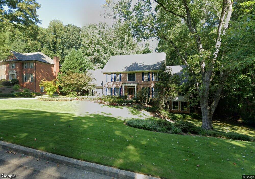
130 Emily Dr SW Unit 1 Lilburn, GA 30047
Estimated Value: $602,000 - $656,000
5
Beds
5
Baths
3,746
Sq Ft
$168/Sq Ft
Est. Value
About This Home
This home is located at 130 Emily Dr SW Unit 1, Lilburn, GA 30047 and is currently estimated at $627,672, approximately $167 per square foot. 130 Emily Dr SW Unit 1 is a home located in Gwinnett County with nearby schools including Arcado Elementary School, Trickum Middle School, and Parkview High School.
Ownership History
Date
Name
Owned For
Owner Type
Purchase Details
Closed on
Oct 15, 1997
Sold by
Sansbury Roy Kenneth and Sansbury Ann Walker
Bought by
Barton Donald L and Barton Janice C
Current Estimated Value
Home Financials for this Owner
Home Financials are based on the most recent Mortgage that was taken out on this home.
Original Mortgage
$240,000
Outstanding Balance
$33,092
Interest Rate
6.62%
Mortgage Type
New Conventional
Estimated Equity
$594,580
Create a Home Valuation Report for This Property
The Home Valuation Report is an in-depth analysis detailing your home's value as well as a comparison with similar homes in the area
Home Values in the Area
Average Home Value in this Area
Purchase History
| Date | Buyer | Sale Price | Title Company |
|---|---|---|---|
| Barton Donald L | $339,000 | -- |
Source: Public Records
Mortgage History
| Date | Status | Borrower | Loan Amount |
|---|---|---|---|
| Open | Barton Donald L | $240,000 |
Source: Public Records
Tax History Compared to Growth
Tax History
| Year | Tax Paid | Tax Assessment Tax Assessment Total Assessment is a certain percentage of the fair market value that is determined by local assessors to be the total taxable value of land and additions on the property. | Land | Improvement |
|---|---|---|---|---|
| 2025 | -- | $272,000 | $37,840 | $234,160 |
| 2024 | -- | $242,320 | $37,840 | $204,480 |
| 2023 | $1,363 | $184,800 | $26,320 | $158,480 |
| 2022 | $0 | $156,400 | $26,320 | $130,080 |
| 2021 | $5,000 | $156,400 | $26,320 | $130,080 |
| 2020 | $5,000 | $164,440 | $26,320 | $138,120 |
| 2019 | $5,000 | $142,160 | $21,520 | $120,640 |
| 2018 | $5,333 | $142,160 | $21,520 | $120,640 |
| 2016 | $4,963 | $128,080 | $14,080 | $114,000 |
| 2015 | $5,017 | $128,080 | $14,080 | $114,000 |
| 2014 | $5,045 | $128,080 | $14,080 | $114,000 |
Source: Public Records
Map
Nearby Homes
- 4627 Nantucket Dr SW
- 4740 Nantucket Dr SW
- 146 King David Dr SW
- 4989 Woodfall Dr SW
- 3589 Annsbury Ct
- The Maisie II Plan at Annsbury Park
- The Sadler Plan at Annsbury Park
- The Talbot Plan at Annsbury Park
- The Idlewild Plan at Annsbury Park
- 3549 Annsbury Ct
- 4879 Joy Ln SW
- 4151 Tillrock Ln
- 4171 Tillrock Ln
- 4191 Tillrock Ln
- 4131 Tillrock Ln
- 311 Arbor Point Ct SW
- 4160 Tillrock Ln
- 4181 Tillrock Ln
- Oxford Plan at The Preserve at Killian Hill - Townhomes
- 248 Kettlewood Dr SW
- 120 Emily Dr SW
- 110 Emily Dr SW
- 134 Mystic Cove SW
- 4650 Nantucket Dr SW
- 85 Emily Dr SW
- 100 Emily Dr SW
- 160 Emily Dr SW Unit 2
- 4660 Nantucket Dr SW Unit 1
- 4640 Nantucket Dr SW
- 75 Emily Dr SW
- 133 Mystic Cove SW
- 4670 Nantucket Dr SW
- 50 Village Green Ct SW
- 60 Village Green Ct SW
- 40 Village Green Ct SW
- 144 Mystic Cove SW
- 90 Emily Dr SW
- 4630 Nantucket Dr SW
- 4680 Nantucket Dr SW
- 65 Emily Dr SW