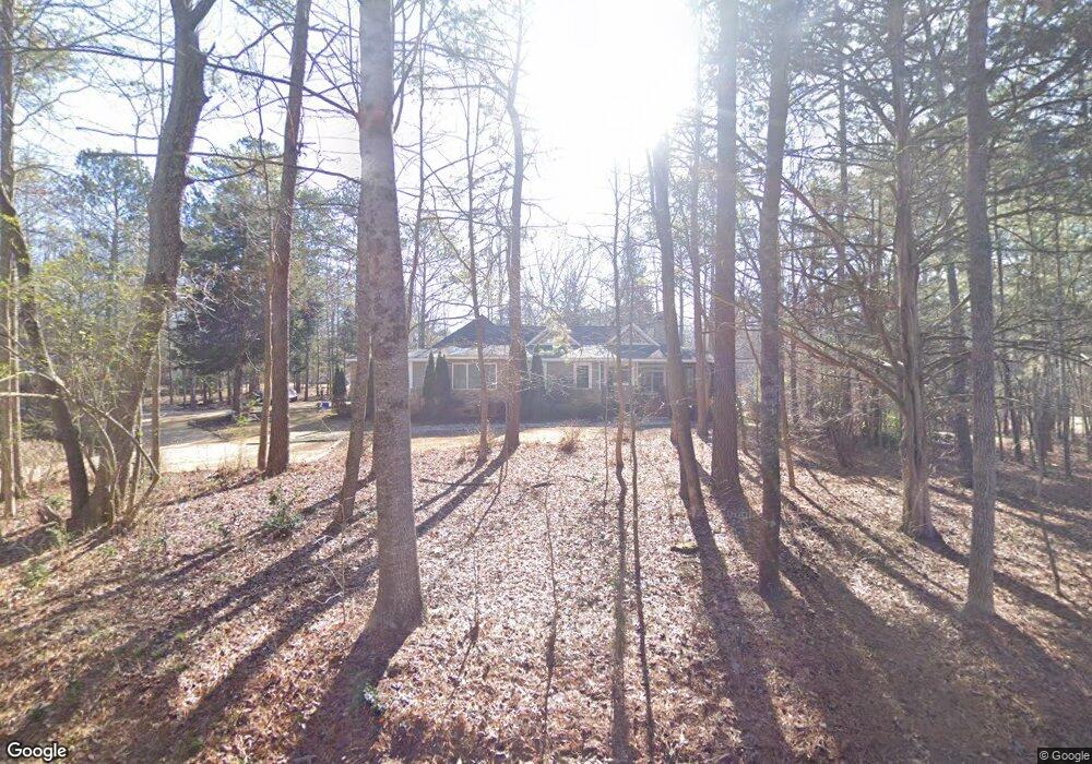
130 Hanover Cir Bogart, GA 30622
Estimated Value: $526,000 - $618,000
--
Bed
1
Bath
2,920
Sq Ft
$197/Sq Ft
Est. Value
About This Home
This home is located at 130 Hanover Cir, Bogart, GA 30622 and is currently estimated at $574,455, approximately $196 per square foot. 130 Hanover Cir is a home located in Clarke County with nearby schools including Cleveland Road Elementary School, Burney-Harris-Lyons Middle School, and Clarke Central High School.
Ownership History
Date
Name
Owned For
Owner Type
Purchase Details
Closed on
May 2, 2012
Sold by
Onac Llc
Bought by
Cano Shirley and Cano Francis T
Current Estimated Value
Purchase Details
Closed on
Nov 24, 2009
Sold by
Cano Francis Theodore
Bought by
Onac
Purchase Details
Closed on
Aug 5, 2008
Sold by
Burkhard Donald G
Bought by
Cano Shirley Ann and Cano Francis Theodore
Home Financials for this Owner
Home Financials are based on the most recent Mortgage that was taken out on this home.
Original Mortgage
$32,500
Interest Rate
6.32%
Mortgage Type
New Conventional
Create a Home Valuation Report for This Property
The Home Valuation Report is an in-depth analysis detailing your home's value as well as a comparison with similar homes in the area
Home Values in the Area
Average Home Value in this Area
Purchase History
| Date | Buyer | Sale Price | Title Company |
|---|---|---|---|
| Cano Shirley | -- | -- | |
| Onac | -- | -- | |
| Cano Shirley Ann | $42,500 | -- |
Source: Public Records
Mortgage History
| Date | Status | Borrower | Loan Amount |
|---|---|---|---|
| Previous Owner | Cano Shirley Ann | $32,500 |
Source: Public Records
Tax History Compared to Growth
Tax History
| Year | Tax Paid | Tax Assessment Tax Assessment Total Assessment is a certain percentage of the fair market value that is determined by local assessors to be the total taxable value of land and additions on the property. | Land | Improvement |
|---|---|---|---|---|
| 2024 | $3,823 | $211,366 | $17,000 | $194,366 |
| 2023 | $3,860 | $194,393 | $17,000 | $177,393 |
| 2022 | $3,404 | $152,264 | $17,000 | $135,264 |
| 2021 | $3,386 | $137,598 | $17,000 | $120,598 |
| 2020 | $3,338 | $134,074 | $17,000 | $117,074 |
| 2019 | $3,218 | $123,242 | $17,000 | $106,242 |
| 2018 | $2,947 | $103,778 | $17,000 | $86,778 |
| 2017 | $2,904 | $100,694 | $17,000 | $83,694 |
| 2016 | $2,831 | $95,478 | $17,000 | $78,478 |
| 2015 | $3,125 | $91,918 | $17,000 | $74,918 |
| 2014 | $3,137 | $92,141 | $17,000 | $75,141 |
Source: Public Records
Map
Nearby Homes
- 100 Hanover Dr
- 112 Deerhollow Rd
- 500 Cleveland Rd
- 125 Deerfield Rd
- 190 W Huntington Rd
- 150 Callaway Dr
- 240 W Huntington Rd
- 250 Cleveland Rd Unit 228
- 240 Deerfield Rd
- 116 Laurel Springs Dr
- 240 Cleveland Rd Unit 400
- 240 Cleveland Rd Unit 105
- 637 Huntington Rd Unit B1
- 211 Littleton Way
- 212 Huntington Shoals Dr
- 141 Huntington Shoals Dr
- 470 Huntington Rd Unit 5
- 632 Creek Pointe Dr
- 180 Hanover Dr
- 0 Hanover Cir Unit 8031165
- 0 Hanover Cir Unit 3062583
- 137 Hanover Cir
- 170 Hanover Cir
- 186 Hanover Dr
- 157 Hanover Cir
- 157 Hanover Cir Unit 9
- 165 Hanover Dr
- 120 Hanover Dr
- 175 Hanover Dr
- 785 Cleveland Rd
- 135 Hanover Dr
- 185 Hanover Dr
- 190 Hanover Dr
- 775 Cleveland Rd
- 885 Cleveland Rd
- 820 Cleveland Rd
- 840 Cleveland Rd
- 0 Hanover Dr Unit CM382540