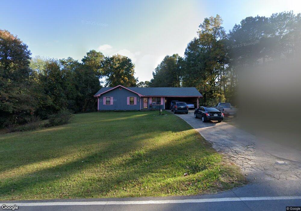
130 Henson Cir Carrollton, GA 30117
Abilene NeighborhoodEstimated Value: $199,000 - $234,000
3
Beds
2
Baths
1,242
Sq Ft
$171/Sq Ft
Est. Value
About This Home
This home is located at 130 Henson Cir, Carrollton, GA 30117 and is currently estimated at $212,028, approximately $170 per square foot. 130 Henson Cir is a home located in Carroll County with nearby schools including Sharp Creek Elementary School, Central Middle School, and Central High School.
Ownership History
Date
Name
Owned For
Owner Type
Purchase Details
Closed on
Sep 20, 2006
Sold by
Smith Willie T
Bought by
Mason Eddie L
Current Estimated Value
Home Financials for this Owner
Home Financials are based on the most recent Mortgage that was taken out on this home.
Original Mortgage
$71,350
Outstanding Balance
$42,356
Interest Rate
6.46%
Mortgage Type
New Conventional
Estimated Equity
$169,672
Purchase Details
Closed on
Jun 6, 1990
Bought by
Smith
Create a Home Valuation Report for This Property
The Home Valuation Report is an in-depth analysis detailing your home's value as well as a comparison with similar homes in the area
Home Values in the Area
Average Home Value in this Area
Purchase History
| Date | Buyer | Sale Price | Title Company |
|---|---|---|---|
| Mason Eddie L | $89,200 | -- | |
| Smith | $45,500 | -- |
Source: Public Records
Mortgage History
| Date | Status | Borrower | Loan Amount |
|---|---|---|---|
| Open | Mason Eddie L | $71,350 |
Source: Public Records
Tax History Compared to Growth
Tax History
| Year | Tax Paid | Tax Assessment Tax Assessment Total Assessment is a certain percentage of the fair market value that is determined by local assessors to be the total taxable value of land and additions on the property. | Land | Improvement |
|---|---|---|---|---|
| 2024 | $637 | $39,436 | $4,000 | $35,436 |
| 2023 | $637 | $36,343 | $4,000 | $32,343 |
| 2022 | $527 | $29,940 | $4,000 | $25,940 |
| 2021 | $476 | $26,403 | $4,000 | $22,403 |
| 2020 | $431 | $23,838 | $4,000 | $19,838 |
| 2019 | $412 | $22,712 | $4,000 | $18,712 |
| 2018 | $391 | $21,312 | $4,000 | $17,312 |
| 2017 | $384 | $20,912 | $4,000 | $16,912 |
| 2016 | $384 | $20,912 | $4,000 | $16,912 |
| 2015 | $268 | $13,585 | $4,000 | $9,586 |
| 2014 | $269 | $13,586 | $4,000 | $9,586 |
Source: Public Records
Map
Nearby Homes
- 0 Henson Cir Unit 10584639
- 0 Henson Cir Unit 7632920
- 70 Henson Cir
- 85 Mary Ln
- 345 Henson Cir
- 114 Kyle Way
- 219 Candlewood Dr
- 300 Georgia 113
- 0 Center Point Rd Unit TR 3 10274074
- 0 Center Point Rd Unit 7361099
- 70 W Meadowcliff Cir
- 125 Springwood Dr
- 110 Sharp Dr
- 524 Old Bremen Rd
- 281 Northwinds Blvd
- 281 Northwinds Blvd Unit B3
- 281 Northwinds Blvd Unit D3
- 138 Zachary Dr
- 1015 Mote Rd
- 101 Deer Park
- 140 Henson Cir
- 540 Henson Cir
- 520 Henson Cir
- 110 Henson Cir
- 150 Henson Cir
- 125 Henson Cir
- 135 Henson Cir
- 115 Henson Cir
- 550 Henson Cir
- 510 Henson Cir
- 145 Henson Cir
- 0 Henson Cir Unit 7194177
- 0 Henson Cir Unit 8578988
- 0 Henson Cir Unit 8320932
- 0 Henson Cir Unit 8201749
- 0 Henson Cir Unit 8717585
- 0 Henson Cir Unit 7127813
- 0 Henson Cir Unit 8448770
- 0 Henson Cir Unit 8918600
- 0 Henson Cir Unit 7510083