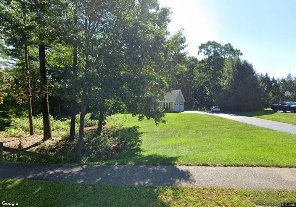
130 Laurie Ln Wrentham, MA 02093
Estimated Value: $883,277 - $967,000
4
Beds
3
Baths
2,569
Sq Ft
$359/Sq Ft
Est. Value
About This Home
This home is located at 130 Laurie Ln, Wrentham, MA 02093 and is currently estimated at $922,069, approximately $358 per square foot. 130 Laurie Ln is a home located in Norfolk County with nearby schools including Delaney Elementary School and Charles E Roderick.
Ownership History
Date
Name
Owned For
Owner Type
Purchase Details
Closed on
Jan 12, 2017
Sold by
Palmer Robert and Palmer Kathy
Bought by
Palmer 2Nd Robert L and Palmer Kathy
Current Estimated Value
Purchase Details
Closed on
Dec 18, 2002
Sold by
Butler Paul F and Butler Susan J
Bought by
Palmer Robert and Palmer Kathy
Home Financials for this Owner
Home Financials are based on the most recent Mortgage that was taken out on this home.
Original Mortgage
$140,000
Interest Rate
6.16%
Mortgage Type
Purchase Money Mortgage
Purchase Details
Closed on
Aug 17, 1993
Sold by
Colwell Tr Calvin W and Colwell Scott W
Bought by
Butler Paul F and Butler Susan J
Home Financials for this Owner
Home Financials are based on the most recent Mortgage that was taken out on this home.
Original Mortgage
$185,000
Interest Rate
7.16%
Mortgage Type
Purchase Money Mortgage
Create a Home Valuation Report for This Property
The Home Valuation Report is an in-depth analysis detailing your home's value as well as a comparison with similar homes in the area
Home Values in the Area
Average Home Value in this Area
Purchase History
| Date | Buyer | Sale Price | Title Company |
|---|---|---|---|
| Palmer 2Nd Robert L | -- | -- | |
| Palmer Robert | $515,000 | -- | |
| Butler Paul F | $250,000 | -- |
Source: Public Records
Mortgage History
| Date | Status | Borrower | Loan Amount |
|---|---|---|---|
| Previous Owner | Palmer Robert | $140,000 | |
| Previous Owner | Butler Paul F | $185,000 |
Source: Public Records
Tax History Compared to Growth
Tax History
| Year | Tax Paid | Tax Assessment Tax Assessment Total Assessment is a certain percentage of the fair market value that is determined by local assessors to be the total taxable value of land and additions on the property. | Land | Improvement |
|---|---|---|---|---|
| 2025 | $9,019 | $778,200 | $329,200 | $449,000 |
| 2024 | $8,663 | $721,900 | $329,200 | $392,700 |
| 2023 | $8,549 | $677,400 | $299,500 | $377,900 |
| 2022 | $7,519 | $550,000 | $231,300 | $318,700 |
| 2021 | $7,534 | $535,500 | $242,100 | $293,400 |
| 2020 | $7,544 | $529,400 | $218,700 | $310,700 |
| 2019 | $7,276 | $515,300 | $218,700 | $296,600 |
| 2018 | $7,315 | $513,700 | $218,900 | $294,800 |
| 2017 | $7,122 | $499,800 | $214,700 | $285,100 |
| 2016 | $6,970 | $488,100 | $208,400 | $279,700 |
| 2015 | $6,771 | $452,000 | $185,200 | $266,800 |
| 2014 | $6,661 | $435,100 | $178,200 | $256,900 |
Source: Public Records
Map
Nearby Homes
- 570 Franklin St
- 50 Reed Fulton Ave Unit Lot 61
- 131 Creek St Unit 7
- 45 Joshua Rd
- 10 Nature View Dr
- 15 Nature View Dr
- 246 Forest Grove Ave
- 11 Earle Stewart Ln
- Lot 3 - 14 Earle Stewart Ln
- Lot 1 - Blueberry 2 Car Plan at King Philip Estates
- Lot 8 - Blueberry 2 Car Plan at King Philip Estates
- Lot 5 - Hughes 2 car Plan at King Philip Estates
- Lot 6 - Blueberry 3 Car Plan at King Philip Estates
- Lot 2 - Camden 2 Car Plan at King Philip Estates
- Lot 7 - Cedar Plan at King Philip Estates
- Lot 4 - Hemingway 2 Car Plan at King Philip Estates
- Lot 3 - Blueberry 2 Car Plan at King Philip Estates
- 270 Dedham St
- 12 Waites Crossing Way
- 11 Elliot Mills Unit 11