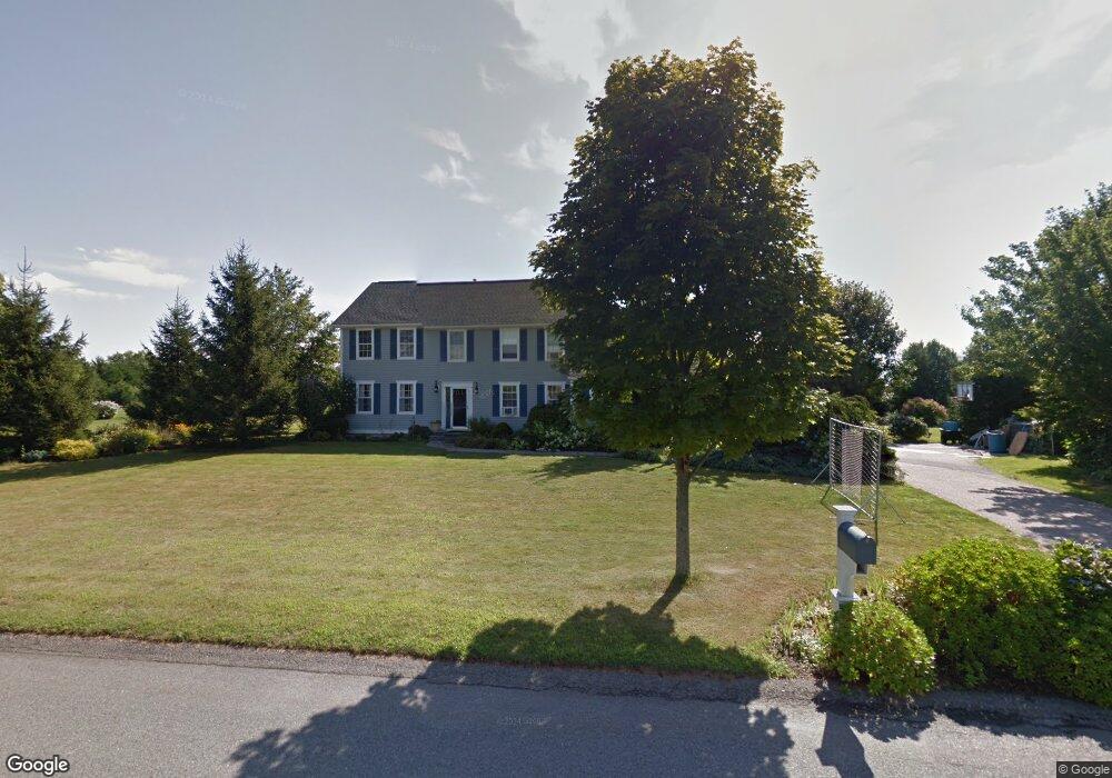
130 Lighthouse View Dr Middletown, RI 02842
Estimated Value: $1,095,000 - $1,324,000
3
Beds
3
Baths
2,598
Sq Ft
$470/Sq Ft
Est. Value
About This Home
This home is located at 130 Lighthouse View Dr, Middletown, RI 02842 and is currently estimated at $1,221,238, approximately $470 per square foot. 130 Lighthouse View Dr is a home located in Newport County with nearby schools including Middletown High School, St Michael's Country Day School, and St George's School.
Ownership History
Date
Name
Owned For
Owner Type
Purchase Details
Closed on
Jan 25, 1999
Sold by
Ocean Ridge Dev
Bought by
Martin Michael J and Martin Carolyn
Current Estimated Value
Home Financials for this Owner
Home Financials are based on the most recent Mortgage that was taken out on this home.
Original Mortgage
$192,600
Interest Rate
6.7%
Mortgage Type
Purchase Money Mortgage
Create a Home Valuation Report for This Property
The Home Valuation Report is an in-depth analysis detailing your home's value as well as a comparison with similar homes in the area
Home Values in the Area
Average Home Value in this Area
Purchase History
| Date | Buyer | Sale Price | Title Company |
|---|---|---|---|
| Martin Michael J | $241,000 | -- |
Source: Public Records
Mortgage History
| Date | Status | Borrower | Loan Amount |
|---|---|---|---|
| Closed | Martin Michael J | $93,600 | |
| Open | Martin Michael J | $175,800 | |
| Closed | Martin Michael J | $187,000 | |
| Closed | Martin Michael J | $192,600 |
Source: Public Records
Tax History
| Year | Tax Paid | Tax Assessment Tax Assessment Total Assessment is a certain percentage of the fair market value that is determined by local assessors to be the total taxable value of land and additions on the property. | Land | Improvement |
|---|---|---|---|---|
| 2025 | $10,593 | $898,500 | $406,500 | $492,000 |
| 2024 | $10,117 | $898,500 | $406,500 | $492,000 |
| 2023 | $7,766 | $616,800 | $288,400 | $328,400 |
| 2022 | $7,414 | $616,800 | $288,400 | $328,400 |
| 2021 | $7,414 | $616,800 | $288,400 | $328,400 |
| 2020 | $7,279 | $529,000 | $235,800 | $293,200 |
| 2018 | $7,274 | $529,000 | $235,800 | $293,200 |
| 2016 | $8,237 | $534,200 | $239,900 | $294,300 |
| 2015 | $8,034 | $534,200 | $239,900 | $294,300 |
| 2014 | $8,274 | $514,900 | $218,900 | $296,000 |
| 2013 | $8,089 | $514,900 | $218,900 | $296,000 |
Source: Public Records
Map
Nearby Homes
- 10 Oceanview Dr
- 476 Green End Ave
- 206 Reservoir Rd
- 310 Corey Ln
- 118 Wolcott Ave
- 55 John Clarke Rd Unit 8
- 55 John Clarke Rd Unit 3
- 55 John Clarke Rd Unit 24
- 223 Corey Ln
- 181 Center Ave
- 141 Gray Craig Rd
- 81 Beagle Dr
- 403 Valley Rd
- 23 Indian Hill Cir
- 16 Ward Ave
- 57 Warren Ave
- 0 Allston Ave
- 1 Ichabod Ln
- 0 Bliss Mine Rd
- 11 Odonnell Rd
- 130 Lighthouse Dr
- 261 Compton View Dr
- 106 Lighthouse Dr
- 106 Lighthouse View Dr
- 156 Lighthouse Dr
- 156 Lighthouse View Dr
- 135 Lighthouse Dr
- 135 Lighthouse View Dr
- 241 Compton View Dr
- 291 Compton View Dr
- 121 Lighthouse Dr
- 121 Lighthouse View Dr
- 101 Lighthouse View Dr
- 101 Lighthouse Dr
- 351 Compton View Dr
- 221 Compton View Dr
- 0 Serenity Dr
- 68 Serenity Dr
- Lot68A Serenity Dr
- Lot 68B Serenity Dr
Your Personal Tour Guide
Ask me questions while you tour the home.