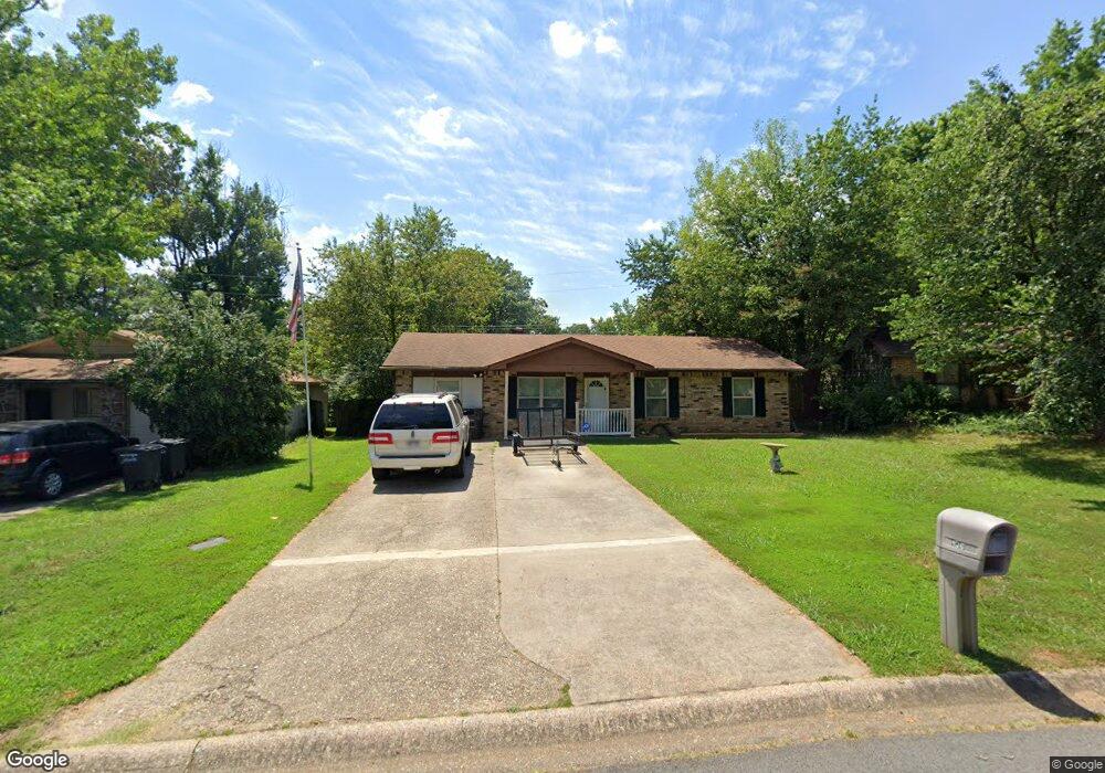
130 Lonsdale Cir Jacksonville, AR 72076
Estimated Value: $112,000 - $147,000
--
Bed
3
Baths
1,344
Sq Ft
$91/Sq Ft
Est. Value
About This Home
This home is located at 130 Lonsdale Cir, Jacksonville, AR 72076 and is currently estimated at $122,540, approximately $91 per square foot. 130 Lonsdale Cir is a home located in Pulaski County with nearby schools including Murrell Taylor Elementary School, Jacksonville Middle School, and Jacksonville High School.
Ownership History
Date
Name
Owned For
Owner Type
Purchase Details
Closed on
Jun 8, 1998
Sold by
Basil Louis E and Basil Alice A
Bought by
Smith Thomas R
Current Estimated Value
Home Financials for this Owner
Home Financials are based on the most recent Mortgage that was taken out on this home.
Original Mortgage
$44,500
Outstanding Balance
$8,778
Interest Rate
7.21%
Mortgage Type
FHA
Estimated Equity
$113,762
Create a Home Valuation Report for This Property
The Home Valuation Report is an in-depth analysis detailing your home's value as well as a comparison with similar homes in the area
Home Values in the Area
Average Home Value in this Area
Purchase History
| Date | Buyer | Sale Price | Title Company |
|---|---|---|---|
| Smith Thomas R | $45,000 | Beach Abstract & Guaranty Co |
Source: Public Records
Mortgage History
| Date | Status | Borrower | Loan Amount |
|---|---|---|---|
| Open | Smith Thomas R | $44,500 |
Source: Public Records
Tax History Compared to Growth
Tax History
| Year | Tax Paid | Tax Assessment Tax Assessment Total Assessment is a certain percentage of the fair market value that is determined by local assessors to be the total taxable value of land and additions on the property. | Land | Improvement |
|---|---|---|---|---|
| 2025 | $946 | $18,431 | $1,200 | $17,231 |
| 2024 | $760 | $18,431 | $1,200 | $17,231 |
| 2023 | $760 | $18,431 | $1,200 | $17,231 |
| 2022 | $828 | $18,431 | $1,200 | $17,231 |
| 2021 | $789 | $12,850 | $1,600 | $11,250 |
| 2020 | $414 | $12,850 | $1,600 | $11,250 |
| 2019 | $414 | $12,850 | $1,600 | $11,250 |
| 2018 | $439 | $12,850 | $1,600 | $11,250 |
| 2017 | $439 | $12,850 | $1,600 | $11,250 |
| 2016 | $581 | $15,170 | $2,400 | $12,770 |
| 2015 | $758 | $15,170 | $2,400 | $12,770 |
| 2014 | $758 | $14,092 | $2,400 | $11,692 |
Source: Public Records
Map
Nearby Homes
- 1404 Southeastern Ave
- 219 Lonsdale Cir
- 13 Michelle Ln Unit A
- 813 Lehman Dr
- 720 Southeastern Ave
- 2003 Old Military Rd
- 2209 Old Military Rd
- 1302 King St
- 600 Sorrells Dr
- 1401 Tamara Park
- 0 S J P Wright Loop Rd
- 404 S J P Wright Loop Rd
- 1305 Glenn Rd
- 32 Ross Cir
- 910 Ray Rd
- 26 Wright Cir
- 419 Church St
- 1110 Wright St
- 602 Ray Rd
- 134 Pike Ave
- 132 Lonsdale Cir
- 128 Lonsdale Cir
- 1318 Southeastern Ave
- 1320 Southeastern Ave
- 1316 Southeastern Ave
- 134 Lonsdale Cir
- 126 Lonsdale Cir
- 131 Lonsdale Cir
- 1322 Southeastern Ave
- 1314 Southeastern Ave
- 121 Lonsdale Cir
- 200 Lonsdale Cir
- 201 Lonsdale Cir
- 124 Lonsdale Cir
- 1400 Southeastern Ave
- 1312 Southeastern Ave
- 202 Lonsdale Cir
- 122 Lonsdale Cir
- 203 Lonsdale Cir
- 119 Lonsdale Cir