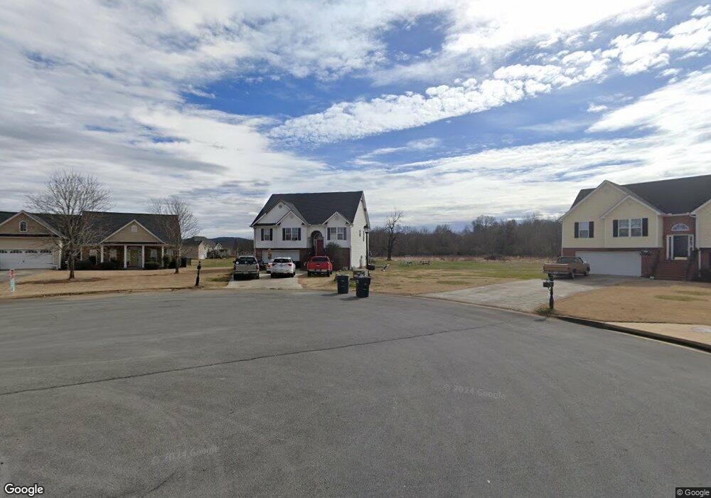
130 Mallory Ct SW Adairsville, GA 30103
Estimated Value: $342,772 - $398,000
4
Beds
3
Baths
2,315
Sq Ft
$164/Sq Ft
Est. Value
About This Home
This home is located at 130 Mallory Ct SW, Adairsville, GA 30103 and is currently estimated at $380,193, approximately $164 per square foot. 130 Mallory Ct SW is a home located in Bartow County with nearby schools including Adairsville Elementary School, Adairsville Middle School, and Adairsville High School.
Ownership History
Date
Name
Owned For
Owner Type
Purchase Details
Closed on
Nov 7, 2006
Sold by
Gillman Jennifer Jean
Bought by
Pfw Properties Inc
Current Estimated Value
Purchase Details
Closed on
Aug 8, 2006
Sold by
Gillman Arnold and Gillman Jennifer
Bought by
Gillman Jennifer Jean
Purchase Details
Closed on
Sep 7, 2005
Sold by
Hamideh Issam
Bought by
Gillman Arnold and Gillman Jennifer
Home Financials for this Owner
Home Financials are based on the most recent Mortgage that was taken out on this home.
Original Mortgage
$131,920
Interest Rate
7.75%
Mortgage Type
New Conventional
Purchase Details
Closed on
Jul 22, 2004
Sold by
C & M Construction Services Inc
Bought by
Hamideh Issam and Hana Ayyad
Create a Home Valuation Report for This Property
The Home Valuation Report is an in-depth analysis detailing your home's value as well as a comparison with similar homes in the area
Home Values in the Area
Average Home Value in this Area
Purchase History
| Date | Buyer | Sale Price | Title Company |
|---|---|---|---|
| Pfw Properties Inc | -- | -- | |
| Gillman Jennifer Jean | -- | -- | |
| Gillman Arnold | $162,900 | -- | |
| Hamideh Issam | $84,000 | -- |
Source: Public Records
Mortgage History
| Date | Status | Borrower | Loan Amount |
|---|---|---|---|
| Previous Owner | Gillman Arnold | $131,920 | |
| Previous Owner | Gillman Arnold | $32,980 |
Source: Public Records
Tax History Compared to Growth
Tax History
| Year | Tax Paid | Tax Assessment Tax Assessment Total Assessment is a certain percentage of the fair market value that is determined by local assessors to be the total taxable value of land and additions on the property. | Land | Improvement |
|---|---|---|---|---|
| 2024 | $2,748 | $108,160 | $7,680 | $100,480 |
| 2023 | $2,431 | $95,680 | $7,680 | $88,000 |
| 2022 | $2,426 | $89,800 | $7,680 | $82,120 |
| 2021 | $2,045 | $73,000 | $7,680 | $65,320 |
| 2020 | $1,795 | $62,640 | $6,520 | $56,120 |
| 2019 | $1,801 | $62,520 | $6,520 | $56,000 |
| 2018 | $1,651 | $57,320 | $6,520 | $50,800 |
| 2017 | $1,605 | $54,160 | $6,520 | $47,640 |
| 2016 | $1,609 | $54,160 | $6,520 | $47,640 |
| 2015 | $1,555 | $51,880 | $6,360 | $45,520 |
| 2014 | $1,445 | $49,632 | $6,391 | $43,240 |
Source: Public Records
Map
Nearby Homes
- 51 Robin Rd
- 58 Thacker Trail
- 172 Graham Cir
- 166 Graham Cir
- Woodridge Plan at The Landing at Miller’s Ferry
- Kensington Plan at The Landing at Miller’s Ferry
- Northwyck Plan at The Landing at Miller’s Ferry
- Richmond Plan at The Landing at Miller’s Ferry
- Brookhaven Plan at The Landing at Miller’s Ferry
- Newport I Plan at The Landing at Miller’s Ferry
- Wesley Plan at The Landing at Miller’s Ferry
- Newport II Plan at The Landing at Miller’s Ferry
- Richardson Plan at The Landing at Miller’s Ferry
- Dewhurst Plan at The Landing at Miller’s Ferry
- 38 Woody Way NW
- 32 Starling Ct
- 269 Riverboat Dr
- 178 Harbor Trail
- 315 Woody Rd NW
- 365 Riverboat Dr
- 124 Mallory Ct SW
- 135 Mallory Ct SW
- 0 Mallory Ct Unit 7189765
- 141 Bryce Valley Ct SW
- 135 Bryce Valley Ct SW
- 129 Mallory Ct SW
- 273 Bowdoin Ln SW
- 283 Bowdoin Ln SW
- 123 Mallory Ct SW
- 293 Bowdoin Ln SW
- 147 Bryce Valley Ct SW
- 263 Bowdoin Ln SW
- 303 Bowdoin Ln SW
- 313 Bowdoin Ln SW
- 247 Bowdoin Ln SW
- 0 Bowdoin Ln Unit 8650178
- 0 Bowdoin Ln Unit 8659785
- 0 Bowdoin Ln Unit 8652445
- 0 Bowdoin Ln Unit 8340873
- 0 Bowdoin Ln Unit 3162637