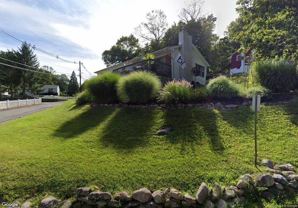
130 Maxim Dr Hopatcong, NJ 07843
Estimated Value: $345,000 - $475,000
--
Bed
--
Bath
1,260
Sq Ft
$329/Sq Ft
Est. Value
About This Home
This home is located at 130 Maxim Dr, Hopatcong, NJ 07843 and is currently estimated at $414,139, approximately $328 per square foot. 130 Maxim Dr is a home located in Sussex County with nearby schools including Hudson Maxim Elementary School, Durban Avenue Elementary School, and Tulsa Trail Elementary School.
Ownership History
Date
Name
Owned For
Owner Type
Purchase Details
Closed on
Dec 23, 2004
Sold by
Ross John R and Ross Kathryn M
Bought by
Ohare Brian
Current Estimated Value
Home Financials for this Owner
Home Financials are based on the most recent Mortgage that was taken out on this home.
Original Mortgage
$35,250
Outstanding Balance
$17,868
Interest Rate
5.81%
Mortgage Type
Credit Line Revolving
Estimated Equity
$396,271
Purchase Details
Closed on
Sep 1, 1999
Sold by
Dunnigan Colin and Dwyer Catherine
Bought by
Ross John R and Ross Kathryn M
Home Financials for this Owner
Home Financials are based on the most recent Mortgage that was taken out on this home.
Original Mortgage
$95,900
Interest Rate
7.65%
Purchase Details
Closed on
May 2, 1994
Sold by
Huber Christian W
Bought by
Dunnigan Colin and Dwyer Catherine
Home Financials for this Owner
Home Financials are based on the most recent Mortgage that was taken out on this home.
Original Mortgage
$103,000
Interest Rate
7.93%
Create a Home Valuation Report for This Property
The Home Valuation Report is an in-depth analysis detailing your home's value as well as a comparison with similar homes in the area
Home Values in the Area
Average Home Value in this Area
Purchase History
| Date | Buyer | Sale Price | Title Company |
|---|---|---|---|
| Ohare Brian | $235,000 | Chicago Title Insurance Co | |
| Ross John R | $92,646 | Fidelity National Title Ins | |
| Dunnigan Colin | $109,000 | -- |
Source: Public Records
Mortgage History
| Date | Status | Borrower | Loan Amount |
|---|---|---|---|
| Open | Ohare Brian | $35,250 | |
| Closed | Ohare Brian | $188,000 | |
| Previous Owner | Ross John R | $95,900 | |
| Previous Owner | Dunnigan Colin | $103,000 |
Source: Public Records
Tax History Compared to Growth
Tax History
| Year | Tax Paid | Tax Assessment Tax Assessment Total Assessment is a certain percentage of the fair market value that is determined by local assessors to be the total taxable value of land and additions on the property. | Land | Improvement |
|---|---|---|---|---|
| 2025 | $7,018 | $336,600 | $120,400 | $216,200 |
| 2024 | $6,981 | $336,600 | $120,400 | $216,200 |
| 2023 | $6,981 | $199,500 | $69,800 | $129,700 |
| 2022 | $6,843 | $199,500 | $69,800 | $129,700 |
| 2021 | $6,727 | $199,500 | $69,800 | $129,700 |
| 2020 | $6,657 | $199,500 | $69,800 | $129,700 |
| 2019 | $6,629 | $199,500 | $69,800 | $129,700 |
| 2018 | $6,615 | $199,500 | $69,800 | $129,700 |
| 2017 | $6,605 | $199,500 | $69,800 | $129,700 |
| 2016 | $6,619 | $199,500 | $69,800 | $129,700 |
| 2015 | $6,470 | $199,500 | $69,800 | $129,700 |
| 2014 | $6,448 | $199,500 | $69,800 | $129,700 |
Source: Public Records
Map
Nearby Homes
- 18 Sutton Rd
- 131 Maxim Dr
- 208 Maxim Dr
- 26 Bayview Ave
- 14 Marshall Trail
- 6 Bonaparte
- 4 Kansas Way
- 6 Bonaparte Point Rd
- 23 Fordham Trail
- 12 Adelphi Trail
- 46 Oklahoma Trail
- 34 Oklahoma Trail
- 12 Bass Rock Rd
- 354 Maxim Dr
- 8 Oneida Ave
- 11 Bass Rock Rd
- 280 Carentan Rd
- 496 River Styx Rd
- 61 Elba Ave
- 56 Raccoon Island Rd